

Looking for a waterfall hike without the crowds? Yellow Branch Falls Trail in South Carolina might be your answer. This short trail leads to a beautiful 50-foot waterfall that most people have never heard of.
I’ve hiked this trail multiple times and spoken with dozens of fellow hikers.
In this guide, I’ll share the real story: trail conditions, parking details, what to bring, and the best times to visit. No fluff, just practical information.
I’ll walk you through finding the trailhead, what the path is really like, and how to make the most of your visit.
Where Is the Yellow Branch Falls Trail Located?
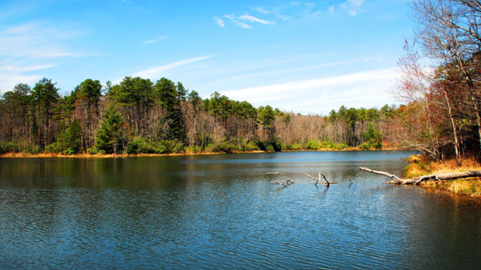
Yellow Branch Falls sits off Highway 28, about 5 miles north of Walhalla, South Carolina. From Greenville, expect a 90-minute drive through mountain roads. The trailhead at Yellow Branch Recreation Area offers parking, picnic tables, restrooms, and water fountains.
From downtown Walhalla, take SC Highway 28 North for 5.3 miles and watch for the marked turnoff on your right. Parking is free but limited. Large vehicles may need roadside parking.
Nearby attractions include Issaqueena Falls, Stumphouse Tunnel, and Oconee State Park. Arrive early on weekends to secure parking and avoid crowds.
Overview of the Yellow Branch Falls Trail

This out-and-back trail covers 3.3 miles round trip: 1.65 miles to the falls and 1.65 miles back. You’ll climb about 900 feet in elevation with a gentle grade suitable for most hikers.
Plan 2 to 2.5 hours at a moderate pace with time at the waterfall. The easy-to-moderate rating works well for families, beginners, and casual hikers. Follow lime green blazes on trees to stay on track.
Trail Features:
- Free parking and entry
- Dogs allowed (leashed)
- Well-maintained with clear markings
- Suitable for kids and older hikers
The difficulty level is balanced: enough challenge to feel accomplished without being overwhelming or boring.
What to Expect on the Trail
You’ll notice the trail’s charm before you even start walking. The trailhead area sets a welcoming tone with picnic tables, educational signboards about local plants and animals, and clean facilities. Everything you need is right there.
At the Trailhead
The recreation area welcomes you with practical amenities. Picnic tables sit ready for pre or post hike meals. Educational signboards detail local flora and fauna worth watching for during your walk.
Facilities include vault toilets and water fountains. Fill your bottles here since no water sources exist along the trail. The setup is clean and functional.
Along the Hike
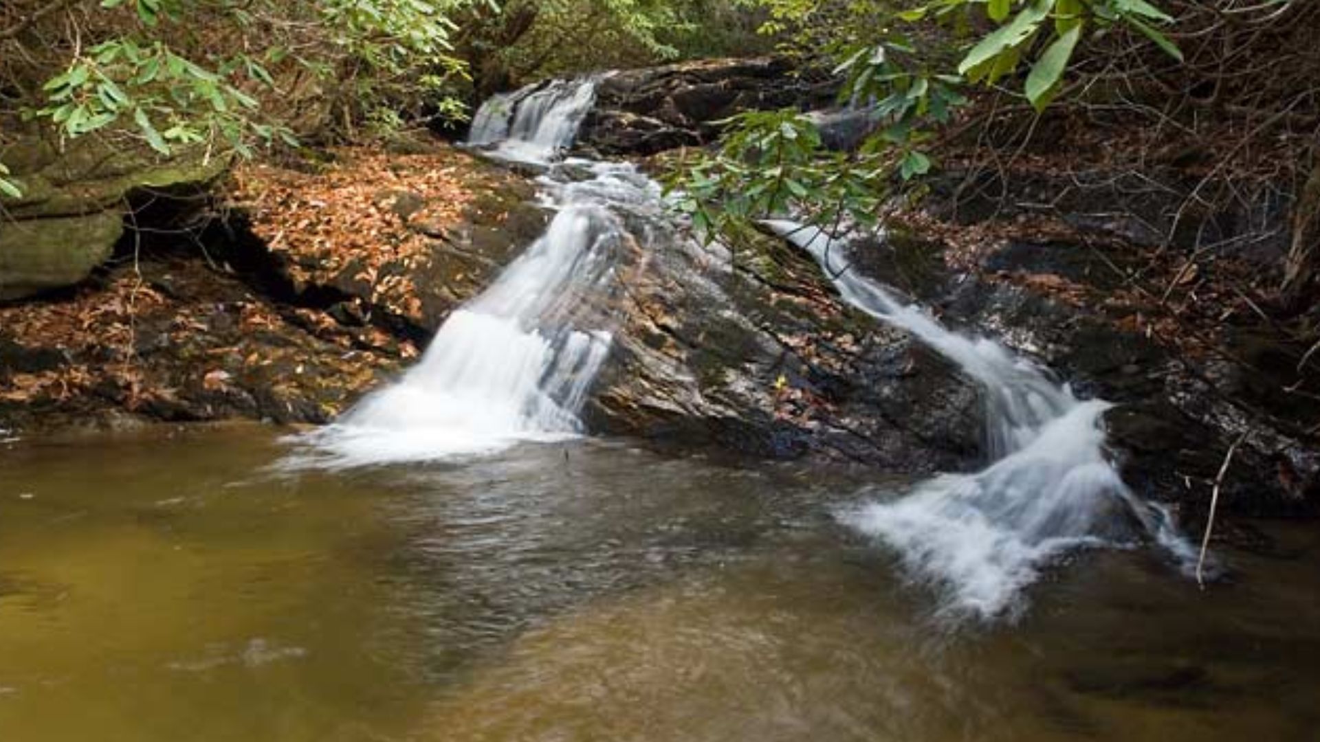
The path begins with a gentle downhill slope through hardwood forest. Tall trees provide overhead shade while moss blankets the rocks below. You’ll cross Yellow Branch Creek five times via stepping stones, shallow fords, and one wooden footbridge.
What You’ll See:
- Little Yellow Branch Falls at 150 feet from the start
- Middle Yellow Branch Falls at the 0.3-mile mark
- Mossy boulders and small wooden bridges
- Birds, woodpeckers, and foxes
- Snakes occasionally sunning on rocks
The trail gets slippery after rain. Mud patches form in low areas, and wet rocks become treacherous. Wear hiking boots with solid traction. Regular sneakers won’t provide enough grip.
Final Descent to the Waterfall
The character shifts in the last section. A short, rocky staircase leads down to the waterfall’s base. The trail narrows with mild cliff edges on one side. Keep children close but don’t worry. It’s manageable with attention.
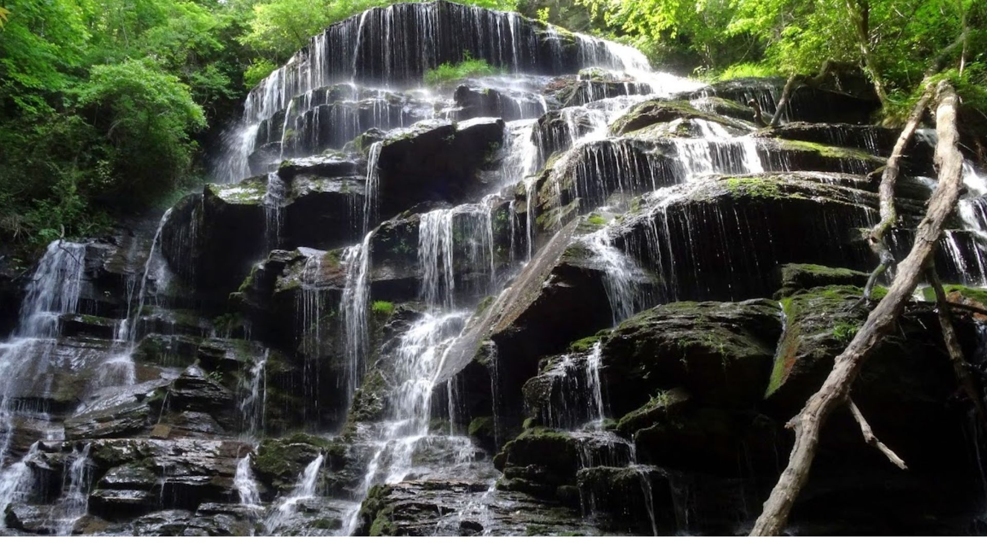
This final stretch delivers your reward. Rushing water grows louder with each step. The air becomes cooler and damper. Round the last corner and the 50-foot falls appear before you.
The Main Attraction: Yellow Branch Falls
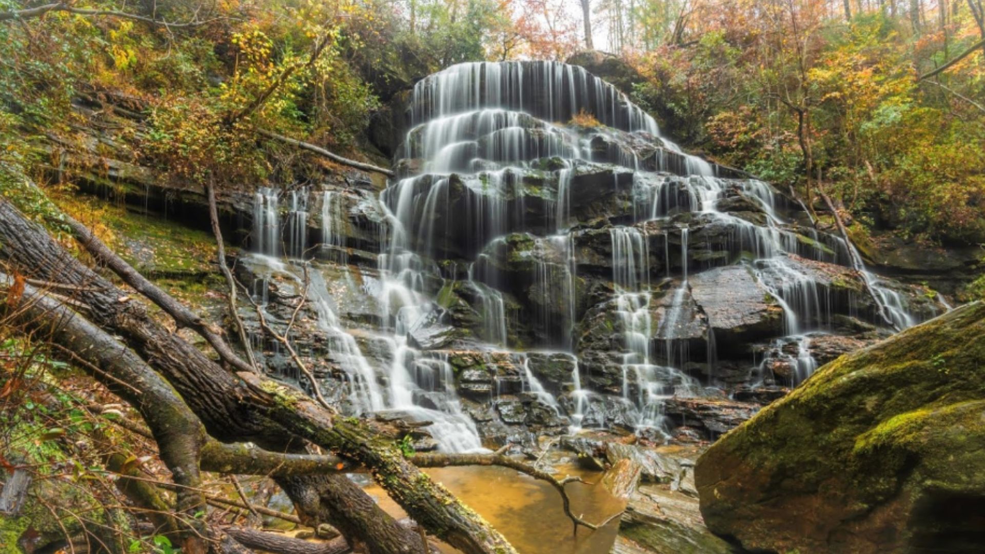
The Waterfall’s Appearance
The waterfall spreads wide instead of dropping straight down. It measures about 50 feet tall and 75 feet wide, more impressive in width than height.
The multi-tiered design creates natural frames and layers. Even during dry spells, the rock formations and moss-covered ledges remain visually striking.
Water Flow and Conditions
Flow varies dramatically based on recent rainfall. Spring offers the heaviest flow, while summer can reduce it to a trickle. Swimming is not recommended due to shallow pools and uneven water distribution across the rocks.
Best Time to Visit
Plan your trip after good rain or during spring months when the waterfall runs at full power. The increased water volume makes the cascades more impressive and photogenic.
Viewing and Photography
Multiple flat rock platforms let you choose your angle and find the perfect spot to sit. The layered design creates excellent photo opportunities with natural framing. Different vantage points offer varied perspectives of the falls.
Nearby Attractions Worth Visiting
Don’t leave Yellow Branch without visiting nearby attractions. Waterfalls, historic tunnels, and state parks sit within a short drive from the campground.
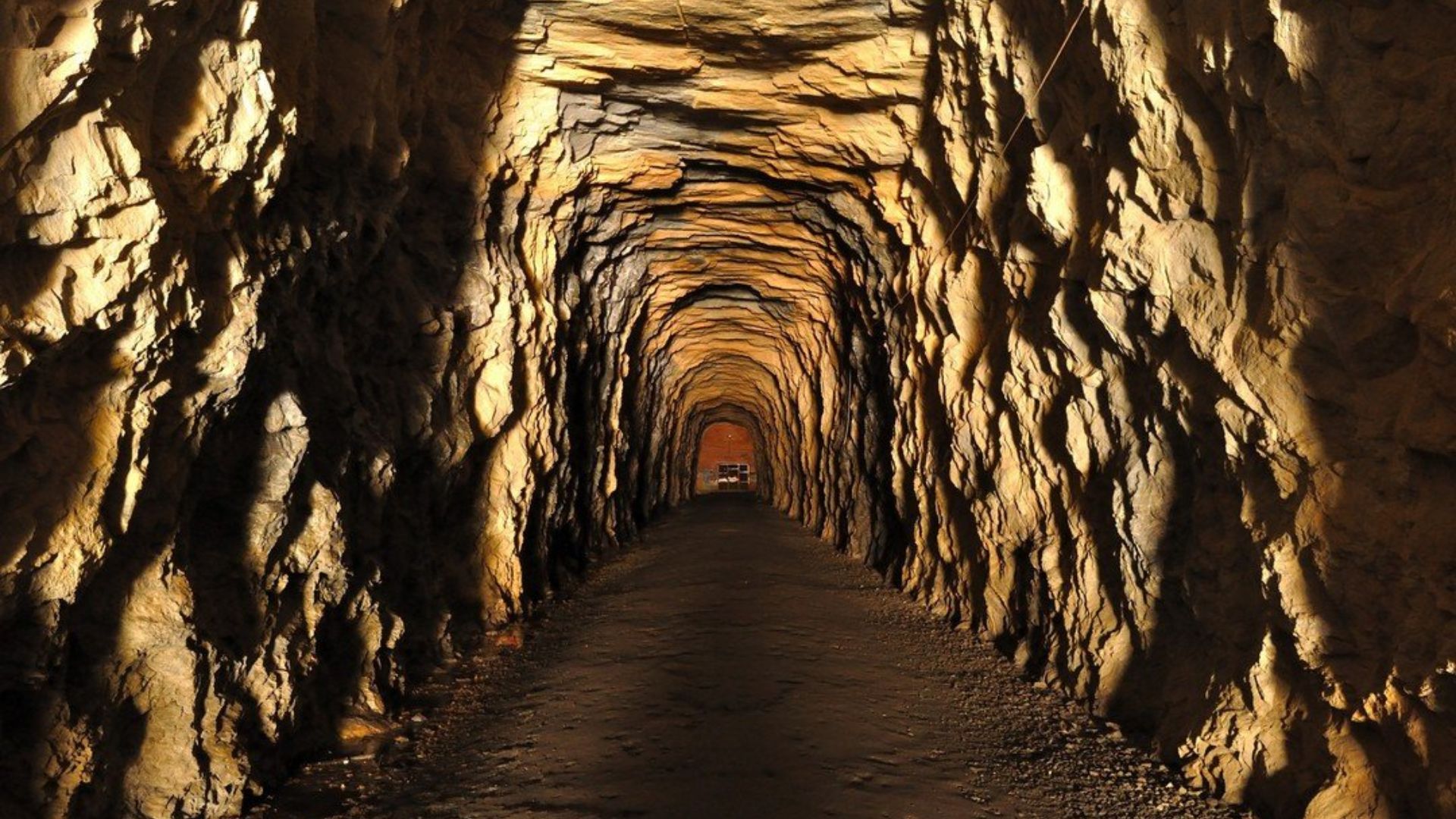
Issaqueena Falls and Stumphouse Tunnel
Drive a few minutes north to visit two incredible sites close together. Issaqueena Falls drops over 200 feet with a dramatic viewing platform at the top.
Stumphouse Tunnel, a historic Civil War-era railroad tunnel, stays cold year-round at around 50°F.
Both family-friendly spots take under an hour to explore and make a perfect afternoon stop before setting up camp at Yellow Branch.
Oconee State Park
Ten minutes up Highway 28 sits Oconee State Park, offering something for everyone. The park features camping sites, historic cabins, and a lake for swimming and fishing.
Multiple hiking trails wind through mountain forests alongside a mini-golf course. Picnic areas with grills suit day visitors perfectly.
The mountain location stays cool, so bring a light jacket even in summer. Plan at least half a day for your visit.
Other Options for Campers

Looking for more camping options near Yellow Branch? Two solid choices offer completely different experiences.
Grapevine Campground near Mountain Rest is free, first-come first-served, and sits about 20 minutes away. Lake Hartwell Anderson KOA, an hour away, provides full RV hookups and modern amenities.
Choose based on your style: Grapevine for budget-friendly simplicity, KOA for comfort and facilities including hot showers and convenience.
Tips for a Safe and Enjoyable Hike
I always check conditions before I go. You should, too.
- Check conditions first: Look at AllTrails or USDA Forest Service pages before you leave. Trail conditions change fast, especially after rain.
- Wear proper footwear: Get waterproof, non-slip hiking shoes for creek crossings. Wet rocks are slippery and dangerous.
Pack the essentials: Bring water, snacks, and insect repellent with you. You’ll need energy and protection on the trail. - Watch the weather: Don’t hike during storms or right after heavy rain. The paths get slick and unsafe quickly.
- Stay safe and respectful: Keep children close to the waterfall’s rocky base. Follow Leave No Trace principles and respect wildlife.
Conclusion
Yellow Branch Falls Trail delivers what you’re looking for: a beautiful waterfall without crowded parking lots and packed trails. The easy hike and impressive 50-foot falls make it worth visiting.
You now have everything needed: parking information, trail details, timing tips, and packing suggestions. No more second-guessing or worrying about getting lost.
Ready to go? Pack your gear and hit the trail. Share your experience in the comments below. Did you visit after rain? Bring kids? Spot wildlife? Your story could motivate others to visit.
Frequently Asked Questions
How long is the Yellow Branch Falls Trail?
The Yellow Branch Falls Trail is approximately 0.8 miles round-trip. It’s a short, easy hike that takes most people 30 to 45 minutes to complete. The gentle terrain makes it perfect for families with kids or anyone looking for a quick nature walk to a beautiful waterfall.
Where is the Yellow Branch Falls Trail located?
Yellow Branch Falls Trail is located in Oconee County, South Carolina, near Walhalla. It’s part of the Sumter National Forest. The trailhead is off Wigington Road, just a short drive from Highway 107. You’ll find it tucked away in the mountains of Upstate South Carolina.
Is Yellow Branch Falls Trail difficult?
No, the Yellow Branch Falls Trail is considered easy. The path is well-maintained with minimal elevation gain. There are some roots and rocks to watch for, but it’s manageable for most fitness levels. Kids and beginners handle it without problems, making it a great introductory waterfall hike.
Do you need a permit to hike the Yellow Branch Falls Trail?
No permit is required to hike the Yellow Branch Falls Trail. It’s free to visit and open year-round. Just park at the small trailhead area and start walking. There are no fees, no reservations, and no special permissions needed to enjoy this beautiful spot.
When is the best time to visit Yellow Branch Falls?
Spring offers the best waterfall flow after winter rains, with blooming wildflowers as a bonus. Fall brings gorgeous foliage colors. Avoid summer weekends if you want fewer crowds. Visit after rainfall for the most impressive waterfall, but skip the trail during heavy storms for safety.