

Planning a hike on the Wapack Trail? I’ve got you covered. This 21-mile trail winds through New Hampshire and Massachusetts, offering rocky summits and quiet forest paths.
I’ll walk you through maps, routes, parking spots, and seasonal tips to help you plan your hike. You’ll learn about thru-hiking options, day hike sections, and camping guidelines.
I’ve hiked sections of this trail myself and know the challenges you’ll face. Whether you’re tackling Mount Watatic or planning a full thru-hike, this guide gives you the details you need.
Let’s get you ready for the Wapack Trail.
History of Wapack Trail
People talked about connecting these mountains since the mid-1800s, but the trail didn’t become reality until 1923. Frank Robbins and Marion Davis organized volunteers and secured land access to make it happen.
The name Wapack combines the trail’s endpoints: Watatic Mountain plus PACK Monadnock. Simple and it stuck.
The trail crosses public and private land. Friends of the Wapack Trail handles maintenance and coordinates with landowners. The Nature Conservancy protects key sections through land purchases.
State parks cover other portions. Private landowners still allow trail access in some areas. This cooperation keeps the trail open for hikers.
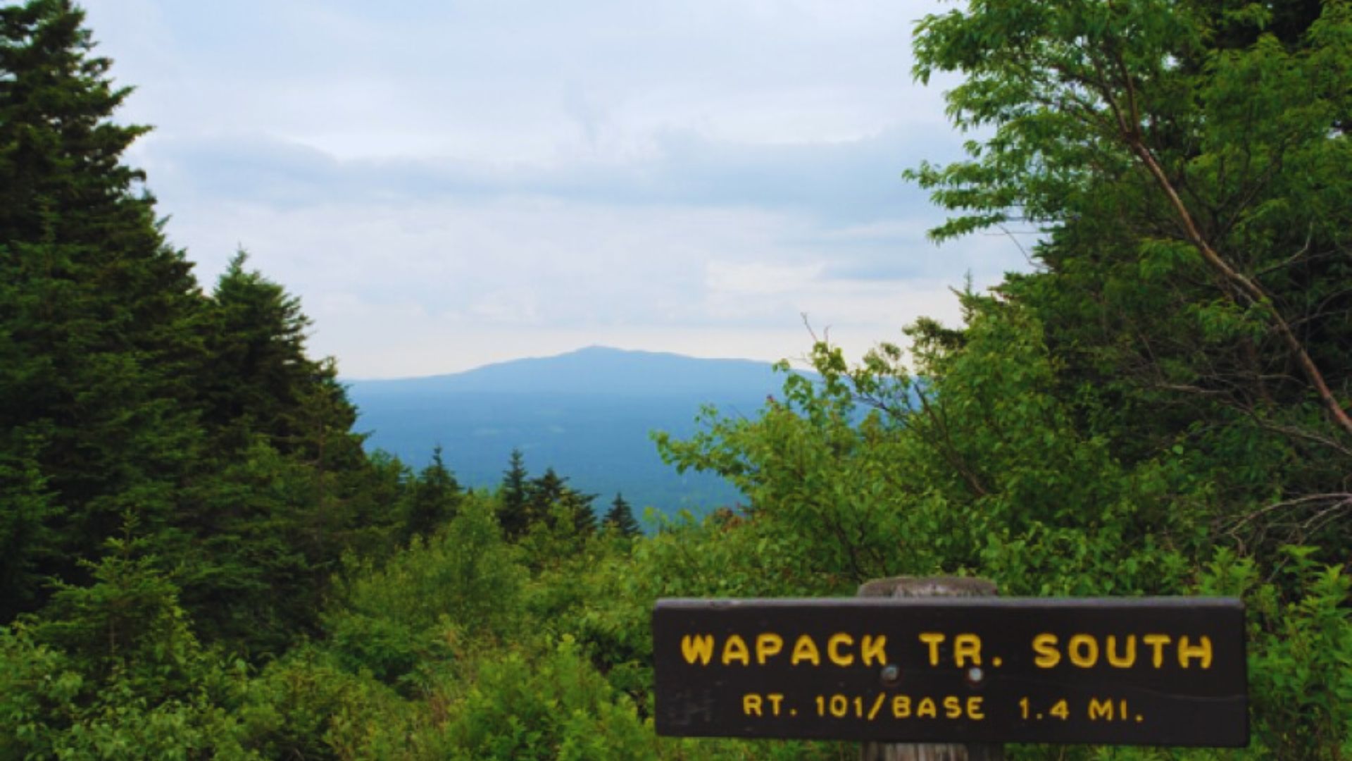
Wapack Trail Map and Routes
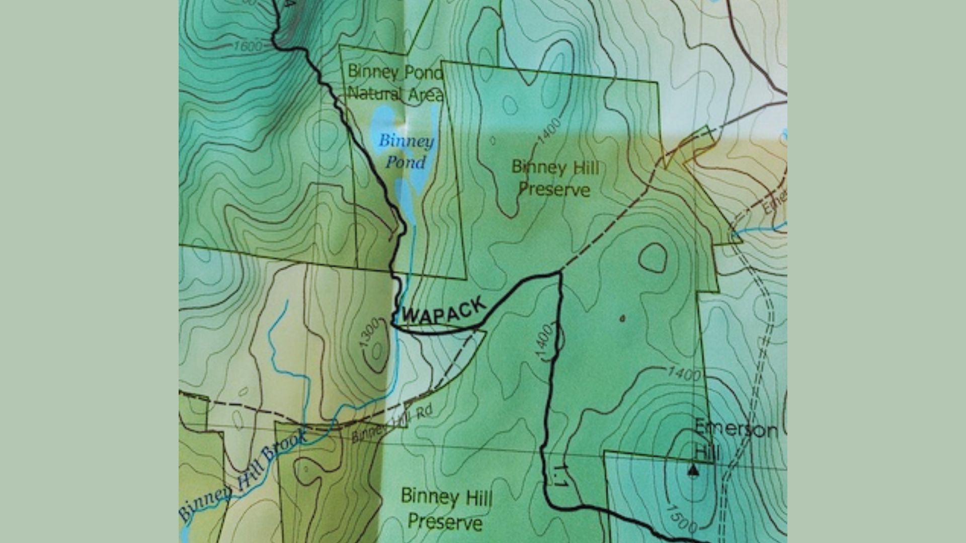
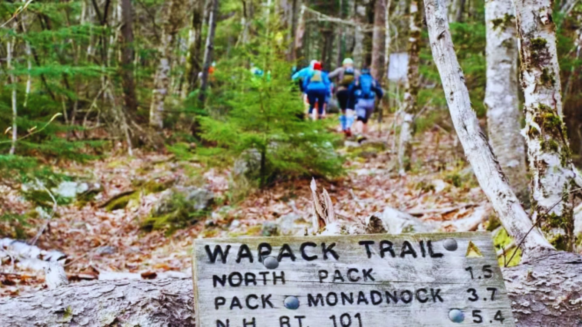
The Wapack Trail map is available online through Friends of the Wapack and AllTrails. Download a Wapack Trail map PDF for offline use. The trail runs from Watatic Mountain in Massachusetts to North Pack Monadnock in New Hampshire.
Six main trailheads offer Wapack Trail parking. Watatic Mountain Trailhead at the southern end fills fast on weekends. Temple Mountain Trailhead provides mid-trail access. Miller State Park gives northern access with a small fee. Park only in designated areas.
Mount Watatic makes a great 3.5-mile day hike with open ledge views. Nutting Hill creates a 5-mile loop. Temple Mountain offers a 6-mile out-and-back. The full Wapack Trail distances total 21 miles. Most thru-hikers complete it in two days.
Break it into thirds for easier planning: Southern section 5 miles, middle 8 miles, northern 8 miles.
Hiking the Wapack Trail

This section covers different hiking approaches, terrain challenges, and camping options to help you plan your trip.
Thru-Hike vs Day Hike
A Wapack Trail thru-hike covers all 21 miles in one push or over multiple days. Most people split it into two days with overnight camping. You’ll need a car shuttle or bike stash at the finish. Single-day attempts take 10 to 14 hours. Bring extra food and water.
Day hikes let you sample sections without logistics hassles. Southern sections near Watatic and northern sections near North Pack Monadnock offer rewarding half-day trips. I prefer day hiking sections on weekends for views without the pressure.
Terrain and Difficulty
Hiking Wapack Trail means varied terrain. You’ll cross rocky ledges, hardwood forests, and overgrown summer sections. Rocky parts demand attention to avoid twisted ankles. Wear boots with ankle support.
Elevation gain totals 4,000 feet over 21 miles. The constant up and down wears you out. Forest paths get muddy after rain. Open fields near Temple Mountain offer big views but zero shade.
Beginners should start with the Watatic section. It’s well-marked and heavily trafficked. Experienced hikers will find middle sections more interesting with fewer people and navigation challenges.
Camping along Wapack Trail
Wapack Trail camping follows Leave No Trace principles. No designated campsites exist, but dispersed camping is allowed on public land. Miller State Park offers the only official camping near the northern terminus. Book ahead during peak season.
Set up at least 200 feet from water and trail. Rocky terrain makes flat spots tricky. Carry enough water or bring a filter. Hang food properly for black bears. No fires during dry conditions.
Seasonal Advice and Weather

Timing your hike right makes a huge difference in your experience and safety on the trail.
Best Times to Visit
Spring brings blooms and flowing water from late April through May. Mud season means slippery trails. Wait until late May for drier conditions. Black flies peak in late May and early June. Bring bug spray.
Summer offers the longest days and warmest weather. Blueberries ripen on ledges in July. I always bring a container to collect them. Afternoon thunderstorms build quickly. Get off exposed ridges by early afternoon.
Fall brings crowds and peak foliage in early October. Temperatures cool down for comfortable hiking. Book parking early as lots fill by 8 AM on October weekends.
Winter creates snowy challenges. Ice on rocky sections is dangerous. Microspikes or crampons become necessary. I don’t recommend it for beginners. Shorter days mean racing darkness.
Weather Considerations
Wapack Trail weather changes fast. Check forecasts for both Ashburnham, Massachusetts and Peterborough, New Hampshire. Temperatures drop 3 to 5 degrees per 1,000 feet of elevation. Pack extra layers even on warm days.
Wind hits hard on exposed ridges. Bring a windbreaker. Rain gear belongs in your pack year-round. Summer thunderstorms appear suddenly. Getting soaked in 60-degree weather leads to hypothermia.
Snow can fall as late as May and as early as October. Winter temps below zero happen regularly. Windchill drops another 10 to 20 degrees. Frostbite risk is real without proper gear.
Events and Activities
The Wapack Trail hosts organized events that bring together the hiking community and offer unique ways to experience the trail.
Wapack Trail Race
The Wapack Trail race tests endurance runners each year, covering the entire 21-mile trail. The race typically happens in late spring or early summer. Course records sit around 3 hours for the fastest runners. Most finishers come in between 4 to 6 hours.
Even if you’re not racing, watching the start or finish gives you trail community vibes. Race entry fees support trail maintenance and improvements throughout the year.
Special Programs or Guided Hikes
The Friends of the Wapack hosts group hikes and trail maintenance days. These events help you meet other hikers while giving back to the trail. Guide to the Wapack Trail services exist through local outdoor education programs offering beginner-friendly introductions.
Local AMC chapters sometimes include Wapack sections in their schedules. Natural history walks focus on ecology and geology. Youth programs bring school groups to easier sections.
Nearby Attractions and Tips
The area around the Wapack Trail offers additional spots to visit and practical information for planning your trip.
- North Pack Monadnock at 2,276 feet offers 360-degree views at the northern terminus. A side trail connects to Pack Monadnock’s fire tower for even better views stretching to Mount Monadnock and Mount Washington.
- Ashburnham, Massachusetts serves the southern trailhead with restaurants and a general store. Temple, New Hampshire is smaller with limited services. Stock up before arriving.
- Peterborough, New Hampshire has the most services including grocery stores, outdoor gear shops, and restaurants. It sits 15 minutes from Miller State Park and is your best option for supplies.
- Lodging includes motels in Peterborough and Jaffrey plus area bed and breakfasts. Book ahead during fall foliage season when everything fills up.
- Parking fills fast on summer and fall weekends. Arrive before 8 AM or hike midweek. No organized shuttle service exists. Ask hiking groups about arrangements or coordinate swaps with other hikers.
Conclusion
The Wapack Trail gives you rocky summits, forest paths, and mountain views without the crowds of more famous peaks. I’ve covered everything from maps and parking to weather and camping to help you plan your hike.
Start with a day hike section to test your interest, then work up to longer distances. The trail rewards those who take time to know it well. Check current trail conditions before heading out and leave no trace behind.
Drop a comment below sharing which section you want to hike first or any questions about planning your Wapack Trail trip.
Frequently Asked Questions
How long does it take to hike the full Wapack Trail?
Most hikers complete the 21-mile trail in 10 to 14 hours for a single-day push. Two-day thru-hikes with overnight camping are more common and easier on your body.
Is the Wapack Trail well-marked?
The trail uses yellow blazes throughout. Southern sections show clearer markings, while middle sections require more attention. Carry a map for faded or missing markers.
Can I bring my dog on the Wapack Trail?
Dogs are allowed on most sections but must be leashed in Miller State Park. Bring extra water for your dog and watch for rocky terrain that’s tough on paws.
Where can I find water along the trail?
Water sources are limited and unreliable, especially in summer. Small streams often dry up, so carry all the water you need or bring a filter.
Do I need permits to hike the Wapack Trail?
No permits are required for hiking. Miller State Park charges a small parking fee during the operating season. All other trailheads offer free parking.