

I’ve hiked Monkey Rock Trailhead three times now, and I’m sharing everything you need to know before you go.
This guide covers exact directions, parking details, trail conditions, and what to expect at the summit.
I’ll walk you through the entire route step by step so you feel prepared. The trail gets busy on weekends, but I’ll show you how to time your visit right.
Having done this hike in different seasons, I know what works and what doesn’t.Let’s get started.
Where Is Monkey Rock Trailhead Located?
The trailhead sits on Lake Tahoe’s East Shore and offers quick access to one of the area’s best viewpoints.
Monkey Rock Trailhead sits on Lake Tahoe’s East Shore in Incline Village, Nevada. You’ll find it along Highway 28 (NV-28), about 2 miles south of the main Incline Village area.
The trailhead is often confused with Hidden Beach Trailhead. They’re close to each other but serve different trails. Monkey Rock gives you access to the Monkey Face rock formation.
The parking area sits right off NV-28. Most GPS devices recognize it if you search “Monkey Rock Trailhead” or “East Shore Trail Incline Village.”
The closest services are in Incline Village. Gas stations and grocery stores are about 5 minutes away by car.
How to Get to Monkey Rock Trailhead
Getting there is straightforward from any direction around Lake Tahoe.
Driving Directions
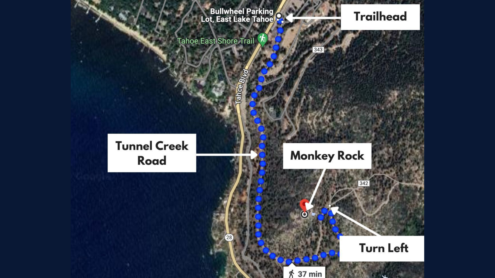
From Incline Village, head south on Highway 28. Drive for about 2 miles. The trailhead appears on your left, lakeside.
Watch for the small parking pullout. There’s a trail sign marking the spot. It’s easy to miss if you’re going too fast.
From South Lake Tahoe, take Highway 50 north to Spooner Summit. Turn right onto Highway 28 north. Continue for about 8 miles. The trailhead will be on your right.
From Reno, take I-580 south to Highway 431 (Mount Rose Highway). Drive over Mount Rose Summit into Incline Village.
Turn right onto Highway 28 south. The trailhead is 2 miles down on your left. The road hugs the lake. Drive carefully, especially in summer when tourist traffic picks up.
Parking Information
The parking situation requires some planning, especially during peak season.
The parking area holds about 10 cars. It’s a gravel pullout directly off the highway. No marked spaces.
Arrive before 8 AM on summer weekends. After that, spots fill up fast. You might have to park at Hidden Beach Trailhead and walk over.
There are no fees. No permits required for day use. The lot has no restrooms. No water fountains either. Bring everything you need.
Monkey Rock Trailhead Quick Facts
Here’s what you need to know at a glance before hitting the trail.
- Distance: 1.2 miles round trip
- Elevation gain: 200 feet
- Trail type: Out and back
- Difficulty: Easy to moderate
- Time needed: 45 minutes to 1.5 hours
- Best for: Lake Tahoe views, rock formations, photography
The trail connects to the East Shore Trail system. You can extend your hike if you want more mileage.
What to Know Before Hiking Monkey Rock Trailhead
A few key details will help you prepare properly for this hike.
Crowds peak between 10 AM and 3 PM in summer. Early morning or late afternoon gives you a quieter experience.
Weather changes fast at Lake Tahoe. Mornings can be cool even in July. I always pack a light jacket.
Afternoon thunderstorms happen in summer. They roll in quickly off the lake. Check forecasts before you go.
Footwear matters here. The trail has loose rocks and sandy sections. Trail runners work fine. Hiking boots give you better ankle support.
Bears are active in the area. Store food in your car before hiking. Don’t leave anything that smells in your vehicle.
Cell service works along most of the trail. It’s reliable near the trailhead and at the Monkey Face rock formation.
Monkey Rock Trail Description (Step-by-Step)
I’ll walk you through each section so you know exactly what to expect.
Starting at the Trailhead
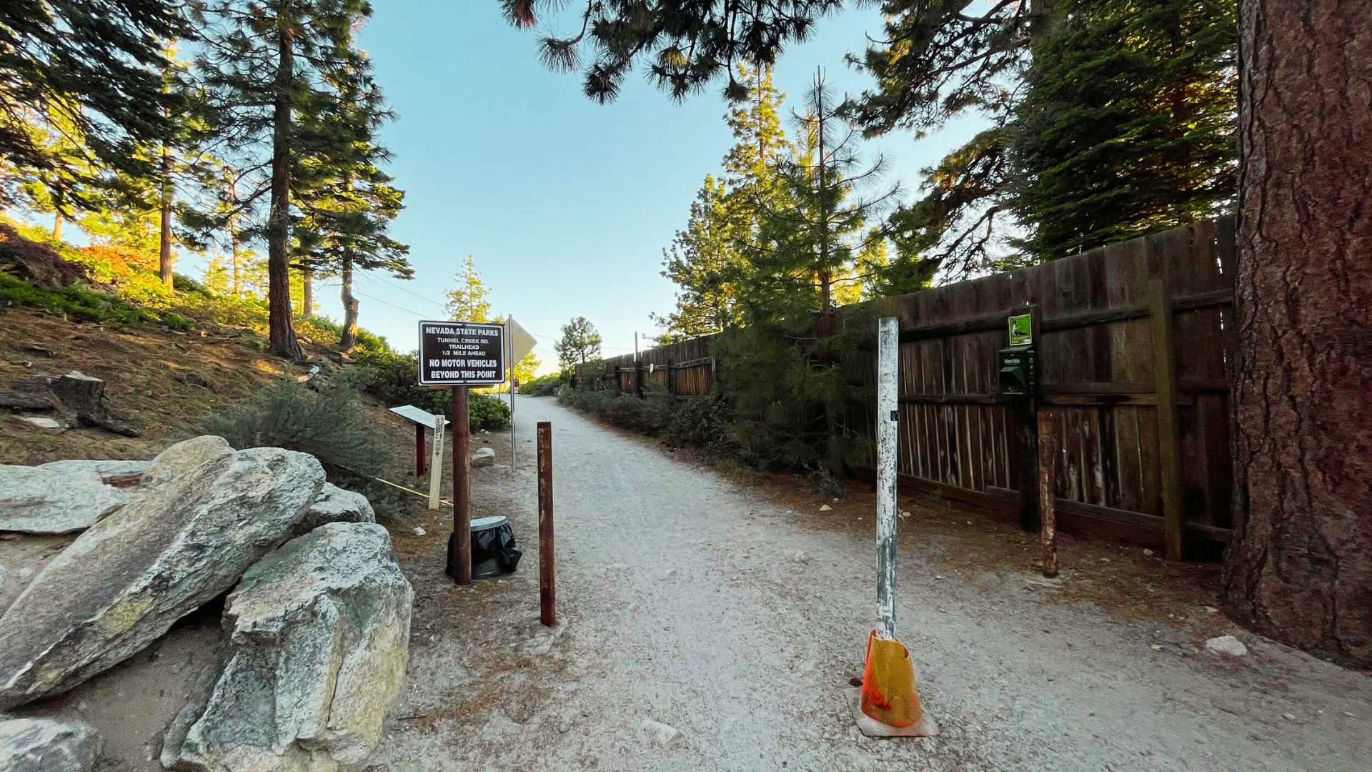
The trail begins at the parking area. You’ll see a clear sandy path heading toward the lake and then up.
The first section is mostly flat. You’re walking through Jeffrey pines and small boulders. Lake Tahoe peeks through the trees on your right.
Trail markers appear every few hundred feet. They’re metal posts with trail names. Hard to miss. The path is wide enough for two people to walk side by side here.
Forest Section
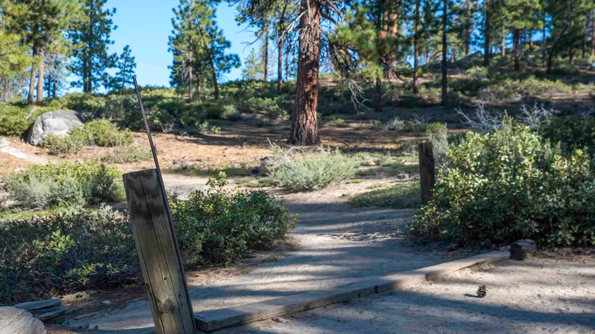
About a quarter mile in, the trail starts climbing. Nothing steep, just a gentle upward grade.
You’re walking through a mixed forest now. Pines provide good shade in summer. This is my favorite part when the sun gets hot.
The footing is sandy with some embedded rocks. Watch for loose spots after other hikers have passed through.
Lake views come and go through the trees. Each glimpse is better than the last. This section takes about 15 minutes at a casual pace.
Final Ascent to Monkey Rock
The trail gets rockier as you approach the Monkey Face rock formation. You’re climbing over and around large boulders now.
The elevation gain is minimal here, maybe 50 feet. But the terrain requires more attention.
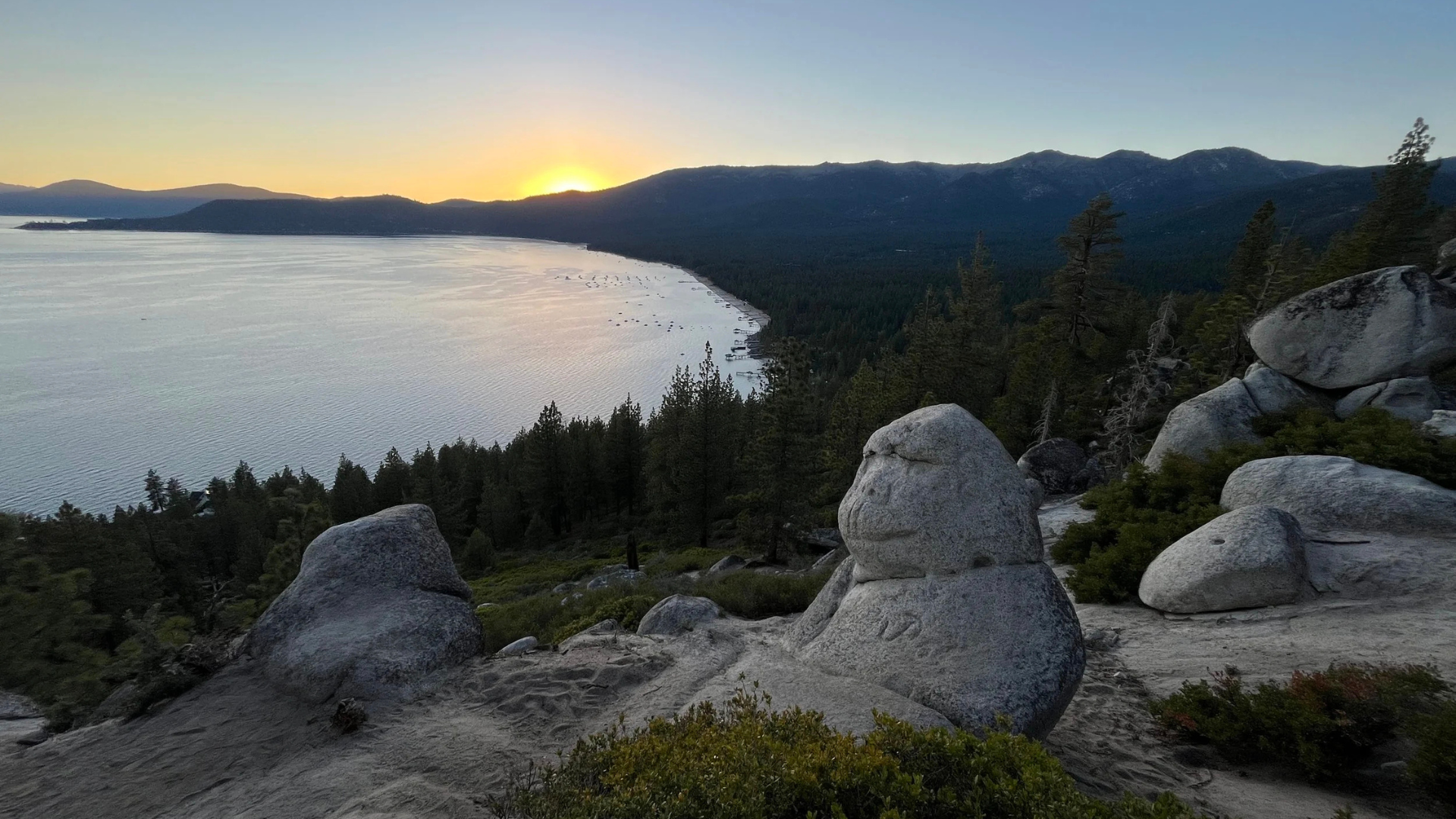
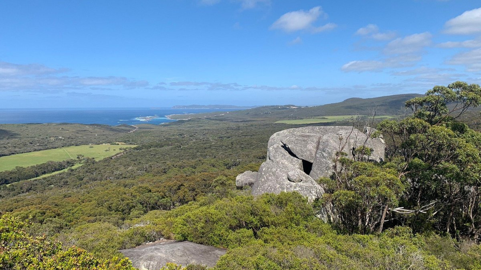
Monkey Face appears suddenly. It’s a large rock formation that looks like a monkey’s profile from certain angles. Some people see it right away. Others need it pointed out.
You can scramble up onto the rocks. The footing is solid if you take your time.
Monkey Rock Viewpoint: What You’ll See at the Top
The payoff at Monkey Face makes this one of my favorite short hikes around the lake.
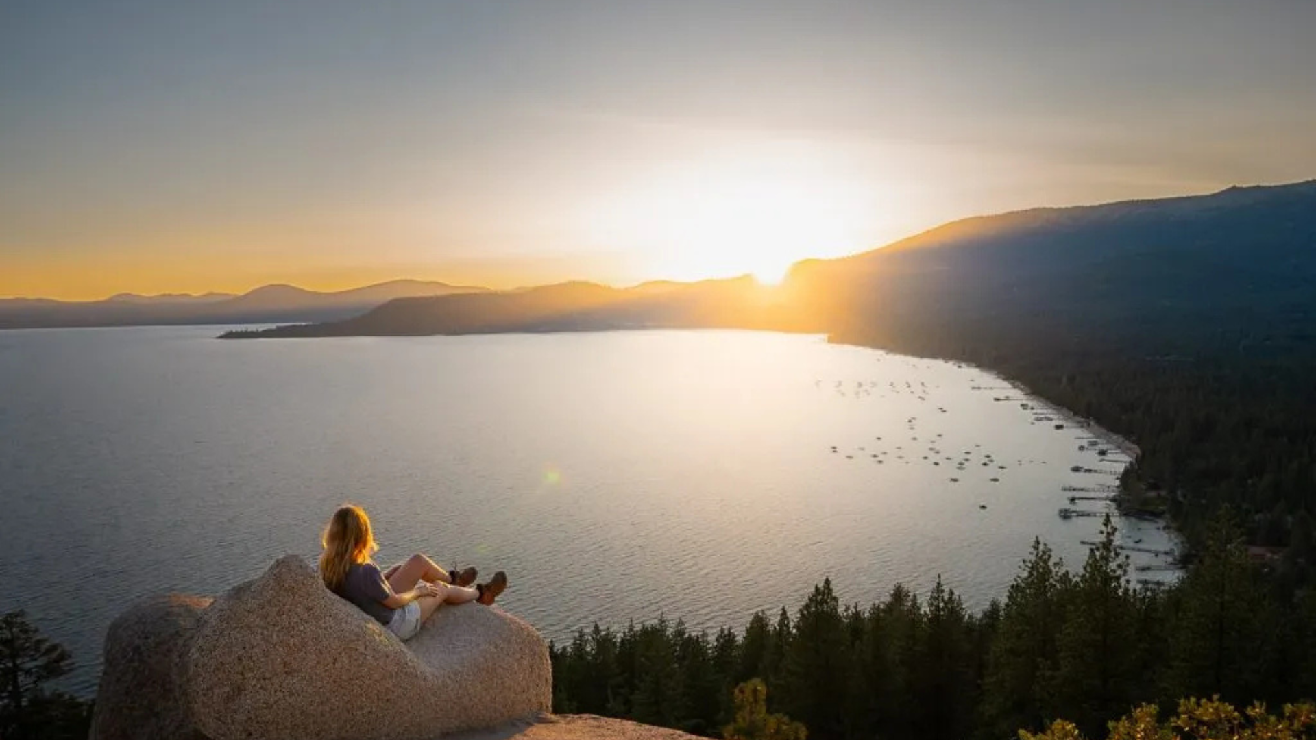
The views from Monkey Face rock formation are worth every step. Lake Tahoe spreads out in front of you in shades of blue and green.
To the west, you see across the entire lake. On clear days, the peaks above Emerald Bay are visible.
South, the East Shore Trail continues along the coastline. You can trace it for miles. North, Incline Village sits tucked against the mountains.
The rock formation itself is fun to climb on. There are multiple levels and perches. I usually spend 20 minutes up here just taking it in.
Photos come out great from this spot. The lighting is best in the early morning or late afternoon.
Best Time to Visit Monkey Rock Trailhead
Timing your visit right makes a huge difference in your experience.
Seasonal Guide
Summer is the most popular time. June through August brings warm weather and clear trails. Temperatures sit in the 70s and 80s most days.
Fall is my favorite. September and October give you cooler temps and fewer people. The aspens turn gold in late September.
Spring can be muddy. Snowmelt makes the trail wet through May. But wildflowers bloom and the lake is at its fullest.
Winter requires extra gear. Snow and ice cover the trail from December through March. I’ve hiked it with microspikes and trekking poles.
Avoid hiking during thunderstorms. They’re common in July and August afternoons.
Best Time of Day
Early morning is best. Start between 7 and 8 AM. You beat the crowds and get soft morning light on the lake.
Late afternoon works too. Starting around 5 PM gives you sunset colors on the water. The trail is less crowded then.
Midday gets hot and busy. I avoid it during summer unless I have no other choice.
Weekday mornings are quietest. I’ve had Monkey Face to myself on Tuesday mornings in September.
Safety Tips for Monkey Rock Trail
A few precautions will keep you safe on the East Shore Trail system.
- Bring at least one liter of water per person. Even on this short hike, dehydration happens.
- Check the weather before you leave. Thunderstorms develop quickly in summer afternoons.
- Watch for bears. I’ve never seen one on this trail, but they’re in the area. Make noise while hiking.
- Pack sunscreen and a hat. The exposed sections get full sun most of the day.
- Don’t climb beyond your comfort level on Monkey Face. The rocks are solid but falls can happen.
Common Mistakes to Avoid at Monkey Rock Trailhead
I’ve seen people make these errors repeatedly at this Lake Tahoe trailhead.
- Confusing this with Hidden Beach Trailhead. They’re different spots with different trails. Double check your location before starting.
- Wearing flip flops or sandals. I see this all the time. The rocky sections will punish your feet.
- Forgetting sun protection. The lake reflects sunlight and intensifies exposure.
- Leaving trash behind. Pack out everything. Lake Tahoe has enough litter problems.
- Not checking for afternoon thunderstorms. Lightning over water is dangerous. Watch the sky.
Final Thoughts
Monkey Rock Trailhead gives you a solid workout with views that make it worth the effort.
I keep returning because it hits that sweet spot between challenging and doable.
You get mountain scenery without needing special gear or skills. The trail stays manageable for most fitness levels while still feeling like an accomplishment.
Pack smart, start early, and take your time on the steep sections. The view from that rock formation makes every uphill step worthwhile.
I’ve shared this trail with friends who loved it and strangers who became hiking buddies along the way. It’s the kind of hike that reminds you why you started hiking in the first place.
Frequently Asked Questions
Can I hike Monkey Rock Trail with my dog?
Yes, dogs are allowed but must stay on leash. Bring extra water for them since there’s none on the trail. The rocky sections near Monkey Face can be tough on paws.
Is Monkey Rock the same as Hidden Beach in Lake Tahoe?
No, they’re different trailheads about half a mile apart on the East Shore. Monkey Rock leads to the Monkey Face rock formation. Hidden Beach takes you to a sandy cove.
How hard is the Monkey Rock hike compared to other Lake Tahoe trails?
It’s much easier than Flume Trail or Mount Tallac. Similar difficulty to Incline Village’s Tahoe Rim Trail access but shorter. Good for families and beginners.
Do I need a parking pass for Monkey Rock Trailhead?
No passes or permits required. Parking is free along Highway 28. Just find a legal spot in the pullout area.
Are there restrooms at Monkey Rock Trailhead?
No restrooms at the trailhead or anywhere along the trail. Use facilities in Incline Village before you drive south on Highway 28.