

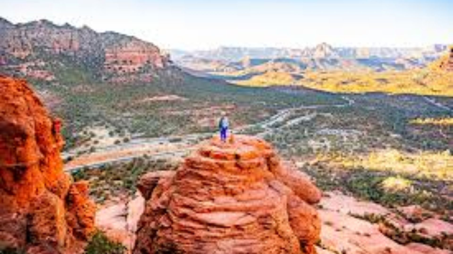
Sedona’s towering red rock formations create some of the most memorable hiking experiences in Arizona. The contrast between rust-colored cliffs and bright blue skies draws millions of visitors each year to this desert town.
I’ve hiked Sedona’s trails extensively and know what makes them stand out. The trails wind through ancient rock formations, offer views that stretch for miles, and range from easy walks to challenging climbs.
Some paths lead to energy vortex sites, while others take you to hidden caves and natural arches.
This guide covers the top trails for every fitness level with practical tips to help you plan your visit.
What Makes Hiking in Sedona Different

Sedona hiking offers something you won’t find anywhere else. The red rock formations create a backdrop unlike any desert landscape in America.
These towering cliffs and canyons formed over millions of years through erosion and geological shifts.
The trails range from flat, easy paths perfect for families to steep climbs that challenge experienced hikers. Many routes lead to energy vortex sites where visitors report feeling spiritual connections.
Others take you to hidden caves, natural arches, and overlooks with panoramic views stretching across the Verde Valley and beyond.
Best Hikes in Sedona for All Skill Levels
Planning your hiking trip means matching trails to your experience level. The options below cover everything from flat loops to steep scrambles, giving you plenty of choices for your Sedona visit.
1. Bell Rock Loop
This 3.6-mile loop ranks as one of the most accessible hikes in Sedona for families and casual hikers. The mostly flat trail circles around Bell Rock, one of the area’s most recognized formations. Many visitors come here to experience the vortex energy that locals say flows through this spot.
The path offers clear views of the surrounding red rocks throughout the walk. Morning hours work best for cooler temperatures and better parking availability. Kids handle this trail well, and you can make it as short or long as you like by turning back at any point.
2. Fay Canyon Trail
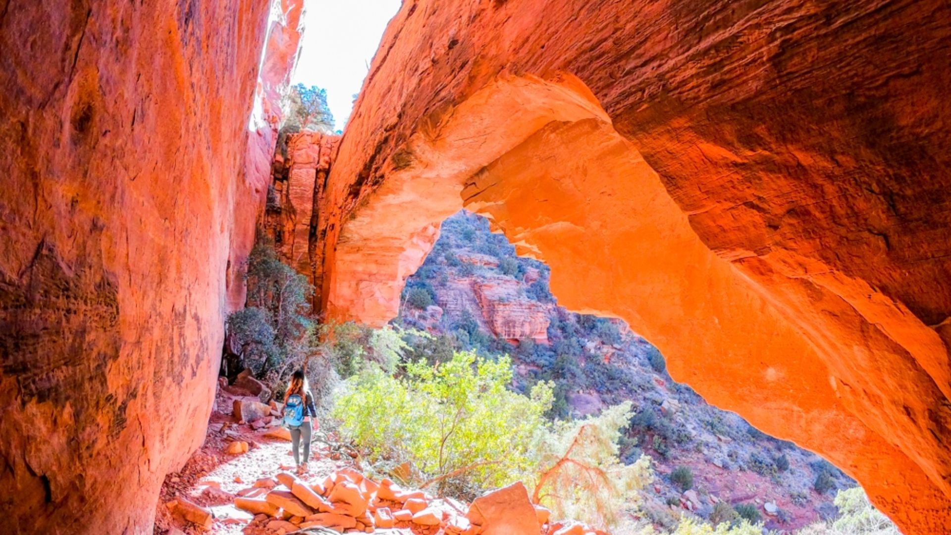
This 2.4-mile out-and-back trail stays shaded for most of the route, making it a smart choice during warmer months.
The canyon walls rise on both sides as you walk deeper into the formation. If you want to extend your hike, a short side path leads to a natural arch tucked into the cliff face.
The trail grade stays moderate with only gentle inclines. You’ll walk through areas with desert plants and might spot wildlife in the early morning. The shaded sections provide relief from direct sun, though you should still bring plenty of water.
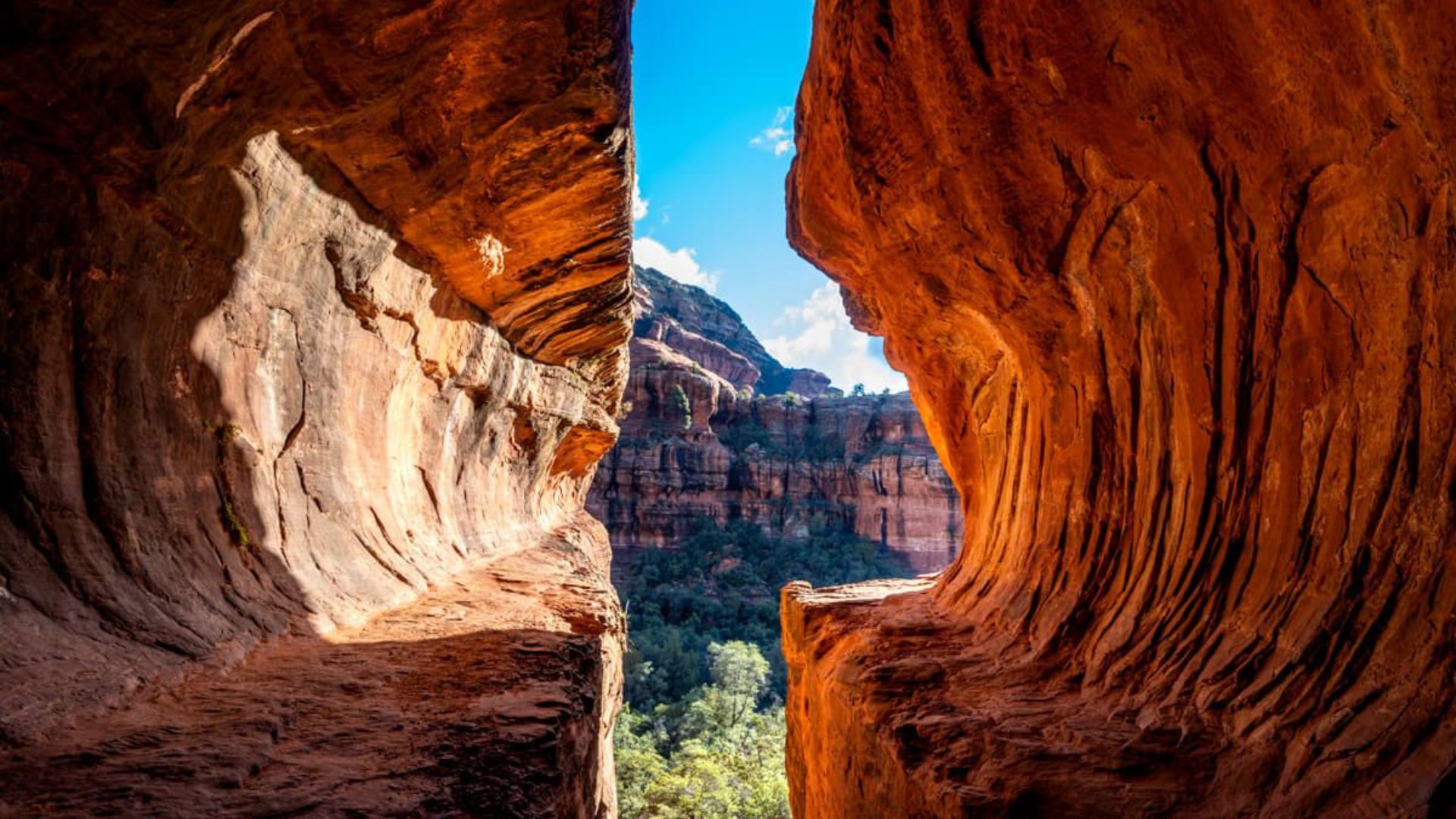
3. Birthing Cave Trail
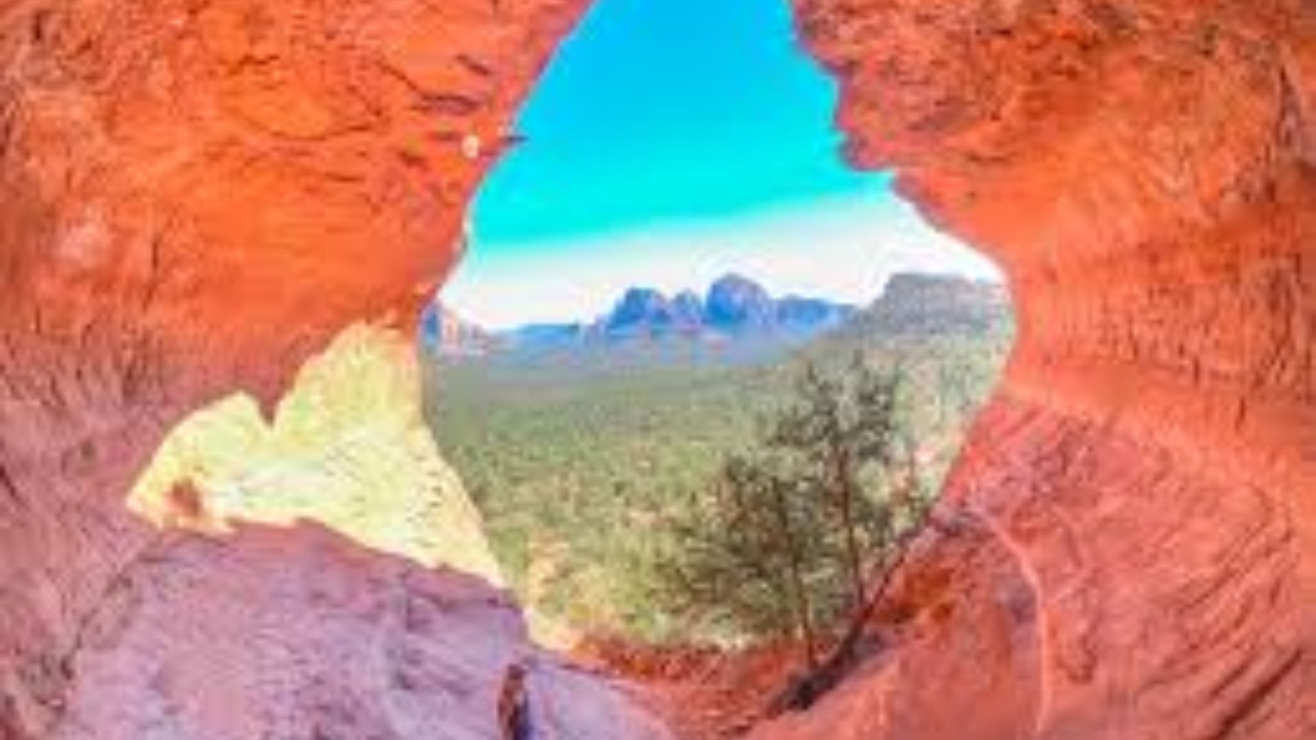
This 2.8-mile round-trip trail climbs steadily to a large cave opening with sweeping views of the valley below.
The cave itself sits high on the hillside and offers a cool resting spot after the uphill walk. Many hikers come specifically to see this formation and take photos from the cave opening.
The path follows a well-worn route but includes some rocky sections near the top. Watch for cairns that mark the way when the trail becomes less obvious. Give yourself about two hours for the complete hike, including time to rest at the cave.
4. Amitabha Stupa Loop

This short 0.6-mile loop takes only 15 to 20 minutes to complete. The trail circles a Buddhist peace park with a white stupa visible from the parking area.
This spot works well for visitors looking for a quiet place to sit and think, or those who want a brief walk without committing to a longer hike.
The path stays flat and easy to follow. The stupa and surrounding area hold cultural meaning for the Buddhist community. Many people visit at sunrise or sunset when the light hits the red rocks behind the structure.
5. Cathedral Rock Trail

This 1.2-mile round-trip trail packs a serious workout into a short distance. The path climbs steeply from the start, with sections that require using your hands to pull yourself up rock faces. Your reward at the top includes some of the best views in all of Sedona.
Plan for this hike to take 90 minutes to two hours, depending on your pace and how long you spend at the summit.
The trailhead parking lot fills up quickly, especially on weekends. Arrive before 7 AM or consider parking at the nearby Buddha Beach lot and walking to the trailhead.
6. Devil’s Bridge Trail
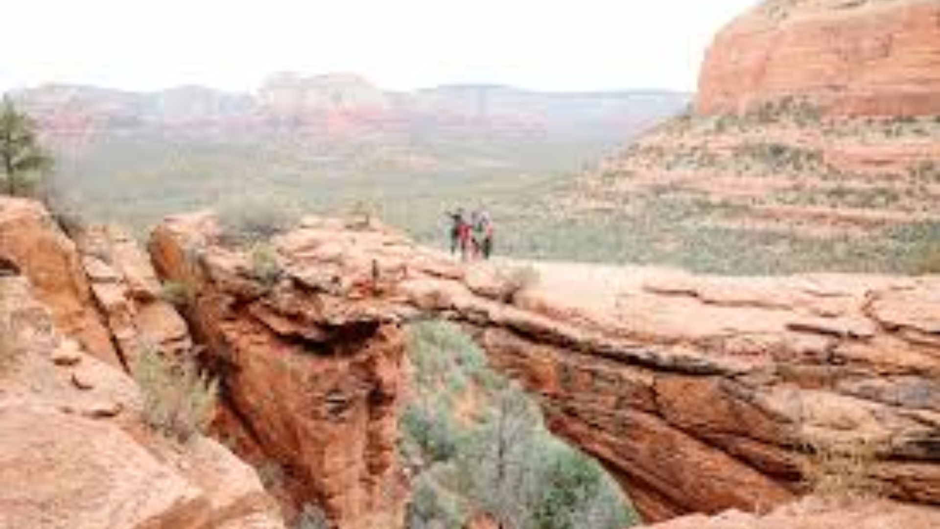
This 4.2-mile round-trip hike leads to Sedona’s most photographed natural feature. The bridge itself is a rock arch that spans a gap high above the canyon floor.
You can walk out onto the bridge for dramatic photos, though the narrow path and drop-offs make some visitors nervous.
Two route options exist: the longer trail from the main parking area or a shorter 1.8-mile version from a dirt road accessible by high-clearance vehicles.
Crowds gather here throughout the day, so early morning visits give you the best chance for photos without other people in the frame. The main trail stays relatively easy until the final climb to the bridge.
7. Boynton Canyon Trail
This 6-mile out-and-back trail offers a longer option for hikers wanting more distance. The path follows the canyon floor between tall rock walls, with the route staying mostly level. About halfway through, a side trail branches off to the Subway Cave, a cool alcove worth the short detour.
This area holds significance as another vortex energy site. The trail sees fewer crowds than some of the shorter, more famous hikes in Sedona.
You’ll need about three to four hours for the full hike, though you can turn around at any point if you want a shorter walk.
8. Soldier Pass Trail
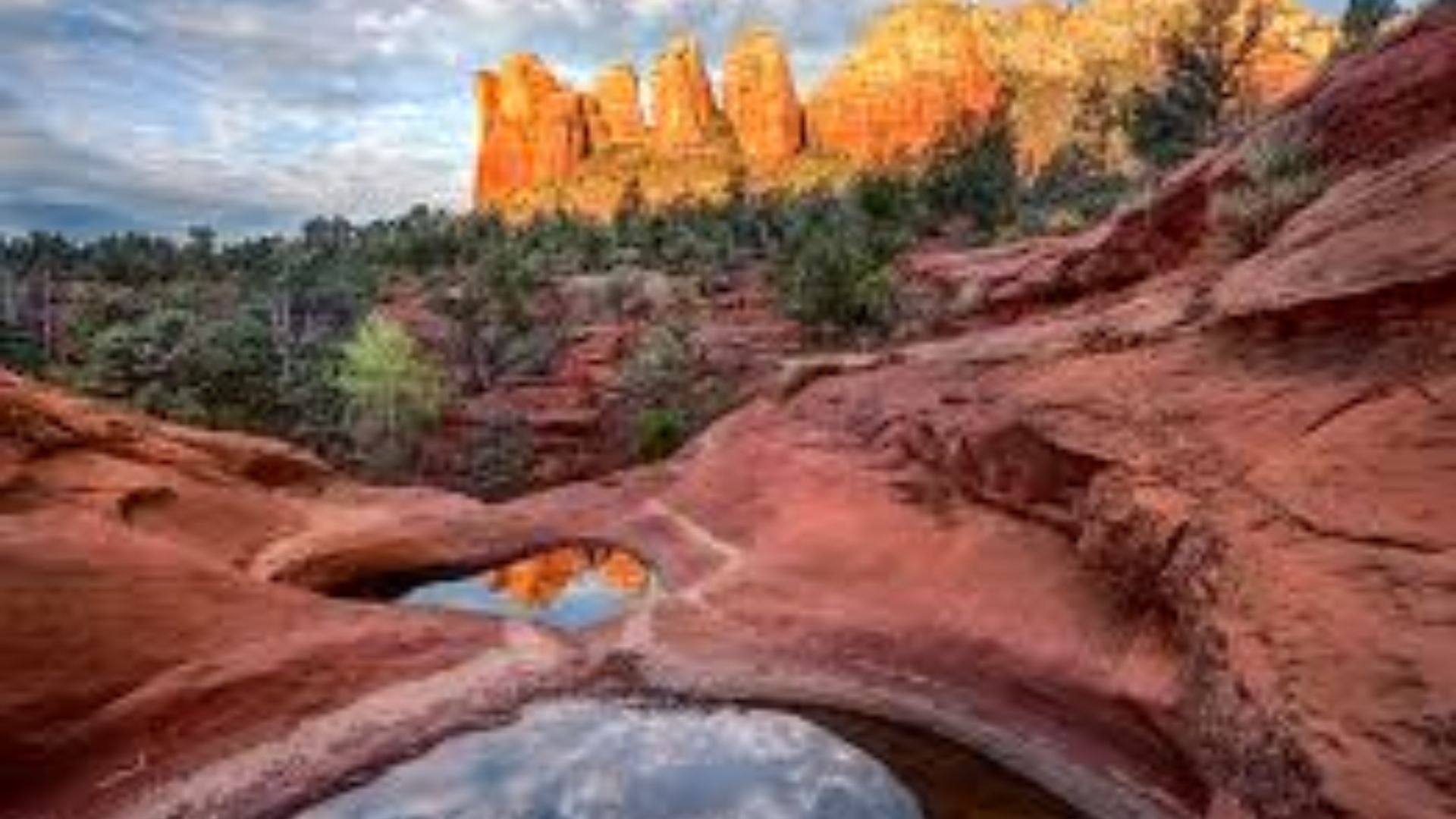
This 4.5-mile loop combines multiple interesting features into one hike. The route passes Seven Sacred Pools, crosses over to Devil’s Kitchen Sinkhole, and includes a hidden cave along the way. Each of these spots provides a reason to pause and look around.
The trail requires a high-clearance vehicle to reach the trailhead, though you can park at the bottom and add distance to your hike.
Rocky sections and some climbing make this a moderate to difficult option. Water pools appear after rain, creating temporary swimming spots in the desert.
9. Airport Loop Trail

This 3.3-mile loop sits on top of Airport Mesa, providing 360-degree views of Sedona and the surrounding area.
The relatively flat trail makes a full circle, so you can start from any point and end up back where you began. Sunset draws crowds here, as the views stretch in every direction.
The exposed trail offers little shade, so bring sun protection. Another vortex site sits along this route. The trail stays open and obvious throughout, making it hard to get lost even for first-time visitors.
Key Tips for Hiking in Sedona
Getting ready for hikes in Sedona means thinking about parking, gear, and timing. A little planning helps you avoid common problems and makes your time on the trails more comfortable.
- All trailheads require a Red Rocks Pass, which costs $5 per day or $15 per week at self-pay stations.
- Popular parking lots fill up by 8 AM on weekends and holidays
- The Sedona shuttle runs Thursday through Sunday to reduce parking pressure at busy trailheads
- Arriving before 7 AM gives you the best parking options and cooler temperatures
- Download the AllTrails app before you start hiking and save maps for offline use
- Cell phone service gets spotty in canyons and remote areas
- Watch for cairns (stacked rocks) and trail markers when paths become unclear
- Take photos at trail junctions to help you find your way back
- Bring at least one liter of water per person for every two hours of hiking in the Arizona heat
- Wear sunscreen, a hat, and sunglasses even on cloudy days
- Choose closed-toe shoes with a good grip for scrambling over rocks
- Bring a small tripod if you want photos of yourself at viewpoints
- Sunrise offers the best combination of cool temperatures, good lighting, and available parking
- Sunset hikes provide great colors, but mean hiking out in darkness on some trails
- March through June and September through October bring the most visitors
- Summer months (July and August) require very early starts to avoid the dangerous heat
- Stay on marked trails to protect desert plants and prevent erosion
- Keep an eye out for javelinas (wild pigs) and rattlesnakes, especially in warmer months
- Pack out everything you bring in, including toilet paper
- Respect the local community by keeping noise levels down and following posted rules
Arizona’s desert climate can catch people off guard. What feels like a short walk in the parking lot becomes much harder after an hour in direct sun with no shade.
Conclusion
Hikes in Sedona give you options no matter your fitness level or available time. The trails range from 20-minute loops to full-day treks through remote canyons. Each path shows off the red rocks from a different angle.
Try some of the less crowded trails once you’ve seen the famous spots. Long Canyon, Fay Canyon, and Soldier Pass offer great experiences without the crowds at Devil’s Bridge or Cathedral Rock.
Check the weather, buy your Red Rocks Pass, and arrive early for the best experience. The desert demands respect, but it rewards careful planning with some of the best scenery in the Southwest.
Start looking at maps and picking your trails now. Your Sedona hiking trip will create memories that last long after you leave the red rocks behind.
Frequently Asked Questions
Do I Need a Guide to Hike in Sedona?
Most people hike independently using trail apps and downloaded maps. Guided tours help if you want to learn about geology, plants, or vortex sites. The trails have clear markers and heavy foot traffic.
What’s the Best Month to Visit Sedona for Hiking?
October and April offer the best weather with mild temperatures and clear skies. Summer brings dangerous heat above 100 degrees. Winter can close higher trails due to ice and snow.
Are Dogs Allowed on Sedona Hiking Trails?
Most trails allow dogs on leashes no longer than six feet. Some areas near water sources restrict pets to protect wildlife. Always pick up after your dog and pack out waste bags.
How Much Water Should I Bring on a Sedona Hike?
Carry one liter per person for every two hours on the trail. Arizona’s dry air and high elevation increase water needs. Hydration packs work better than bottles for longer hikes.
Can Beginners Handle Sedona’s Hiking Trails?
Bell Rock Loop, Amitabha Stupa, and Airport Loop work well for first-time hikers. Start with shorter, flatter trails and build up to moderate climbs. Proper shoes and plenty of water matter more than experience.