

I have hiked a lot of trails in Utah. Most of them I enjoyed and moved on from.
Hickman Bridge Trail stayed with me.
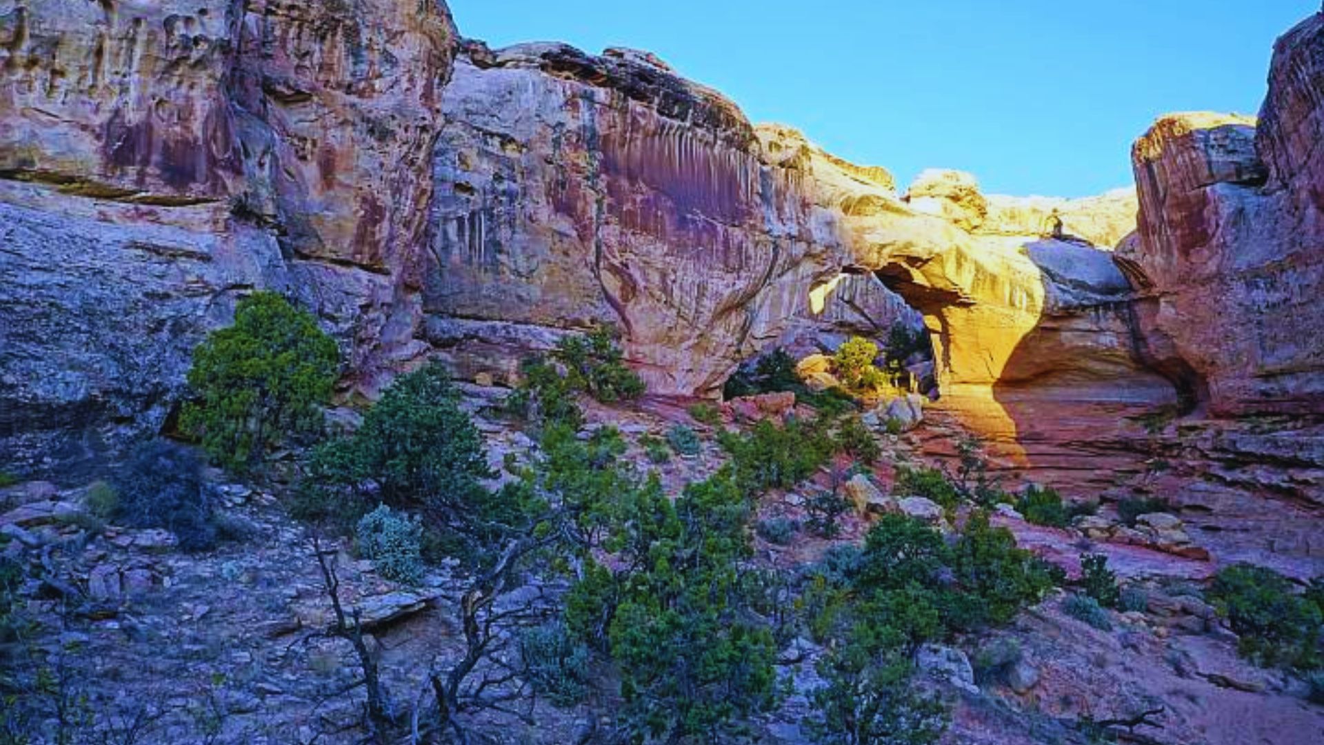
There is a moment on this hike where a 133-foot natural rock bridge just appears in front of you. No warning. No buildup. It is simply there, carved out of red sandstone over thousands of years.
If you are curious about the Hickman Bridge Trail Capitol Reef experience, how long is Hickman Bridge Trail, or whether it is worth the detour, this guide answers all of it honestly.
Hickman Bridge Trail Overview
The Hickman Bridge Trail is located inside Capitol Reef National Park in south-central Utah. It is one of the most visited trails in the park and consistently rated as a highlight of the entire region.
The trail is an out-and-back route, meaning you return the same way you came. Total Hickman Bridge Trail length is approximately 1.8 miles round trip. Most hikers complete it in 1.5 to 2 hours.
Difficulty is rated moderate. There is some elevation gain, around 400 feet, and a few rocky sections. But overall it is very manageable.
It works well for families, beginners, and photographers. The payoff at the end is big relative to the effort required.
Getting to the Trailhead
Finding the trailhead is straightforward. It is one of the more accessible starting points in Capitol Reef and well-signed from the main road.
Trailhead Location

The Hickman Bridge trailhead sits along Highway 24, about two miles east of the Fruita Campground and Capitol Reef Visitor Center. There is a designated parking area directly at the trailhead.
Parking fills up quickly on weekends and during peak season. Arriving before 8 AM gives you the best chance of getting a spot without waiting.
If the main lot is full, limited roadside parking is available nearby. Do not park on the highway itself.
Directions and Accessibility
From the Capitol Reef Visitor Center, head east on Highway 24 for about two miles. The trailhead parking lot will be on your left, clearly marked with signage.
The trail itself is not wheelchair accessible. The terrain includes uneven rock surfaces, sandy sections, and a moderate climb that requires stable footing throughout.
Visitors with mobility concerns should check with park rangers before attempting the hike.
What to Expect on Hickman Bridge Trail
The trail packs a lot into a short distance. From the first steps out of the parking lot, the scenery changes quickly and keeps getting better.
Scenic Highlights Along the Way
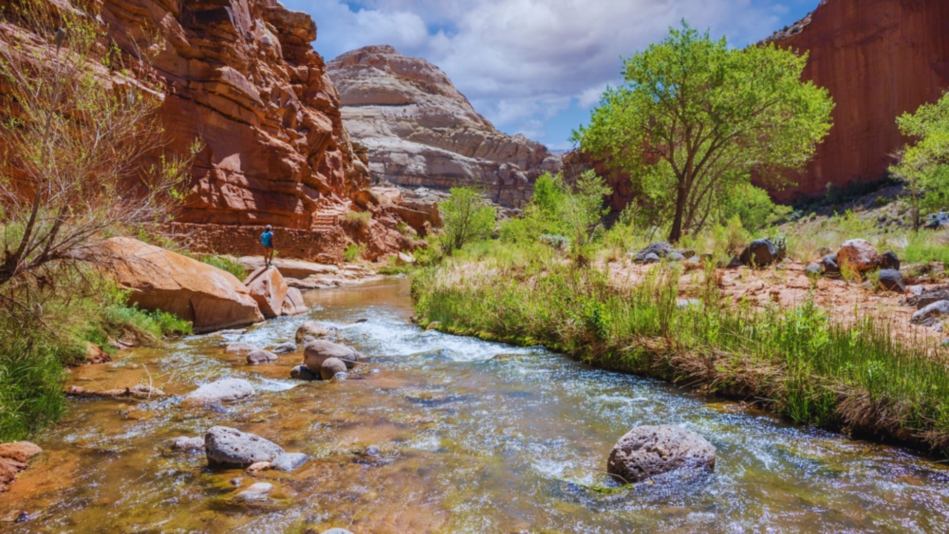
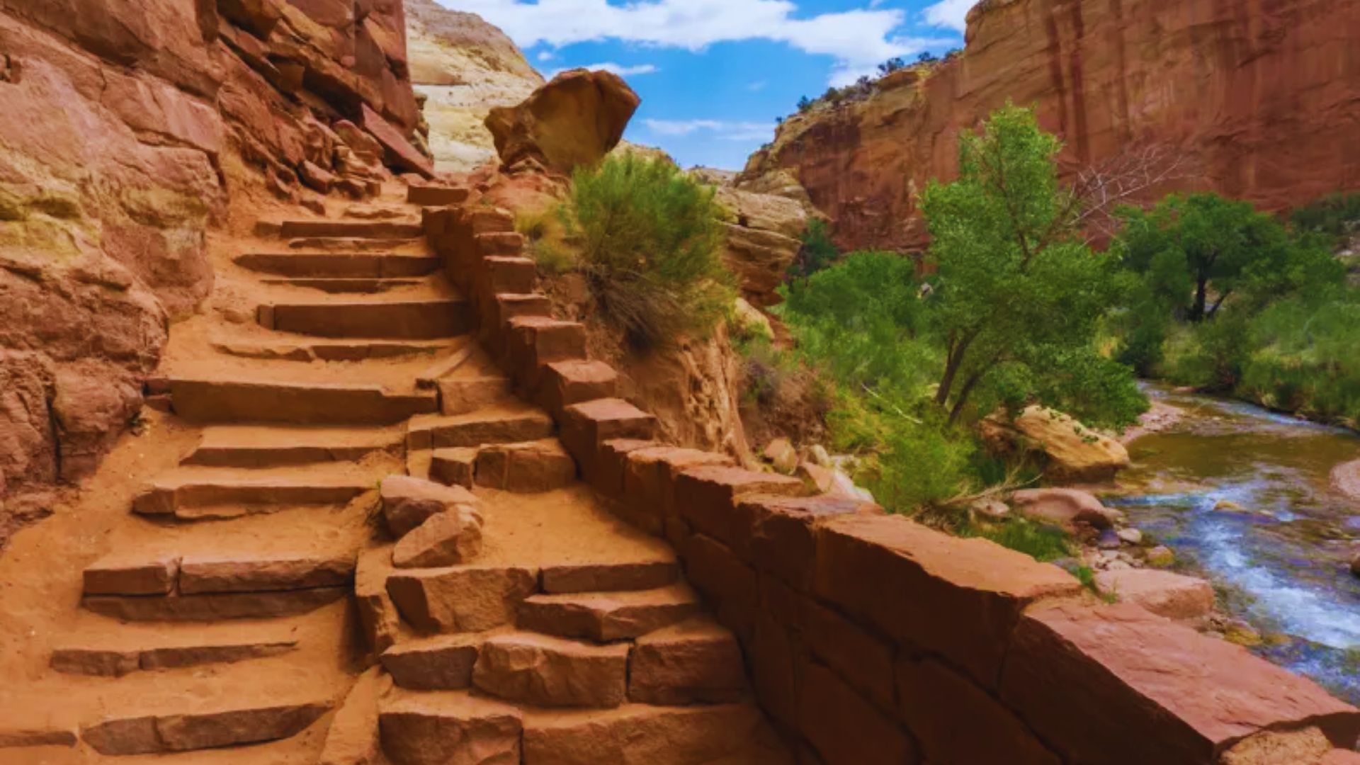
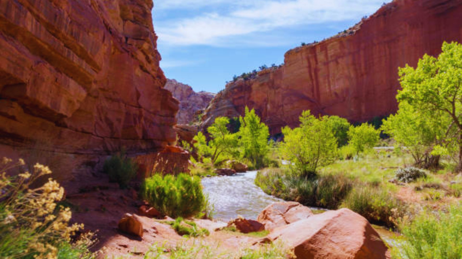
The first section of the trail follows the Fremont River before climbing away from it. The river views from the lower portion are calm and pretty, a nice warm-up before the terrain opens up.
As you gain elevation, the canyon walls close in on both sides. The red and cream-colored sandstone formations are layered and textured in ways that catch the light differently throughout the day.
Desert vegetation dots the landscape. Pinyon pine, juniper, and hardy shrubs fill in the gaps between rock. It feels sparse but alive.
The geology here tells a long story. Capitol Reef preserves one of the longest exposed monoclines in North America, and the trail puts you right in the middle of it.
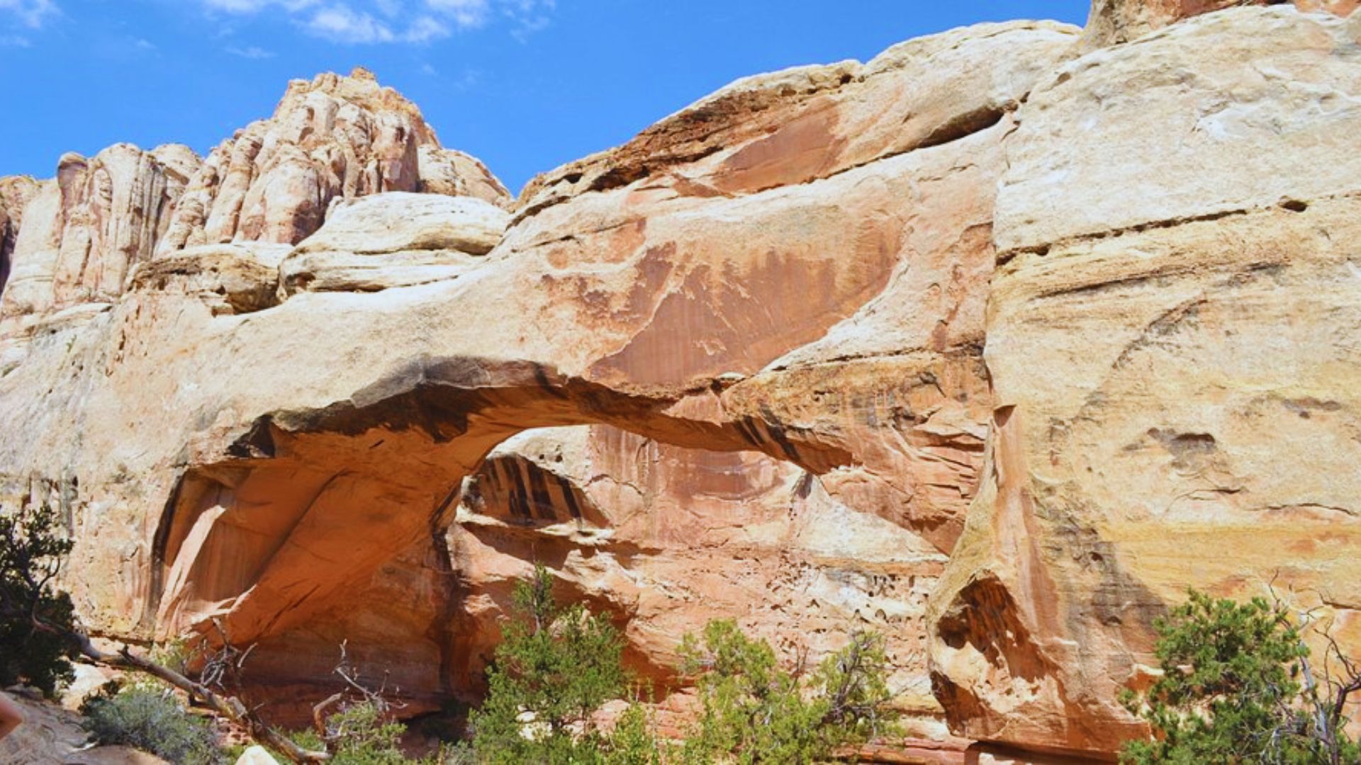
The Hickman Natural Bridge
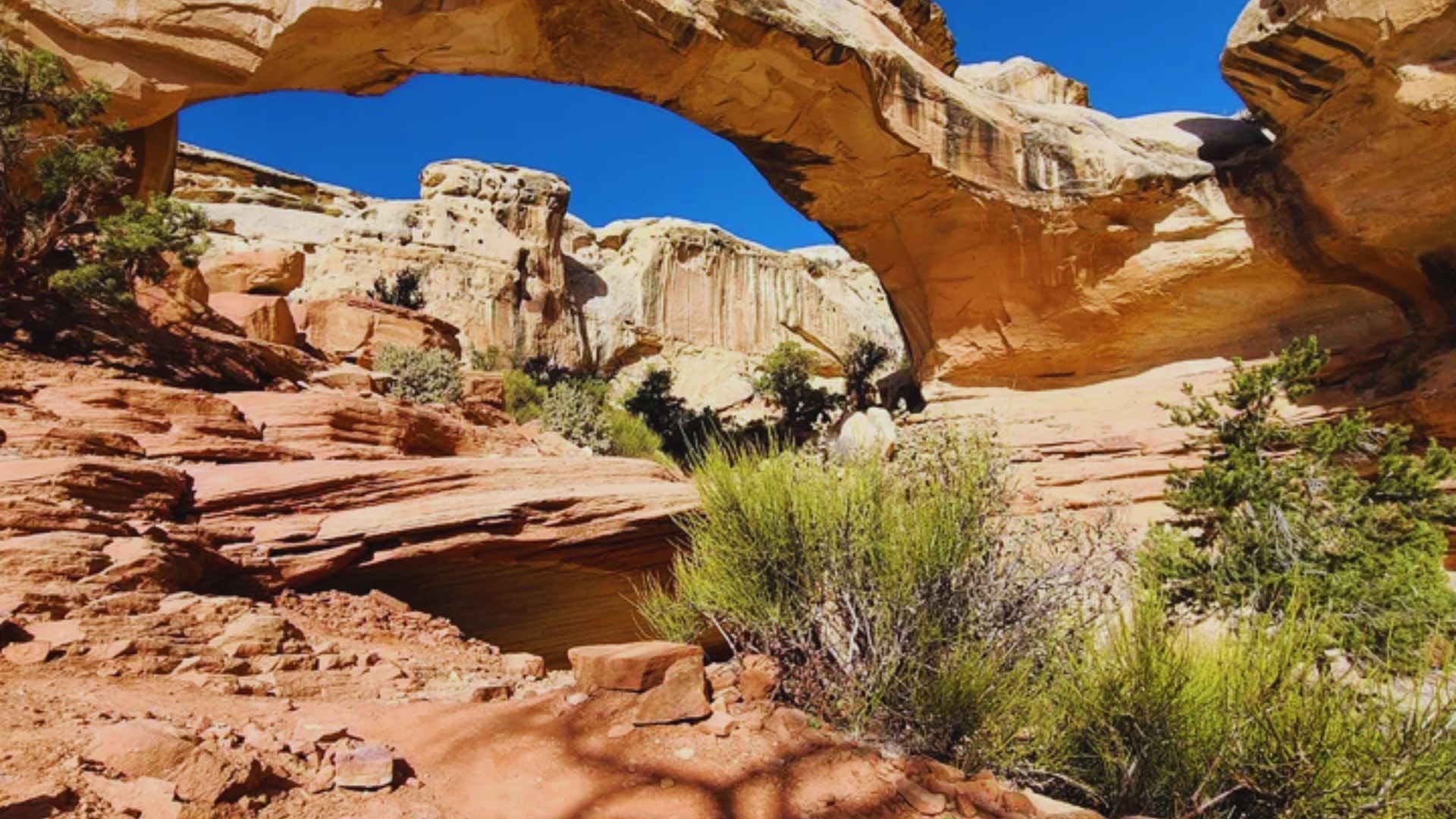
The natural bridge at the end of the trail spans 133 feet across and stands about 125 feet tall. It formed over thousands of years as water carved through the Kayenta sandstone above.
The best viewpoint is from directly below the bridge, looking straight up through the opening. The contrast of the rock against the sky makes for a strong photo regardless of the time of day.
What sets this apart from arches you might see elsewhere is the way it frames the canyon behind it. Standing underneath it gives you a real sense of its scale.
Trail Difficulty and Who It’s For
The moderate rating is accurate, but it deserves a little more context. This is not a casual flat walk, but it is also not a strenuous climb.
The first half of the trail is gentle. The second half involves a sustained climb over rocky, uneven terrain. Footing requires attention, especially on loose gravel sections near the top.
Beginners can absolutely handle this trail with the right footwear and a reasonable pace. I have seen young children and older hikers complete it without issue.
Families with kids aged six and up should find it very manageable. Take breaks on the way up and let kids set the pace.
The one honest caution: exposed sections of the trail have no shade. In summer heat, that matters more than the elevation gain.
Best Time to Hike Hickman Bridge Trail
Spring and fall are the best seasons for this trail. March through May and September through November offer mild temperatures and comfortable hiking conditions.
Summer is the busiest period and also the hottest. Temperatures in Capitol Reef regularly exceed 100°F in July and August. If you hike in summer, start before 7 AM and carry more water than you think you need.
Winter hiking is possible on clear days. Snow and ice can make the rocky sections slippery, so traction devices are worth bringing if temperatures have been low.
Morning light hits the canyon walls and the bridge in a way that afternoon sun simply cannot match. Beyond comfort, that is another strong reason to start early.
Key Hiking Tips
Preparation here is simple but it matters. The trail is short, which makes people underestimate it. Do not make that mistake, especially in warm weather.
- Carry at least two liters of water per person: there is no water source on the trail
- Wear proper hiking shoes: trail runners or hiking boots with grip, sandals and flat sneakers struggle on the rocky sections
- Sun protection is non-negotiable: hat, sunglasses, and sunscreen before you start
- Stay on the marked trail: cutting switchbacks damages the fragile desert soil and contributes to erosion
- Pack out everything you bring in: Leave No Trace principles apply throughout Capitol Reef
The trail is well-marked but take a moment to read the information board at the trailhead before you set off. It gives useful context about the geology and what you will see.
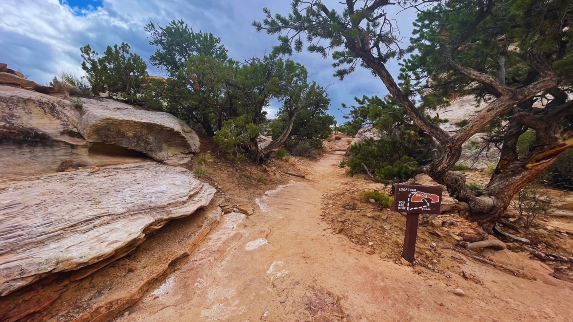
Map and Navigation Tips
Navigation on the Hickman Bridge Trail is not complicated. The path is clear and well-traveled. That said, having a map available is always a smart habit in a national park.
- Download AllTrails offline before you leave cell range, Capitol Reef has limited to no signal in many areas
- Google Maps works for getting to the trailhead but goes quiet once you are on the trail itself
- Trail signage is reliable with markers at key junctions and directional posts throughout
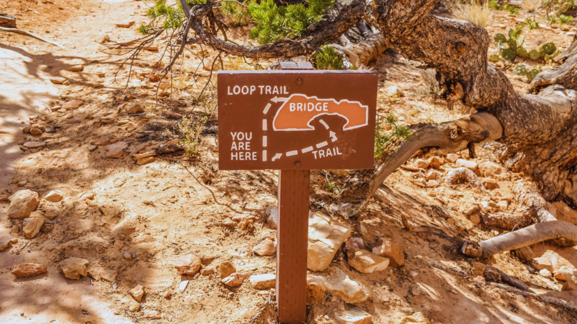
- Turnaround point is the natural bridge itself, from there you retrace your steps back to the parking lot
- The junction near the top splits toward the bridge and toward a viewpoint, both are worth visiting if time allows
Most hikers who get confused do so at that upper junction. Look for the signage and take a moment to read it before choosing a direction.
Photography Tips for Hickman Bridge Trail
The Hickman Bridge Trail is one of the most photogenic short hikes in Utah. With a little planning, you can come away with shots that genuinely capture what the place feels like.
- Best angle for the bridge is from directly below, looking upward through the opening to frame the sky
- Golden hour lighting in the early morning makes the red sandstone glow in a way that midday sun cannot replicate
- Wide-angle lenses work best for capturing the full span of the bridge and its relationship to the surrounding canyon
- Include a person in the frame near the bridge to give viewers a true sense of the scale
- Shoot the approach too, the canyon walls and desert floor on the way up make for strong landscape images that complement the main bridge shot
If photography is a priority, plan your visit for the first hour after sunrise. The light, the quiet, and the empty trail all work in your favor at that time.
Conclusion
That moment when the bridge comes into view? You will not forget it. I promise you that.
Capitol Reef does not get the same attention as Zion or Bryce. Honestly, that works in your favor. Fewer crowds, more space, same jaw-dropping scenery.
Hickman Bridge Trail is the perfect place to start.
Set that early alarm. Lace up your boots. Go see it for yourself.
And when you get back, I want to hear about it. Drop a comment below and share this with someone who has a Utah trip coming up.
Frequently Asked Questions
How Long Is Hickman Bridge Trail?
The Hickman Bridge Trail is 1.8 miles round trip and takes most hikers between 1.5 and 2 hours to complete at a comfortable pace. The trail length makes it one of the more accessible hikes in Capitol Reef National Park.
Is Hickman Bridge Trail Difficult?
The trail is rated moderate due to its rocky terrain and around 400 feet of elevation gain on the return half. Beginners and families with older children handle it well with proper footwear and a steady pace.
Where Is Hickman Bridge Trail Located?
Hickman Bridge Trail is located in Capitol Reef National Park in south-central Utah, approximately two miles east of the Fruita Campground along Highway 24. The trailhead has a dedicated parking area and is clearly marked from the road.
Can Beginners Hike Hickman Bridge Trail?
Yes, beginners can complete this trail comfortably with good hiking shoes and enough water. Taking breaks on the uphill section and starting early in the day makes the experience much more enjoyable.
Do You Need a Permit for Hickman Bridge Trail?
No special permit is required for the Hickman Bridge Trail, but the standard Capitol Reef National Park entry fee applies. As of recent years, a seven-day vehicle pass costs around $20, and America the Beautiful annual passes are accepted.