

Looking for a hike that gives you big rewards without eating up your whole day? Storm King Mountain stands out as one of the Hudson Valley’s most popular trails, and for good reason. This moderate hike packs serious views into a manageable distance.
In just a few hours, you’ll climb through rocky terrain, reach multiple overlooks, and stand atop a summit with 360-degree views of the Hudson River. The trail challenges you just enough to feel accomplished without being too difficult for most hikers.
This guide covers everything you need to know before hitting the trail. You’ll learn about route options, what to expect on your climb, navigation tips, and practical advice to make your hike smooth and safe.
Storm King Mountain Trail Routes Overview

The Storm King Mountain hike offers two main routes, and picking the right one matters. The full Storm King Mountain Loop covers 3.6 miles with 1,102 feet of elevation gain. This moderate trail takes most hikers between 2.5 to 3.5 hours to complete. You’ll get the full experience with this route, including views from multiple peaks.
The shorter option, Storm King via Storm King Trail, runs 2.3 miles with 633 feet of elevation gain. This out-and-back route still gives you the main summit views but cuts down on time and distance. Both routes share the same starting section, so you’ll face similar terrain for the first part of your climb.
The main difference comes down to time and how much you want to see. The loop takes you over Butter Hill and connects several trails for a fuller tour of the area. The shorter route gets you to the best views faster and retraces your steps back down. If you’re short on time or new to hiking, the shorter route works great. If you want more miles and have the energy, the loop won’t disappoint.
The trailhead sits on Route 9W in Cornwall-on-Hudson, New York. Parking is limited to a small lot that fills up quickly on weekends. Plan to arrive early, especially during the fall foliage season.
What to Expect on the Trail?
Get ready for a workout right from the start.:
- The hike starts with a steep climb. You will need to use your hands to get over boulders.
- After the first 30 minutes, the trail becomes easier. You will pass through forests and rocky areas.
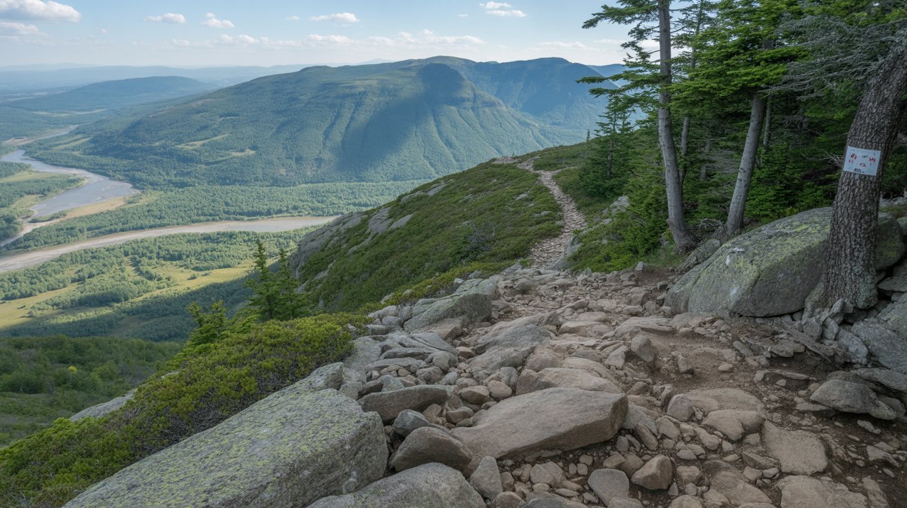
- The trail has colored blazes. Watch trail junctions so you do not get lost.
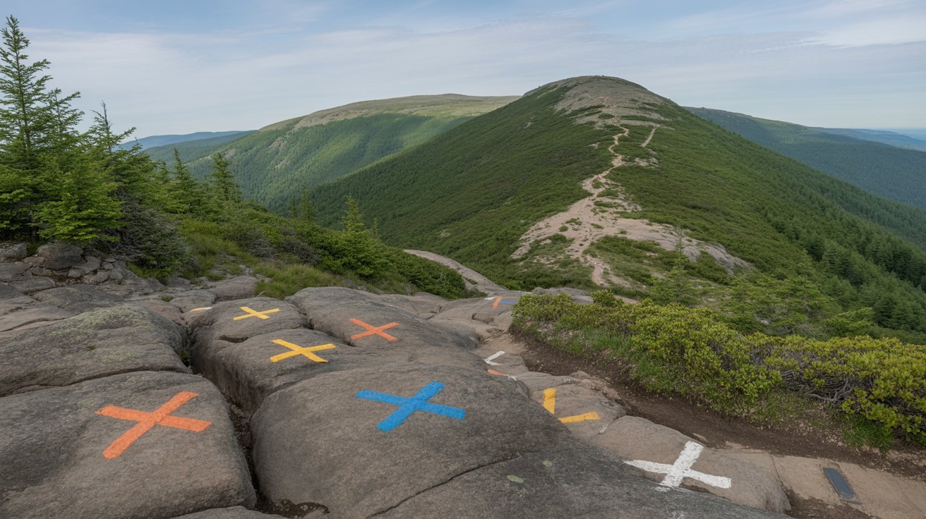
- Do not stop at the first viewpoint. Keep going to the true summit called the money spot.
- Most hikers finish in 2.5 to 3.5 hours. The weather and season can make it harder. Spring and fall are best.
The Views from Storm King Mountain

The summit views make every step worth it. From the top, you’ll see the Hudson River stretching north and south like a silver ribbon through green valleys. The river bends around Storm King, giving you perspectives that few other hikes can match.
Look across the water and you’ll spot Bannerman’s Castle on Pollepel Island. This crumbling Scottish-style castle adds a historic touch to your photos. The Newburgh-Beacon Bridge spans the river to the south, and on clear days, you can see for miles in every direction. The eastern Hudson Highlands fill the opposite shore with rolling peaks.
The “money spot” refers to the rocky outcrop at the summit with zero trees blocking your view. This is where everyone stops to rest, eat snacks, and take photos. Come at sunrise if you can; the early morning light hits the river just right, and you’ll avoid the crowds. Fall brings amazing colors, but any season delivers solid views.
Trail Navigation and Key Waypoints
Start your hike by following the Orange Trail from the parking lot. The trail is marked with orange blazes painted on rocks and trees. This path takes you straight up the mountain through the rocky scramble section. Keep your eyes on the blazes, especially when the trail crosses open rock faces.
The most important junction comes about halfway through your hike. You’ll reach a split where the Orange Trail meets the Yellow and Blue Stillman Trail. Turn RIGHT here—this is critical. Turning left is a common mistake that takes you off course and adds unnecessary miles. After turning right, you’ll continue toward Butter Hill, another peak on the loop route.
To complete the full loop, follow the trail to Butter Hill’s summit, then connect to the White Trail for your descent back to the parking area. The White Trail brings you down the opposite side of the loop. If you’re doing the shorter out-and-back route, just reverse your path on the Orange Trail. Trail blazes are generally easy to follow, but bring a map or download an offline trail map on your phone just in case.
Practical Tips for Hiking Storm King

Plan to visit on a weekday morning if possible. Weekends bring crowds that fill the parking lot by 8 AM, especially in the fall. Getting there early means easier parking and a quieter trail experience.
The parking lot holds about 20 cars, and there’s no overflow lot nearby. If it’s full, you might need to park along Route 9W, but be careful about where you leave your car. Some areas prohibit parking, and you don’t want a ticket.
Here’s what to bring:
- At least 1 liter of water per person
- Snacks or lunch for the summit
- Hiking boots or shoes with a good grip
- Layers for changing weather
- First aid kit basics
- Fully charged phone
- Sunscreen and bug spray
Dogs can come along, but the rock scrambles pose challenges for smaller pups. Keep your dog on a leash and consider their size before bringing them. The rocky sections require lifting or helping some dogs.
Cell service works at the trailhead and summit, but can be spotty in between. Don’t count on it for GPS. Pack out everything you bring i; there are no trash cans on the trail. Stick to marked paths to protect the environment and avoid getting lost.
How to Reach Storm King Mountain Trailhead?

I’ll guide you on the best routes, parking tips, and GPS directions to safely reach the trailhead.
- From the south, take Route 9W north through West Point.
- Continue on 9W for about 8 miles past the town.
- The parking lot is on your right. Look for cars and a small pull-off area.
- From the north, take Route 9W south from Newburgh.
- The parking lot is on the northbound side. If coming from the south, you will need a U-turn.
- There is a safe spot for a U-turn about half a mile past the trailhead. Do not make an illegal U-turn.
- For GPS, search “Storm King State Park parking” or use coordinates 41.4328° N, 74.0053° W.
- If the main lot is full, limited roadside parking is nearby. Make sure you do not block traffic.
- There are no bathrooms, water, or facilities at the trailhead. Plan accordingly.
Conclusion
The Storm King Mountain hike delivers what Hudson Valley hikers want most: big views from a reasonable effort. You’ll work for those summit panoramas, but the trail doesn’t require expert skills or all-day commitment. Rock scrambles add fun without being scary, and the river views from the top beat almost anything else in the area.
This trail works for many skill levels. First-timers with basic fitness can handle it. Experienced hikers enjoy it as a quick morning workout. Families with older kids find it challenging but achievable.
Check the weather before you go, bring enough water, and start early to beat the crowds. Your legs might be tired on the way down, but your camera roll will be full of shots worth sharing.
Frequently Asked Questions
Can Beginners Hike Storm King Mountain?
Yes, but be ready for a workout. The rock scrambles and steep start make this trail harder than typical beginner hikes. If you have basic fitness and take your time, you can do it. Start early, bring plenty of water, and don’t rush the rocky sections.
Is Storm King Mountain Good for Dogs?
Dogs are allowed on leash, but the trail has challenges. The rock scrambles require lifting smaller dogs in several spots. Larger, active dogs handle it fine. Bring extra water for your pup and watch their paws on hot rocks. Consider your dog’s size and fitness before bringing them.
How Long Does It Take to Hike Storm King Mountain?
Most hikers finish in 2.5 to 3.5 hours for the full loop. The shorter out-and-back route takes 1.5 to 2.5 hours. Your time depends on your fitness level, how often you stop for photos, and trail conditions. Add extra time if you’re hiking with kids or dogs.
What Is the Best Time of Year to Hike Storm King?
Fall offers the best combination of weather and views, with peak colors in October. Spring and early summer work well too, with comfortable temperatures. Avoid summer weekends when crowds and heat make hiking less fun. Winter is possible but requires experience with ice and snow.
Are There Bathrooms at Storm King Mountain?
No bathrooms exist at the trailhead or along the trail. The nearest facilities are in Cornwall-on-Hudson, about 10 minutes away. Use restrooms before you arrive. Gas stations and restaurants in town provide options before or after your hike.