

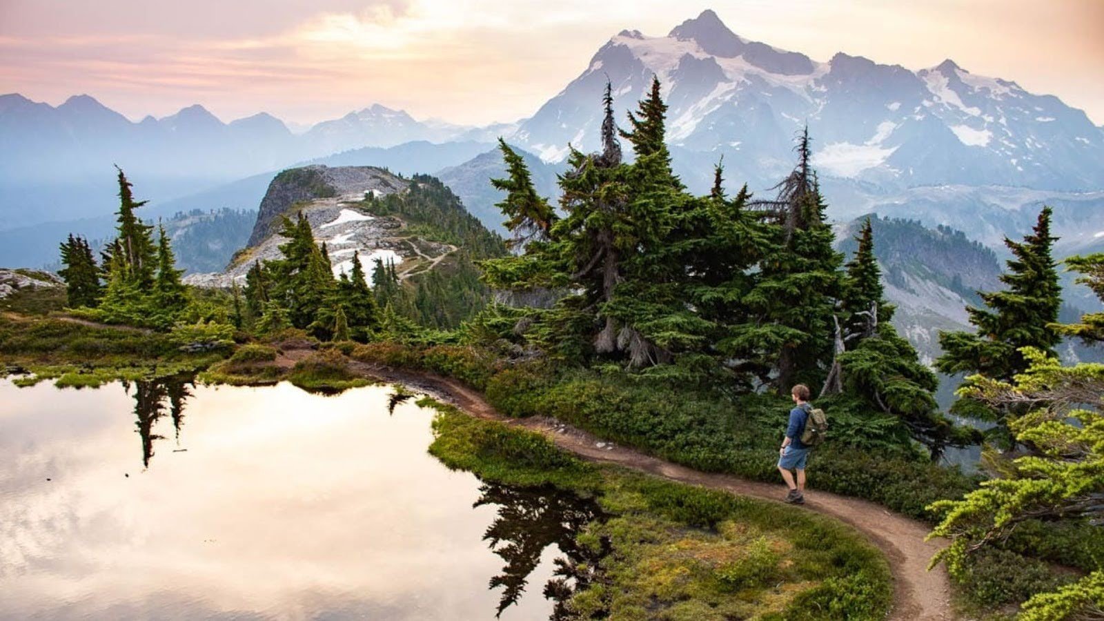
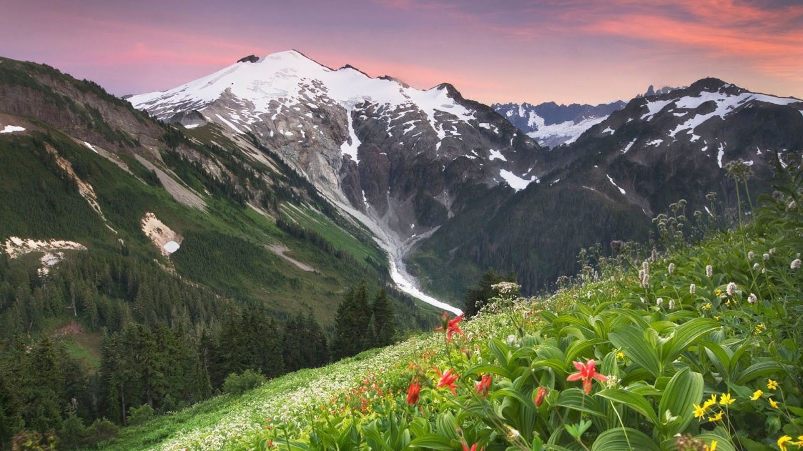
Want to see Mount Baker from its best angles? I’ve got you covered.
This list breaks down my top 9 favorite hikes in the area. I’ve hiked these trails more times than I can count, and I know which ones are actually worth the drive. You’ll find out what makes each one special, how hard they really are, and what you need to know before you go.
I’m not trying to sell you anything here. These are just honest recommendations from someone who loves these mountains and wants you to have a great time out there. Some hikes are tough, some are easy, but they all deliver views that’ll make you stop and stare. Let’s get into it.
Essential Info Before You Go
I want you to be ready for Mount Baker. Let me walk you through what you need to know before hitting the trail.
When to Hike Mount Baker
July through October is your window. That’s when the snow melts enough for safe hiking.
Summer brings wildflowers across the meadows. Fall paints the slopes in red and gold. Glacier views? You’ll get them both seasons. But here’s the catch: roads above Heather Meadows close in winter. Check conditions before you drive up.
Permits and Passes
You need a Northwest Forest Pass or an America the Beautiful Pass. No pass means a ticket on your windshield.
Buy your pass at the Glacier Public Service Center. Or grab one online before you leave home. It’s simple and saves time at the trailhead.
Gear & Safety Tips
Pack smart. Your life might depend on it.
- Water (more than you think)
- Trekking poles for rocky sections
- Layers, temperatures drop fast
- Rain gear (weather changes in minutes)
- Bug spray for meadow areas
- Navigation tools (phon,e G, PS, and paper map)
Alpine meadows are fragile. Stay on trails. Pack out everything you bring in. Leave No Trace isn’t optional here; it protects what makes this place special.
Bears live here. Make noise on blind corners. Check for wildfire updates before you go. Smoke can roll in fast during dry summers.
The 9 Best Mount Baker Hikes
I’ve hiked these trails more times than I can count. Here are the nine best routes that’ll show you what Mount Baker is really about.
Skyline Divide Trail: Best Panoramic Ridge Views
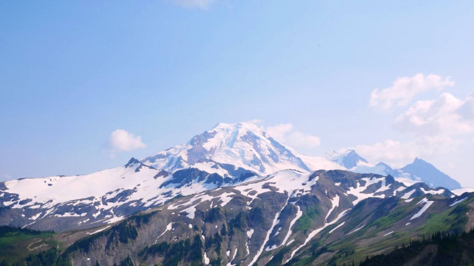
This ridge walk delivers views that never quit. Mount Baker dominates one side. Mount Shuksan fills the other.
You’ll gain 2,500 feet over 7.3 miles round-trip. The trail follows an open ridgeline where mountains surround you in every direction. Bugs swarm in July and August, I mean swarms. Bring a bug net or prepare to jog. The NF-37 road beats up low cars. High clearance helps.
- Distance: 7.3 miles round-trip
- Elevation Gain: 2,500 ft
- Difficulty: Moderate
- Best For: Photographers who want 360° views without fighting huge crowds
Fewer people hike this path than at Artist Point. That’s a win for you.
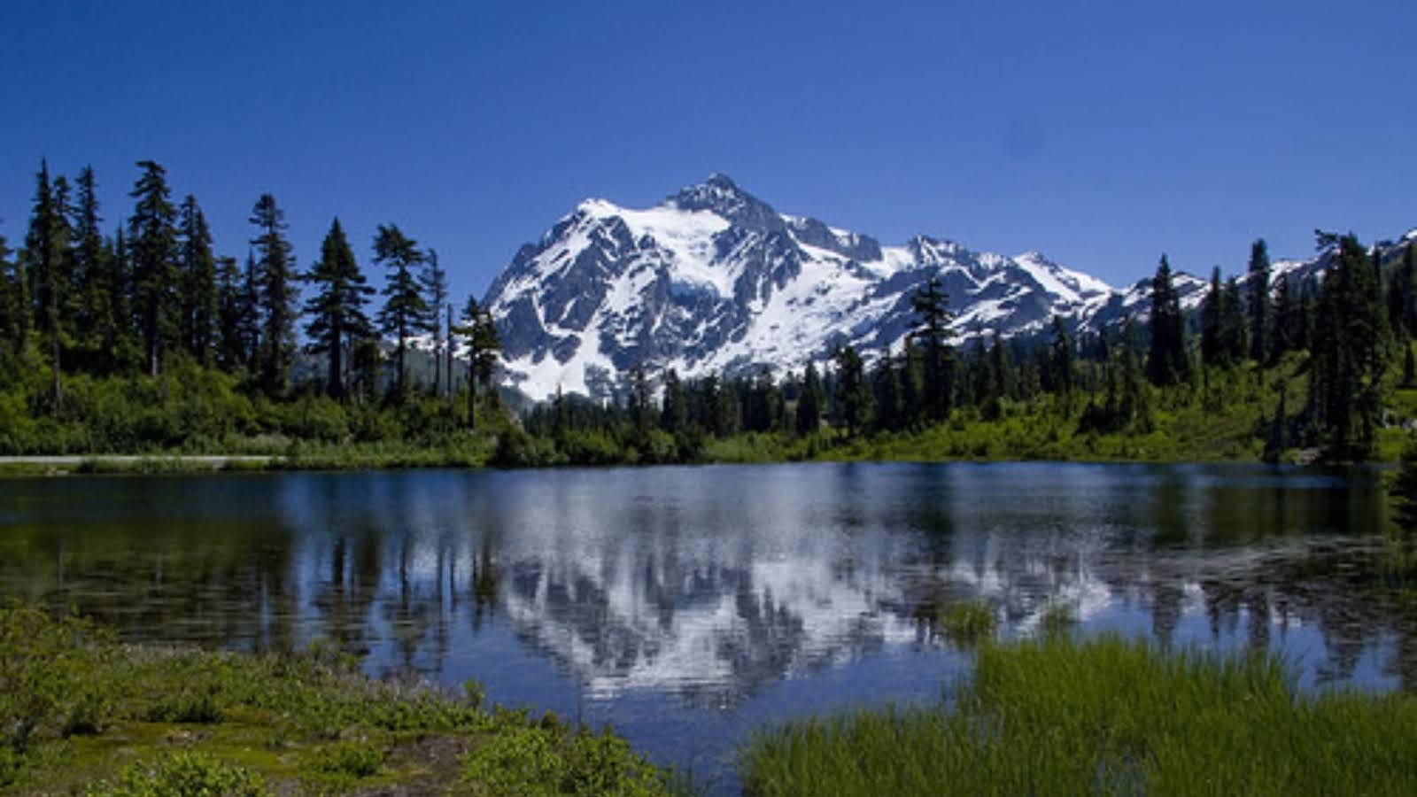
Chain Lakes Loop: Classic Alpine experience
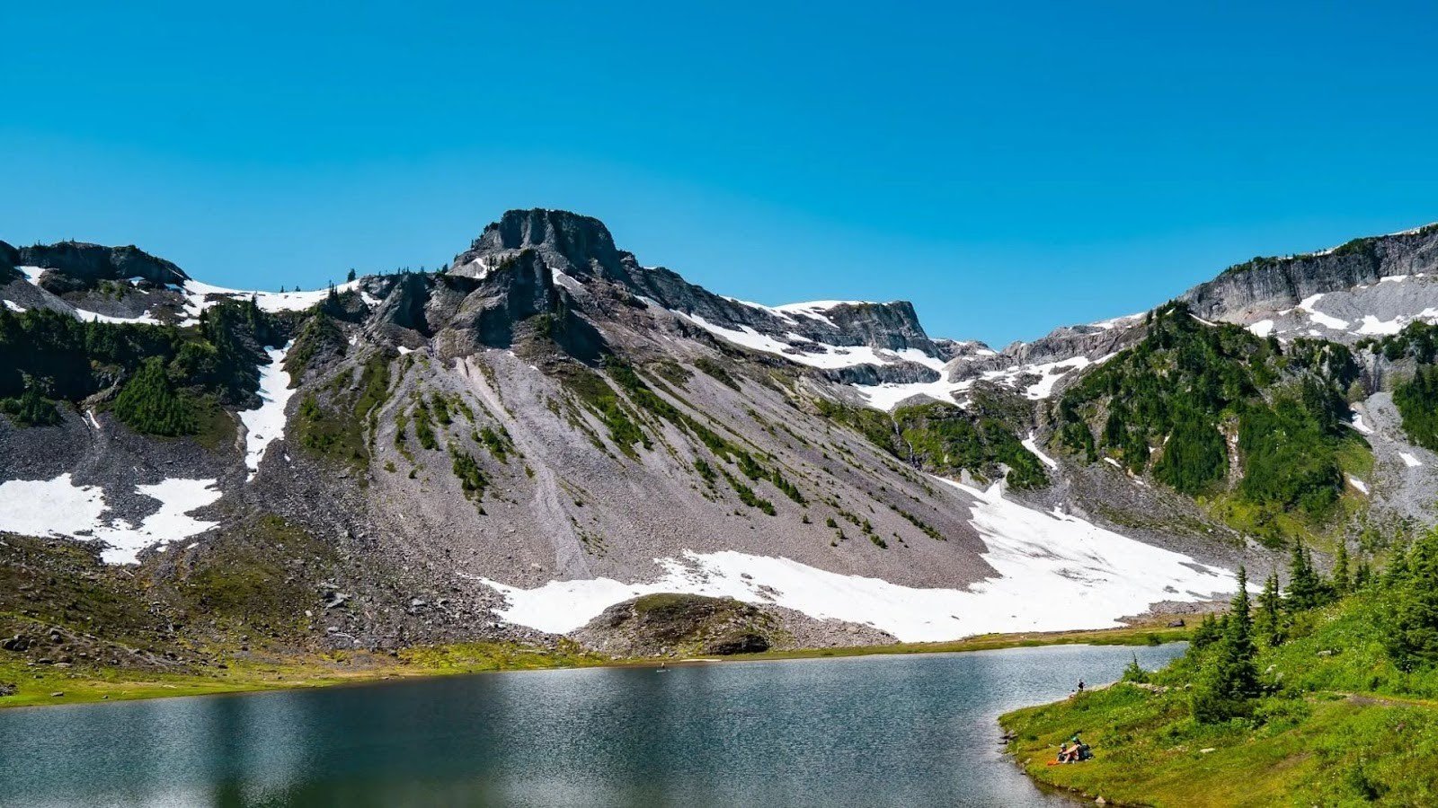
Lakes, meadows, and mountain reflections. This loop has it all in 6.5 miles.
Start at Artist Point or Heather Meadows. The trail circles past multiple alpine lakes with Mount Baker reflected in the water. Wildflowers cover the meadows in late July. Some people even swim in the lakes, cold but refreshing after a climb.
- Distance: 6.5 miles Gain: 1,800 ft
- Difficulty: Moderate
- Best For: Day hikers who want variety and lake views
Pack a lunch. You’ll want to sit by the water and soak it in.
Ptarmigan Ridge: Epic Glacier Views

This trail gets you close to glaciers without ropes or ice axes. Really close.
You’ll cover 11.8 miles with 2,400 feet of climbing. The ridge exposes you to sun, wind, and nonstop glacier views. Mount Baker looms so large you’ll feel like you can touch it. Rocky terrain makes footing tricky in spots. Bring tons of water; there’s no shade out there.
Quick Facts:
- Distance: 11.8 miles round-trip
- Elevation Gain: 2,400 ft
- Difficulty: Hard
- Best For: Strong hikers who want a taste of mountaineering views
This isn’t for beginners. But if you’re ready, it’s unforgettable.
Lake Ann Trail: Alpine Lake & Glacier Combo
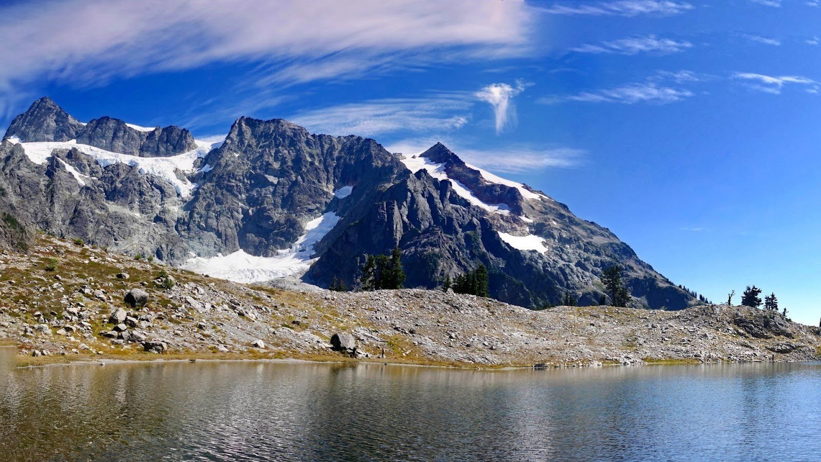
Lake Ann sits in a bowl beneath Mount Shuksan. The Lower Curtis Glacier hangs above it.
The trail starts gently through the forest. Then it punches you with steep switchbacks,2,150 feet over 8.6 miles total. Lake Ann’s water reflects Shuksan on calm days. The glacier calves ice into the lake sometimes. Parking lots fill by 9 AM on weekends.
- Distance: 8.6 miles round-trip
- Elevation Gain: 2,150 ft
- Difficulty: Hard
- Best For: Photographers and strong hikers
Arrive early or prepare to park far down the road. Worth it though.
Yellow Aster Butte: Wildflower Paradise

Wildflowers explode across this trail in late summer. Small alpine tarns dot the landscape.
You’ll climb 2,800 feet over 8 miles. The access road is rough; 4×4 vehicles handle it better. Regular cars scrape the bottom. Views of Mount Baker open up near the top. Fall colors turn the slopes gold and red in September.
- Distance: 8 miles round-trip
- Elevation Gain: 2,800 ft
- Difficulty: Hard
- Best For: Wildflower lovers and fall color hunters
The road scares some people away. Means fewer hikers for you.
Hannegan Peak: Summit With North Cascades Views
This summit gives you views deep into North Cascades National Park. Waterfalls tumble down valleys below.
The 9.7-mile trail gains 3,200 feet. It’s a grind. But the summit panorama spans mountains in every direction. You can connect to Hannegan Pass and continue into the national park if you’re backpacking. Day hikers turn around at the peak.
- Distance: 9.7 miles round-trip
- Elevation Gain: 3,200 ft
- Difficulty: Hard
- Best For: Strong hikers and backpackers
Bring extra snacks. You’ll need the fuel for this climb.
Excelsior Pass & Peak: Challenging with Rewarding Vistas
This is the steepest climb on this list. 3,600 to 4,000 fee, depending on how far you push.
The trail shoots straight up over 8 to 9 miles round-trip. Your legs will burn. But the summit delivers 360° views of Baker, Shuksan, and the entire North Cascades range. Strong hikers love this one as a workout. Weaker knees hate the descent.
- Distance: 8-9 miles round-trip
- Elevation Gain: 3,600-4,000 ft
- Difficulty: Hard
- Best For: Fit hikers looking for a serious challenge
Train before you try this. I’m not kidding.
Heliotrope Ridge: Glacier Close-Up
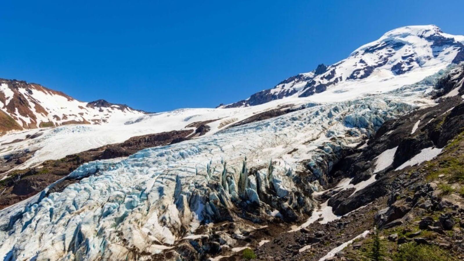
Coleman Glacier dominates this trail. You’ll see crevasses, ice falls, and glacial streams.
The 5.5-mile trail gains 1,850 feet. River crossings require careful footing; trekking poles help. The glacier grows and shrinks each year. You’ll hear it creak and crack. Stay back from the ice edge. Rocks fall without warning.
- Distance: 5.5 miles round-trip
- Elevation Gain: 1,850 ft
- Difficulty: Moderate/Hard
- Best For: Anyone wanting close glacier views
This trail shows you the raw power of ice. Respect it.
Artist Ridge & Huntoon Point: Short & Spectacular

Only 1.5 miles. Only 269 feet of climbing. Maximum views.
This trail starts at Artist Point and delivers instant panoramas of Mount Baker and Mount Shuksan. Families love it. Photographers camp here for sunset. Beginners get mountain views without the suffering. Parking fills fast on weekends.
- Distance: 1.5 miles round-trip
- Elevation Gain: 269 ft
- Difficulty: Easy
- Best For: Families, beginners, and sunset chasers
Don’t skip this because it’s short. The views rival much longer trails.
Where to Stay Near Mount Baker?
You need a place to crash after hiking all day. I’ve stayed at most of these spots. Here’s what works.
Campgrounds
Douglas Fir Campground sits near Glacier. It’s your base for lower trails like Horseshoe Bend.
Silver Fir Campground puts you closer to Artist Point and Hannegan Peak trailheads. Both campgrounds fill up on summer weekends; reserve ahead. You can also camp dispersed along forest roads if the campgrounds are full. Just follow Leave No Trace rules and stay off private property.
- Douglas Fir: Lower elevation, quieter, near the river
- Silver Fir: Higher up, closer to alpine trails
- Dispersed camping: Free but no facilities
Sites cost around $20 per night at developed campgrounds. Pit toilets and water are available at both.
Lodging
Glacier is tiny but has what you need. Cabins and lodges sit close to trailheads, and you’ll wake up ready to hike.
Bellingham offers more options if you want a real town. Hotels, restaurants, and gear shops line the streets. It’s about an hour from the mountain. I stay there when I want a hot shower and a good meal after a hard hike.
- Glacier, WA: Small lodges, cabins, basic motels
- Bellingham: Full-service hotels, dining, REI, and other outdoor shops
Book early for summer weekends. Everything fills up fast between July and September.
Conclusion
So there you have it,9 solid Mount Baker hikes that really deliver. You want a quick morning trip or an all-day experience, there’s something here for you. Each trail has its own vibe, but they all give you those mountain views that make you remember why you love hiking.
You’ve got the info you need now. No more endless research or second-guessing yourself. Pick one that fits your mood, throw your boots on, and get out there.
If you’ve hiked any of these trails or know another good one around Mount Baker, let me know in the comments. I’m always up for hearing about new spots. Hope the weather’s good when you go.
Frequently asked questions
What are the best Mount Baker hikes for beginners?
Artist Point and Photo Lake Loop are great starting points. Both offer stunning views without requiring advanced skills. The trails are well-marked and manageable for most fitness levels. Just check trail conditions before you go, as snow can linger into summer.
When is the best time to hike Mount Baker trails?
Late July through September offers the best conditions. Snow usually clears by then, and wildflowers are in full bloom. Early-season hikes may require microspikes or snowshoes. Always check current trail reports before heading out.
Do I need a permit for Mount Baker hikes?
Most trails require a Northwest Forest Pass for parking. Some popular trailheads may need additional day-use permits during peak season. Overnight trips need wilderness permits. Check the Mount Baker-Snoqualmie National Forest website for current requirements.
Are Mount Baker hikes dog-friendly?
Many trails allow dogs on leash, but some alpine areas restrict them to protect wildlife. Always clean up after your pet and keep them leashed. Check specific trail regulations before bringing your dog along.
How difficult are Mount Baker hikes?
Difficulty varies widely. Some trails are easy 2-mile walks, while others are challenging 9+ mile climbs with significant elevation gain. This list includes options for all skill levels, so read trail descriptions carefully before choosing.