

Few stretches of American highway reward the driver quite like the West Coast. From the tight canyon roads of Southern California to the fog-lined coastal cliffs of Oregon, this coastline packs an unusual variety of driving experiences into a single north-south corridor.
Ocean-hugging switchbacks, elevation changes through old-growth forest, and wide-open desert straights all sit within a day’s drive of each other. For anyone who treats the road itself as the destination, that density of options makes a West Coast road trip hard to beat. What follows is a route-by-route look at the scenic drives worth building a trip around, along with the details that matter most from behind the wheel.
Pacific Coast Highway Through Big Sur
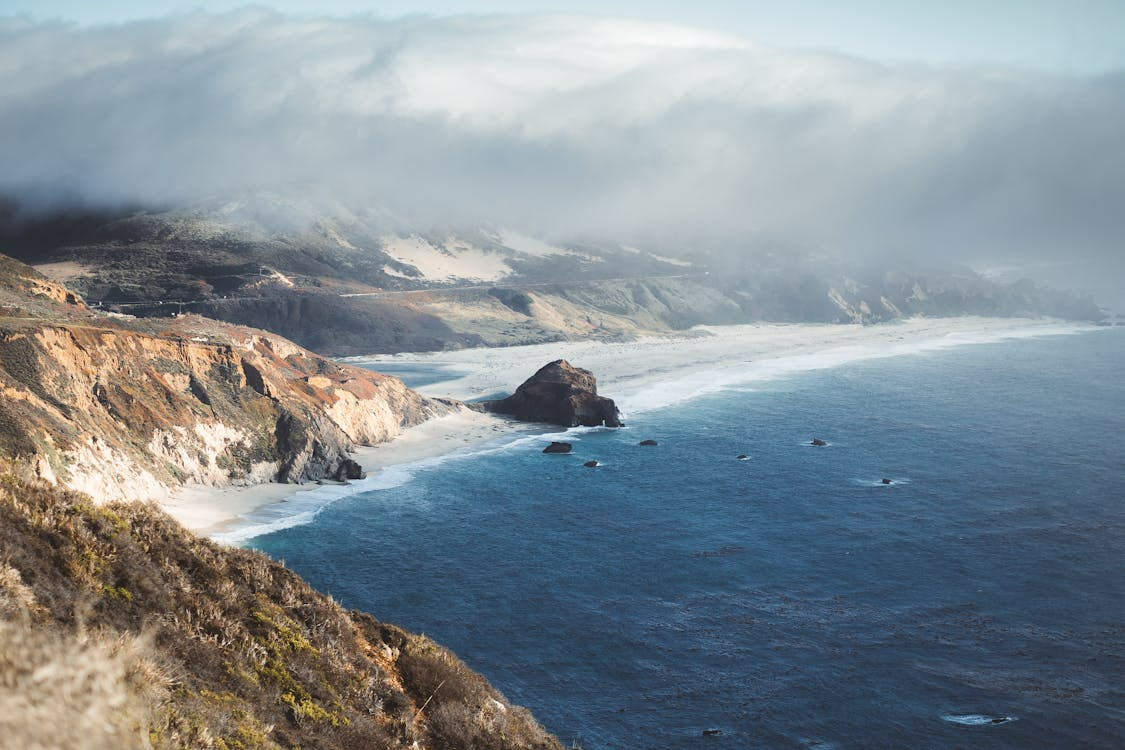
The section of Highway 1 that threads between San Francisco and Big Sur is designated an All-American Road and National Scenic Byway, and it earns every bit of that recognition from the first mile. This is the scenic route that dominates nearly every list of top drives in the country, and for good reason. The Pacific Coast Highway here delivers a driving experience that demands attention, skill, and a car that responds well to constant input.
The road itself is a narrow two-lane ribbon carved into cliffs hundreds of feet above the Pacific. Tight curves come in quick succession, elevation changes are significant, and certain cliffside sections have no guardrails at all. This is not a highway for zoning out or setting cruise control. Steering needs to be precise, sightlines shift constantly, and the rhythm of the road keeps hands engaged on the wheel from start to finish.
Key stops along the way make a strong case for pulling over. Bixby Creek Bridge offers one of the most photographed vantage points on any coastal highway in the world, while the McWay Falls overlook delivers ocean views that feel almost staged. The stretch between Carmel and San Simeon is where the panoramic views hit their peak, with long sightlines over open water broken up by dramatic rocky headlands.
Timing matters here more than most places. Spring through fall offers the most reliable conditions, while winter storms regularly close sections of the road entirely. An early morning start helps avoid the heavy tourist traffic that builds by midday, and the coastal fog tends to burn off before noon, which means better visibility through the most dramatic portions.
Drivers running everything from vintage roadsters to C8 Corvettes built with parts from specialists like West Coast Corvette regularly plan trips around this stretch specifically. The road rewards responsive steering, good brakes, and a driver who actually enjoys the act of driving. For anyone exploring Big Sur’s coastal highway for the first time, the combination of road feel and scenery sets a standard that the rest of the West Coast has to work hard to match.
Mulholland Drive and Angeles Crest Highway
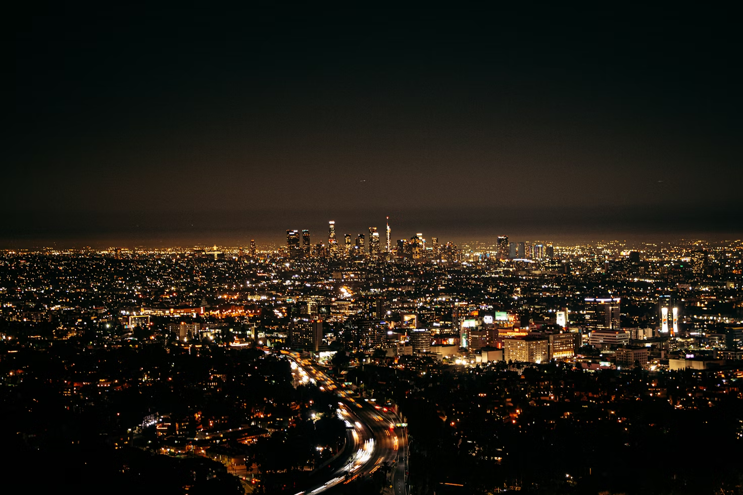
Los Angeles offers two mountain roads that give car enthusiasts very different reasons to set an early alarm. Mulholland Drive and Angeles Crest Highway both start close to the city, but they deliver distinct driving experiences that reflect just how varied the terrain around LA really is.
Mulholland Drive traces the spine of the Santa Monica Mountains, with views dropping away on both sides toward the San Fernando Valley and the LA basin below. The road is famous for its curves and its Hollywood associations, but what makes it worth driving is the rhythm. Short, well-sighted turns come one after another along the ridgeline, and the road rewards smooth inputs without ever feeling like it’s trying to catch you off guard. It connects loosely to the Malibu side of the mountains, and a motivated driver can link it to Pacific Coast Highway for a loop that covers coast and canyon in a single morning.
Angeles Crest Highway, on the other hand, is an entirely different commitment. State Route 2 climbs over 60 miles into the San Gabriel Mountains, with switchbacks that push through more than 7,000 feet of elevation gain. The terrain shifts from dry chaparral into alpine conditions near the top, and the winding roads here demand a level of focus that Mulholland simply does not. This is a half-day drive at minimum, and the reward is a mountain road that feels far removed from the city sitting just below it.
Both routes are popular weekend morning drives among LA car culture communities, though they require different planning. Mulholland is a year-round option, and weekday mornings tend to offer the most open road. Angeles Crest can see snow closures through winter, so checking conditions ahead of time saves a wasted trip. For drivers passing through Los Angeles, fitting both into a single weekend gives a strong feel for why the city’s surrounding mountain roads hold their own against the more famous coastal stretches.
Oregon Coast on Highway 101
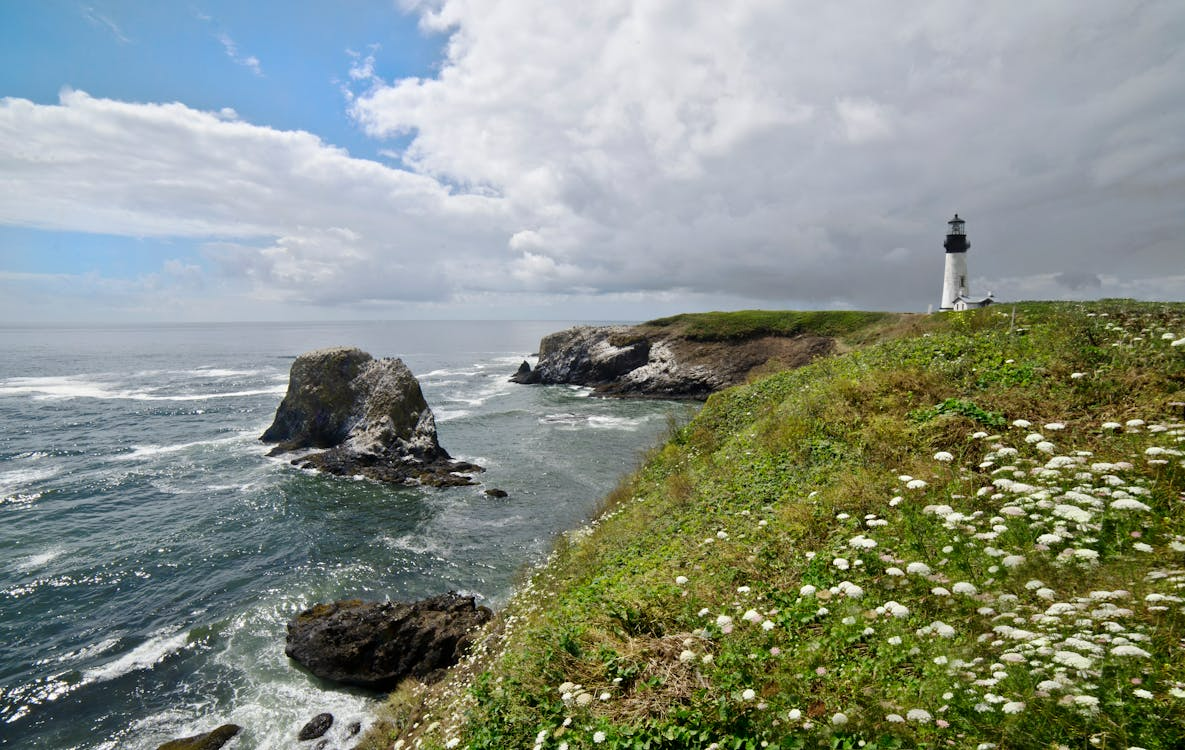
Heading north from California, Highway 101 along the Oregon coast offers a scenic drive that trades PCH’s celebrity for something quieter and arguably more varied. The route runs roughly 360 miles from Astoria in the north to Brookings near the California border, passing sea stacks, forested headlands, and long stretches of empty shoreline with far less traffic than anything south of the border.
What makes this coastal highway interesting from a driving perspective is how often the road changes character. One section will run straight along open bluffs with unobstructed ocean views, and the next will pull inland through corridors of old-growth forest where the canopy closes overhead and the turns tighten up. That alternation between exposure and enclosure gives the road a rhythm that keeps the drive engaging over long distances.
Notable stops along the route include Cannon Beach, Cape Perpetua, and the Samuel H. Boardman Scenic Corridor, where the concentration of rock formations and viewpoints is hard to rival. For anyone building a complete West Coast itinerary, this stretch fills in the Pacific Northwest leg with genuine substance.
Summer is the window to aim for on this road trip segment. Oregon’s coast is rain-heavy from October through May, and fog can cut visibility sharply on the headland sections. Accordingly, planning around July and August gives the best chance at clear conditions along this scenic route.
Planning Your Drive: Timing and Conditions
Regardless of which route makes the final itinerary, timing plays a bigger role in the quality of a West Coast road trip than most drivers expect. Late spring through early fall offers the safest and most enjoyable window across all of these drives, though California’s routes generally stay accessible longer than Oregon’s rain-prone coast.
Weekday mornings consistently deliver the best conditions. Tourist traffic thins out considerably, sightlines stay clear through canyon and coastal sections, and the early light happens to be ideal for photos at turnouts along Pacific Coast Highway or the Boardman Corridor.
Real-time road information is worth checking before heading out, especially on Highway 1 and Angeles Crest, where landslides and snow can trigger closures with little warning. Caltrans and ODOT both offer live updates. Fuel planning also deserves a second thought on Big Sur and remote Oregon stretches, where stations can be few and far between.
The Road Makes the Trip
The West Coast concentrates coastal, canyon, and mountain driving within a single region, and few places anywhere in the country pack that kind of variety so close together. Every route covered here rewards the person behind the wheel, not just the passenger watching out the window.
Pick one scenic drive for a focused weekend, or chain several together for a multi-day trip that moves from Pacific cliffs to alpine switchbacks without ever repeating itself. Along the West Coast, the road is the point.