

I’ve spent years walking Phoenix trails, and I know how hard it can be to find the right hike. Too hot, too crowded, or just not worth the drive. That’s why I put together this guide to the 21 best hikes in Phoenix so you don’t waste a single step.
In this article, you’ll find hikes for all levels, from easy walks to tough summit climbs. I cover what to pack, how to stay safe, and which trails give the best views.
I’ve personally visited many of these, and I’m sharing what actually works.
Overview of the Best Hikes in Phoenix
Phoenix sits inside the Sonoran Desert, where trails run through saguaro forests, rocky canyons, and open ridgelines. Beginners and seasoned hikers both have plenty of options, and most trails are a short drive from the city.
This guide covers 21 of the best hikes in and around Phoenix, with difficulty levels, packing tips, safety advice, and Leave No Trace guidelines all in one place.
Whether you have one hour or a full day, there’s a trail here for you.
21 Best Hikes in Phoenix You Must Try
From quick morning walks to full-day climbs, these trails cover the best of what Phoenix has to offer.
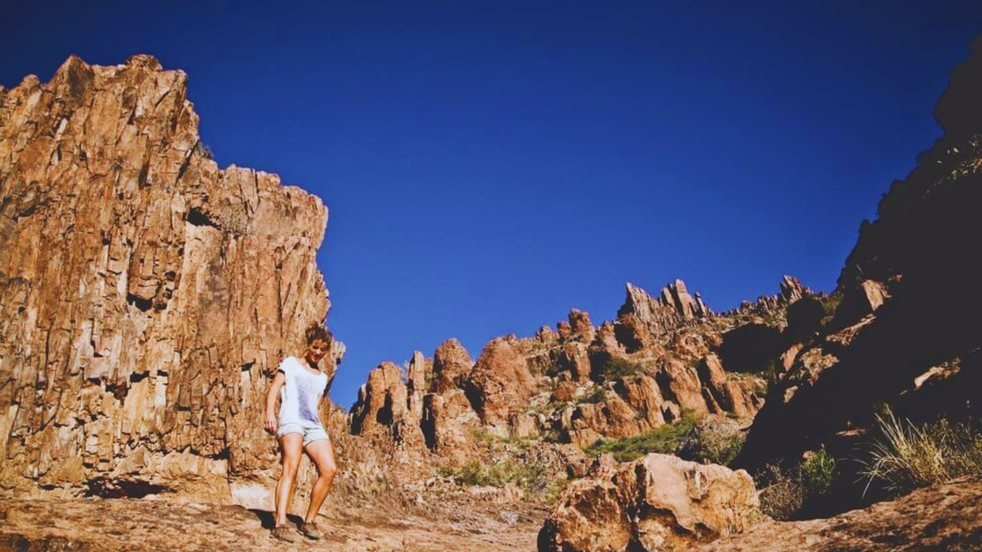
1. Papago Park: Double Butte Loop
Distance: About 4 miles | Difficulty: Easy to Moderate
This loop circles through Papago Park and gives you great views of the red sandstone buttes. The trail is wide and easy to follow. It’s a solid pick if you’re new to hiking in Phoenix or just want a relaxed morning outside.
The path winds past desert plants and connects with other trails in the park. You can extend your walk or keep it short depending on how much time you have.
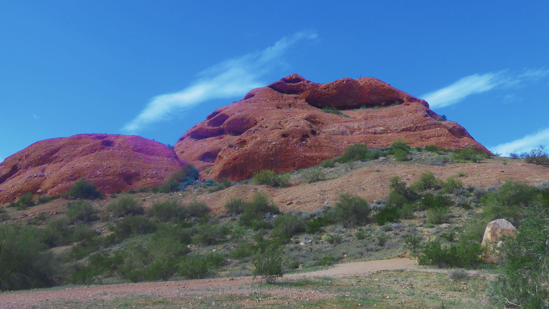
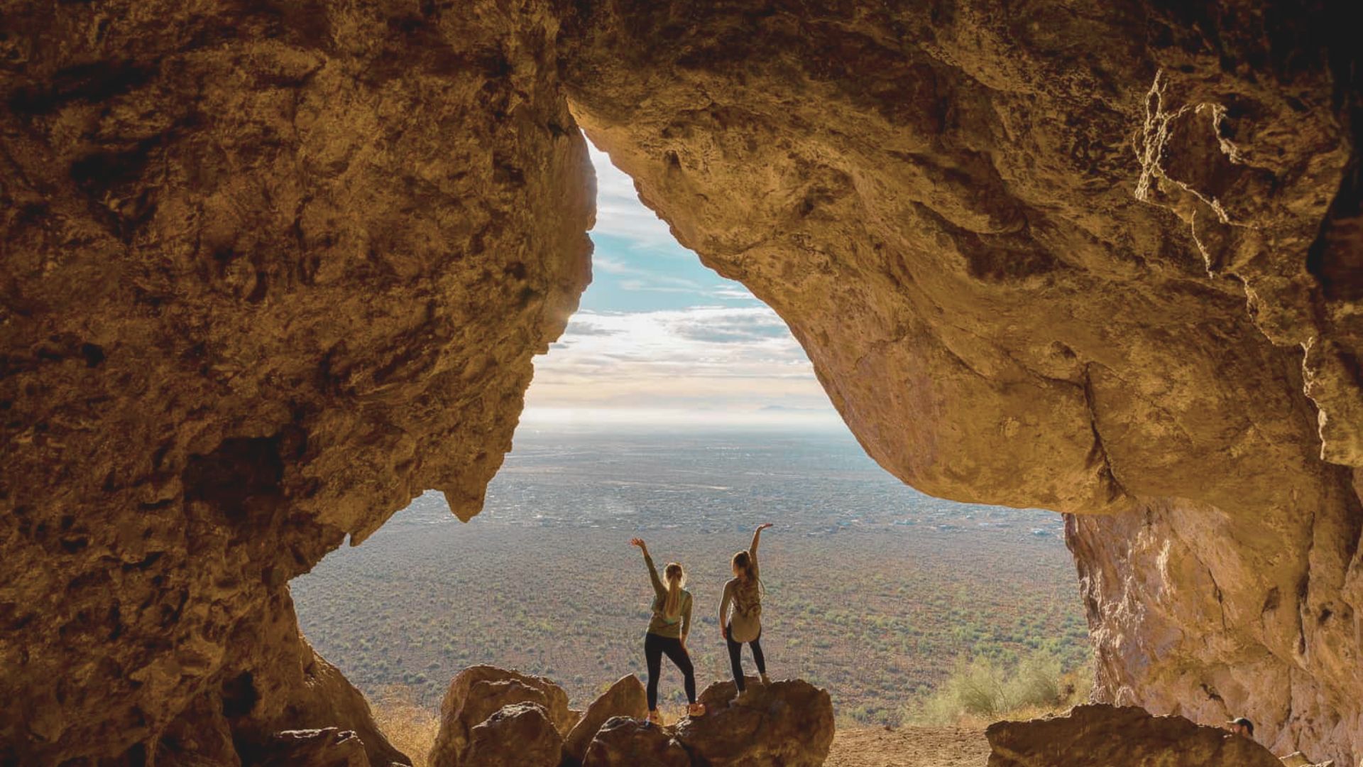
2. Hole-in-the-Rock Trail
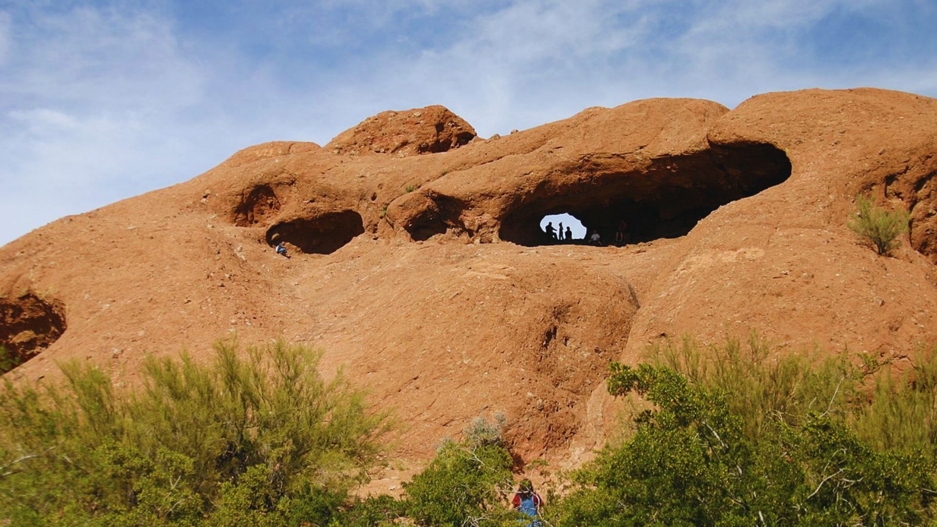
Distance: 0.5 miles | Difficulty: Easy
This is one of the shortest hikes in Phoenix, but it’s worth every step. The trail leads to a natural opening in a sandstone butte where you can look out over the city and the surrounding desert.
It’s a great spot for sunrise or sunset. The hike takes less than 30 minutes round trip, making it perfect if you’re short on time but still want a good view.
3. Phoenix Mountain Nature Trail #304

Distance: 2.5 miles | Difficulty: Easy to Moderate
Trail #304 runs through the Phoenix Mountains Preserve and offers a quiet walk through classic Sonoran Desert scenery. You’ll pass saguaro cacti, palo verde trees, and rocky hillsides.
The trail connects to several others in the preserve, so you can mix and match depending on how far you want to go. It’s a good weekday hike when the city trails get crowded.
4. Valley View Overlook Trail

Distance: 1.3 miles | Difficulty: Easy
This short out-and-back trail sits inside Saguaro National Park West, just outside the Phoenix metro area. The trail climbs gently and ends at a ridge with wide views of the desert valley below.
The saguaro cacti here are thick and tall. Early spring brings wildflowers that dot the hillsides. Go in the morning when the light is soft and the air is cool.
5. Boyce Thompson Arboretum Trails

Distance: 2.5 miles of connected trails | Difficulty: Easy
Boyce Thompson Arboretum is Arizona’s oldest botanical garden and home to miles of walking paths. The trails wind past desert plants from around the world, including cacti, succulents, and native trees.
It’s more of a walk than a hike, but the setting is peaceful and educational. Great for families, plant lovers, and anyone who wants a slower-paced outdoor experience.
6. Hidden Valley Trail (South Mountain)
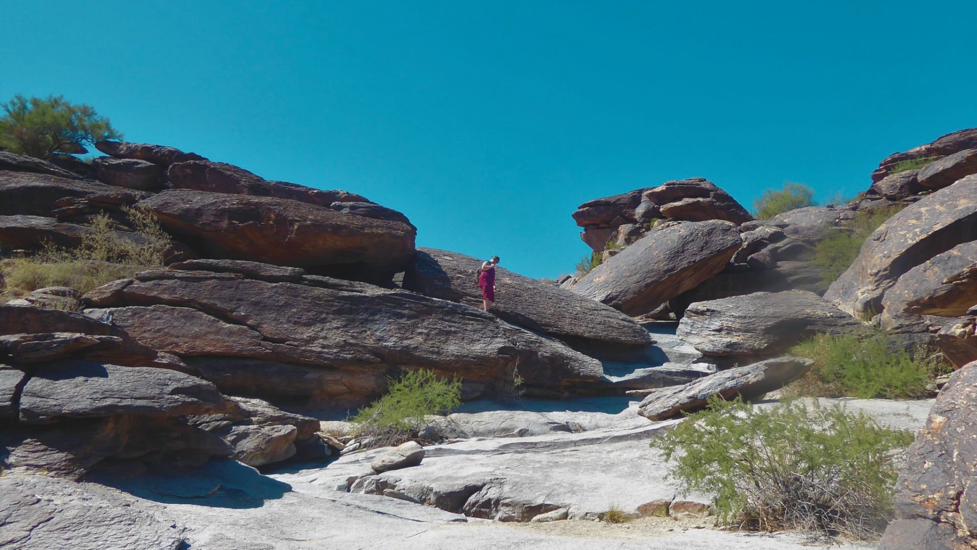
Distance: 4.9 miles | Difficulty: Moderate
South Mountain Park is one of the largest city parks in the country, and Hidden Valley is one of its best trails. The path passes through a natural rock tunnel and a sandy wash that feels like a hidden world inside the park.
The terrain is rocky in spots, so wear solid shoes. The views from the upper sections look out over the entire Phoenix valley.
7. Gateway Loop Trail

Distance: 4.9 miles | Difficulty: Moderate
The Gateway Loop sits at the McDowell Sonoran Preserve in Scottsdale and is one of the most popular hikes near Phoenix. The trail circles through open desert with views of the McDowell Mountains.
The first section is shared with mountain bikers, so stay aware. The loop gets quieter as you move further in. Go early on weekends to beat the crowds.
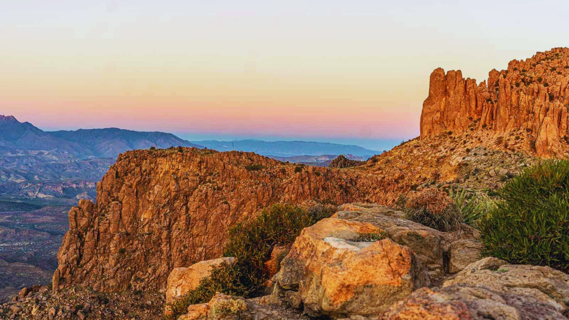
8. Peralta Trail to Fremont Saddle
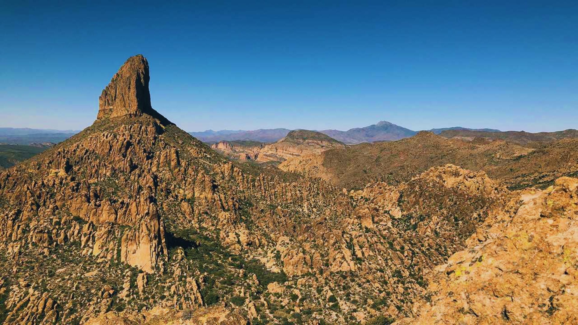
Distance: 4.4 miles round trip | Difficulty: Moderate to Hard
This trail leads to one of the most talked-about views in the Superstition Mountains. From Fremont Saddle, you get a clear shot of Weaver’s Needle, a dramatic volcanic spire rising from the desert floor.
The trail gains about 1,300 feet in elevation. The last section is steep and rocky. But the view at the top makes the effort worth it. Bring plenty of water.
9. Massacre Falls Trail
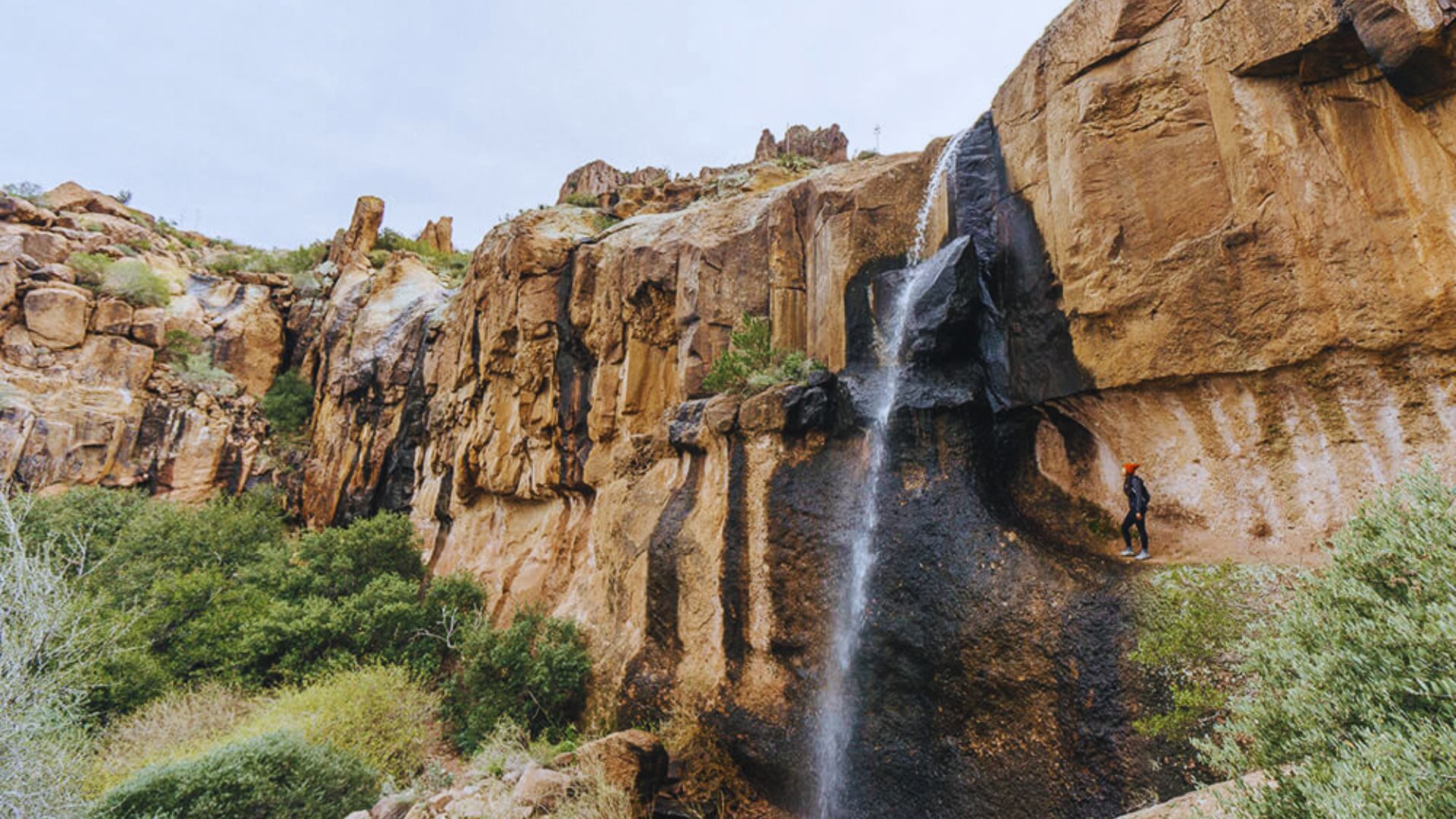
Distance: 5.8 miles round trip | Difficulty: Moderate to Hard
This lesser-known trail leads to a seasonal waterfall deep in the Superstition Wilderness. The hike takes you through rocky terrain and dry washes before ending at the falls.
The waterfall is best after rain. Even when it’s dry, the canyon is worth visiting for its rugged scenery and the feeling of being far from the city. Wear sturdy boots.
10. Broadway Cave
Distance: 5 miles round trip | Difficulty: Moderate
Broadway Cave sits inside South Mountain Park and is one of its more interesting destinations. The trail winds through desert terrain before reaching a small cave carved into the rock.
The cave itself is tight but accessible. It’s a fun trail for those who want something a little different. Go in the cooler months since this trail gets full sun.
11. Tom’s Thumb Trail

Distance: 4.2 miles round trip | Difficulty: Moderate to Hard
Tom’s Thumb is named after the distinctive rock formation at the top of this trail in the McDowell Sonoran Preserve. The hike climbs steadily through boulder fields and desert scrub.
The views from the base of Tom’s Thumb are wide and open. Some hikers scramble to the very top of the rock, but that section requires comfort with heights. The standard trail is rewarding on its own.
12. Camelback Mountain: Echo Canyon Trail
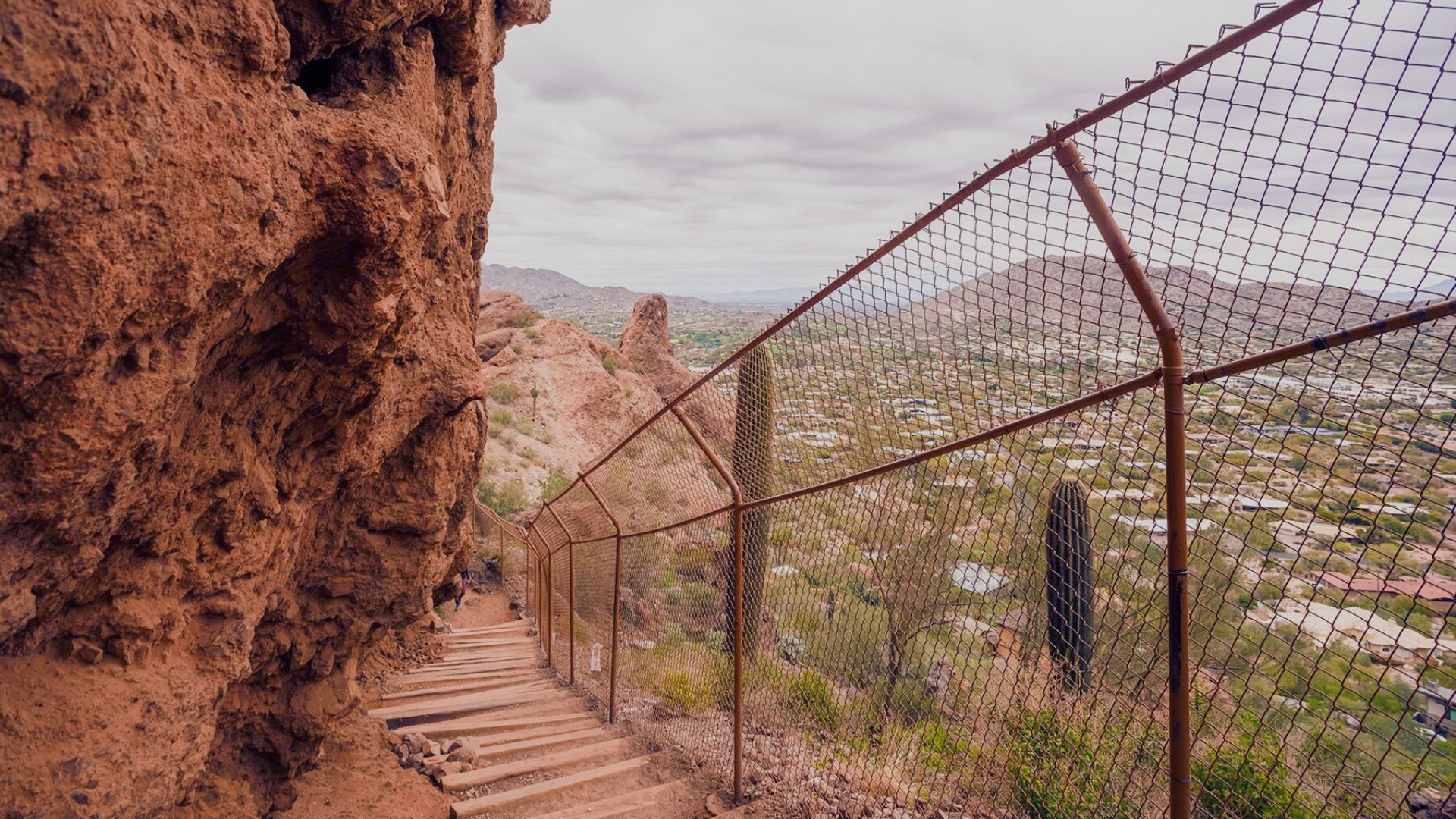
Distance: 2.5 miles round trip | Difficulty: Hard
Echo Canyon is one of the hardest and most famous hikes in Phoenix. The trail gains 1,400 feet in just over a mile. The upper section involves handrails bolted into the rock.
This hike demands fitness and focus. Wear proper shoes, bring water, and start before 7 a.m. on warm days. The view from the top stretches across the entire Phoenix metro. It earns every bit of the effort.
13. Piestewa Peak: Summit Trail

Distance: 2.4 miles round trip | Difficulty: Hard
Piestewa Peak offers a challenging climb inside the Phoenix Mountains Preserve. The trail gains about 1,200 feet and gets steeper near the summit. Handrails and steps help in the upper section.
The views from the top are clear on good days. You can see Camelback Mountain, South Mountain, and the city spread out below. It’s a popular trail, so go early or on weekdays.
14. Wave Cave
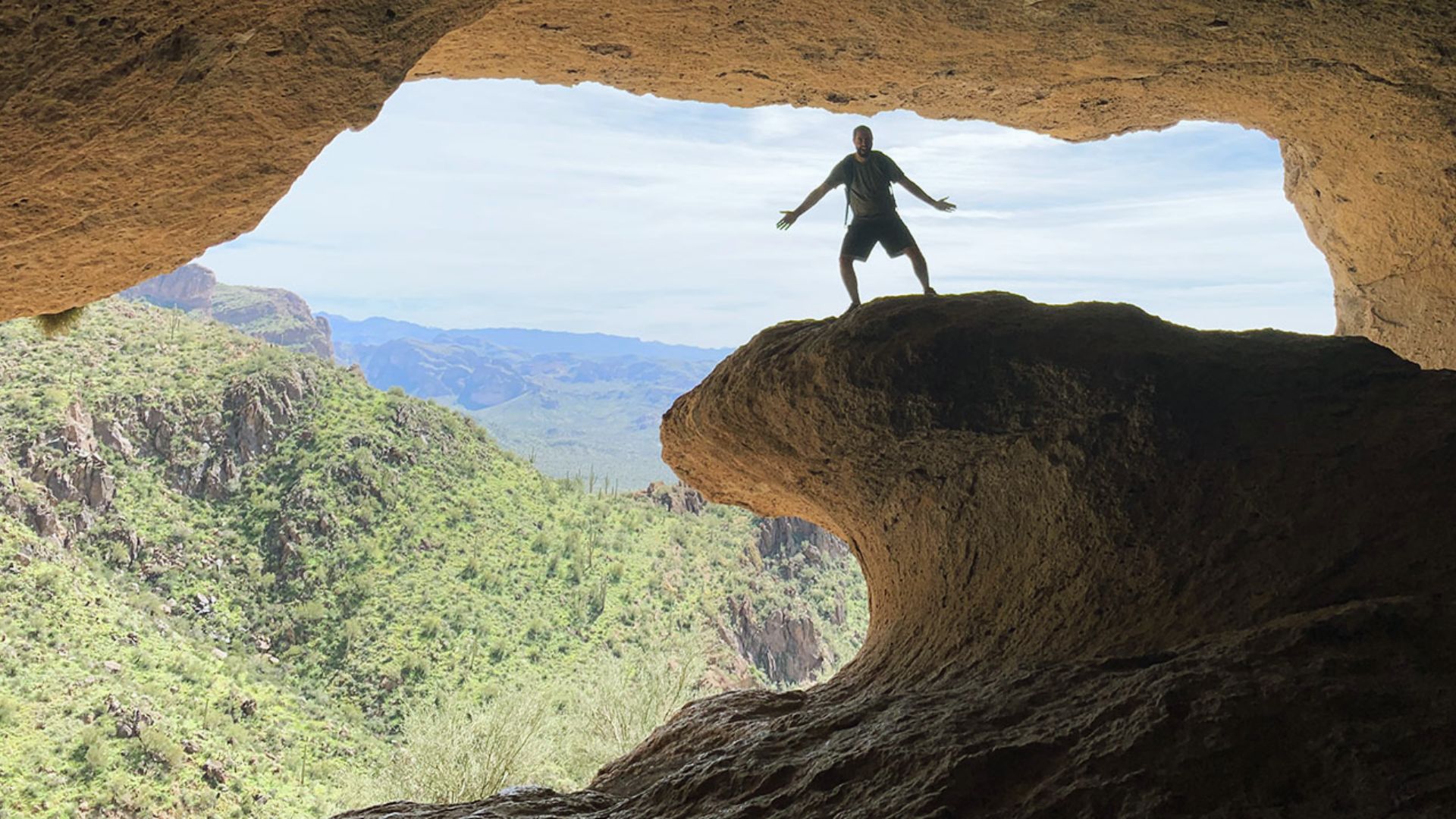
Distance: 5 miles round trip | Difficulty: Moderate to Hard
Wave Cave sits in the Usery Mountain Regional Park east of Phoenix. The trail climbs to a wind-carved cave on the side of a rocky ridge. Inside, the curved walls catch light and shadow in an interesting way.
The trail is mostly dirt and rock with some steep sections near the cave. The hike offers good views of the surrounding desert and is less crowded than the more famous Phoenix trails.
15. Flatiron via Siphon Draw
Distance: 5.5 miles round trip | Difficulty: Very Hard
Flatiron is one of the toughest hikes near Phoenix. The trail follows a dry wash before climbing steeply up a talus field to the flat top of the Flatiron formation above Lost Dutchman State Park.
The upper section is a scramble with no marked trail. You navigate by following rock cairns and instinct. The top is a broad, flat plateau with great views of the Superstition Mountains. Only attempt this if you are fit and experienced.
16. Bob Bear Trail (Fossil Creek)
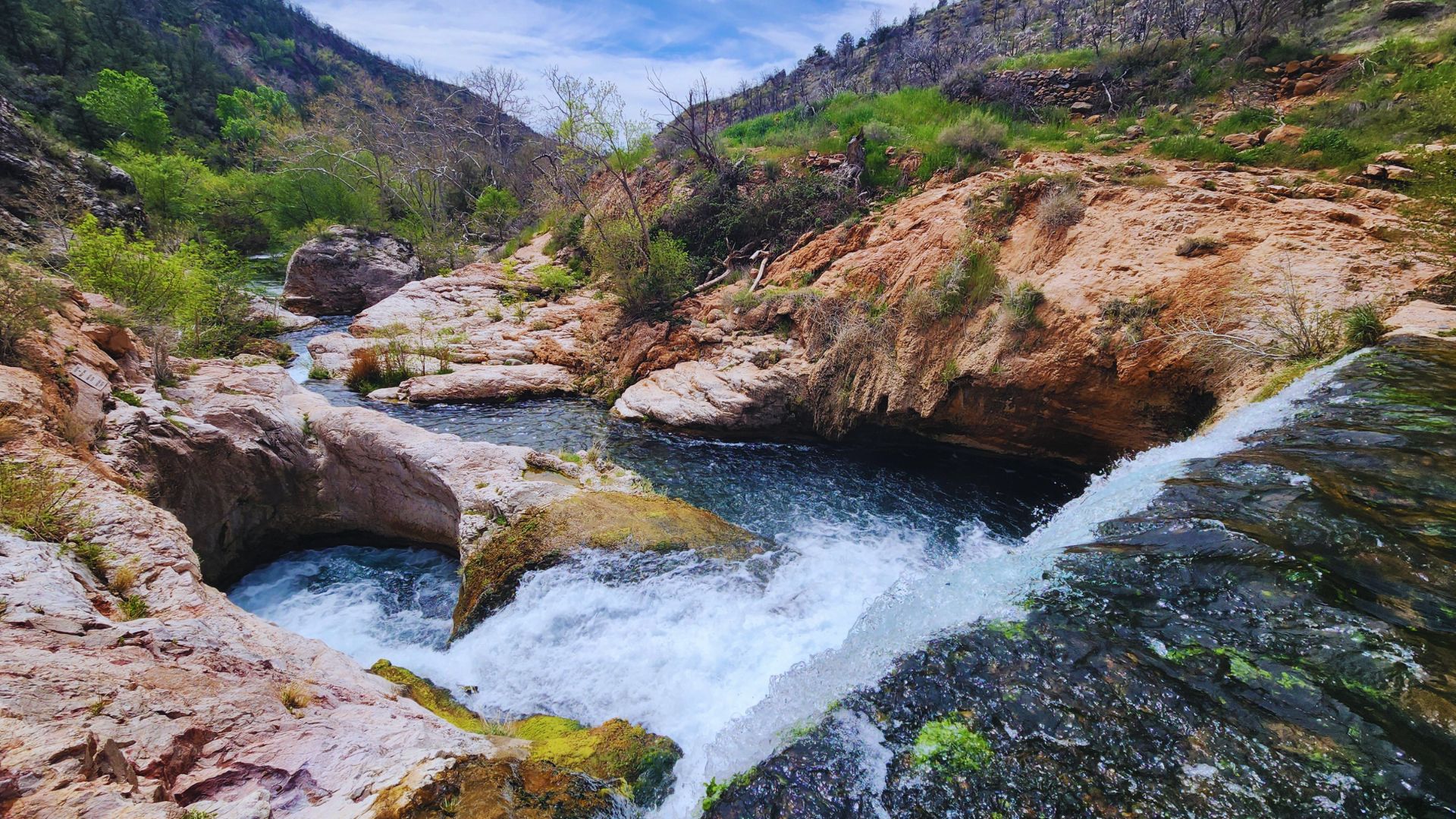
Distance: 6 miles round trip | Difficulty: Moderate to Hard
Fossil Creek is one of only two rivers in Arizona classified as a “wild and scenic river.” The Bob Bear Trail follows the creek through a lush canyon filled with clear blue-green pools and travertine formations.
A permit is required to visit in the warmer months. Book early as spots fill fast. The drive to the trailhead is long and rough, but the creek itself is one of the most rewarding spots in the state.
17. Tonto Natural Bridge State Park Trail
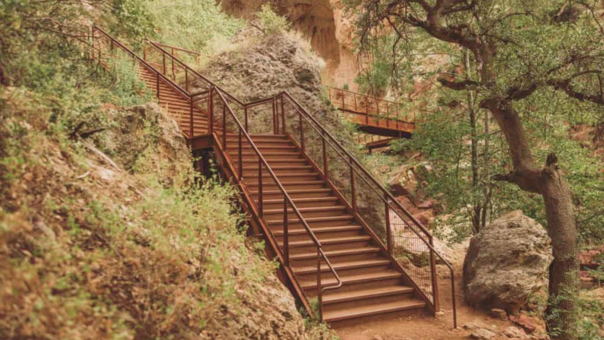
Distance: 0.6 to 1 mile | Difficulty: Easy to Moderate
Tonto Natural Bridge is said to be the largest natural travertine bridge in the world. The trails in the park wind down into the canyon and let you walk under and around the bridge itself.
The trails are short but steep in places. The canyon is cool and green, a sharp contrast to the dry desert above. It’s a good destination for a half-day trip from Phoenix.
18. Watson Lake – Flume Trail
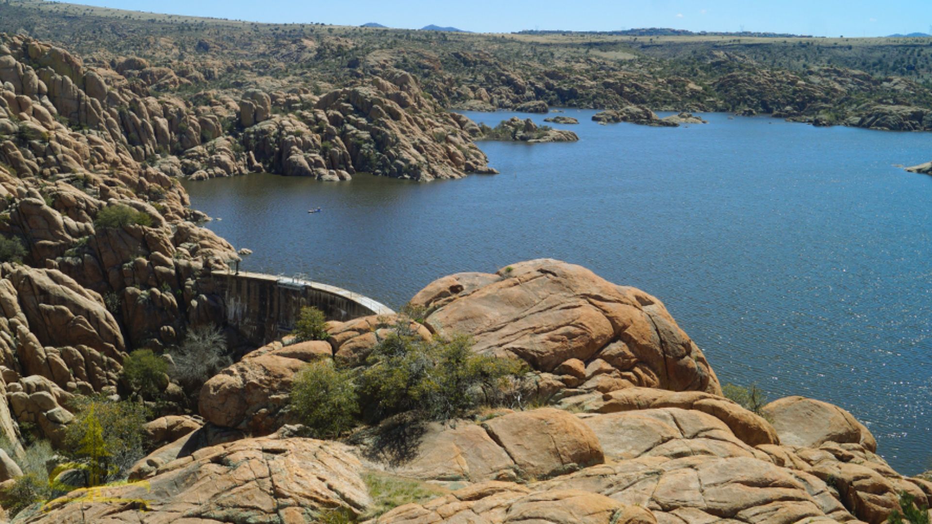
Distance: 4.8 miles round trip | Difficulty: Easy to Moderate
Watson Lake sits near Prescott, about 90 minutes from Phoenix. The Flume Trail circles the lake and passes through a landscape of granite boulders and open water. Kayakers and birds share the scene.
The trail is mostly flat and easy to walk. The boulders along the shore make it feel like a different world. It’s a great escape when Phoenix heat becomes too much.
19. Water Wheel Falls Trail
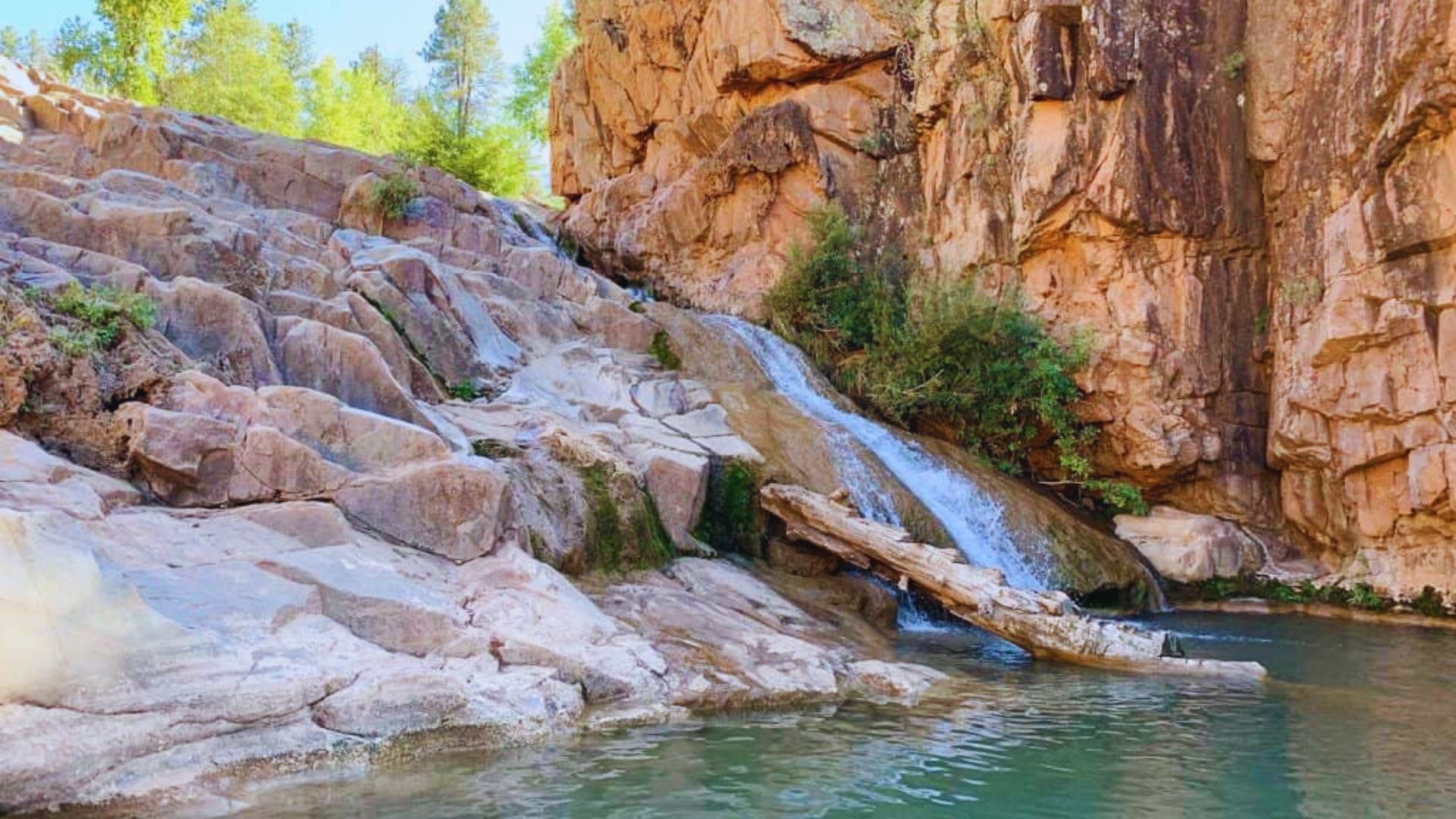
Distance: 6 miles round trip | Difficulty: Moderate
This trail in the Tonto National Forest leads to a series of waterfalls along Fossil Creek Road near Payson. The path follows a creek through pine and sycamore trees.
Water Wheel Falls is the main attraction, a wide cascade that drops into a clear pool. The hike is cooler than most Phoenix-area trails thanks to the creek and tree cover. A good option for late spring or fall.
20. Hayden Butte (“A” Mountain) Trail
Distance: 1.2 miles round trip | Difficulty: Easy to Moderate
Hayden Butte sits in the heart of Tempe and is named for the large “A” painted near the top in honor of Arizona State University. The trail climbs quickly and rewards you with good views of the city, Tempe Town Lake, and Camelback Mountain.
It’s a short hike that works well before or after a visit to downtown Tempe. Go at sunset for the best light over the valley.
21. Treasure Loop Trail (Superstition Mountains)

Distance: 2.3 miles | Difficulty: Easy to Moderate
Treasure Loop is one of the friendlier options at Lost Dutchman State Park. The short loop circles through open desert with clear views of the Superstition Mountains. It’s accessible for most fitness levels and gives a solid taste of what the area looks like.
A small spur at the end leads to a higher viewpoint. The trail is well-marked and easy to follow. A good first hike for anyone new to the Superstitions.
What to Pack for Hiking in Phoenix
Packing right makes a big difference on a desert hike. The sun here is strong, the terrain is rough, and the heat can sneak up on you fast.
Water is your top priority, so bring at least 2 to 3 liters for any hike over two miles and carry more on hot days. Sun protection matters all year, so wear a hat, high SPF sunscreen, and lightweight long sleeves if you run hot.
Proper footwear keeps you steady on rocky ground, so stick to trail runners or hiking boots and skip the sandals. Electrolytes and snacks keep your energy up on longer trails, especially anything over three miles.
Beyond the basics, also pack a small first-aid kit, a fully charged phone, a paper map of the trail area, a light jacket for cooler mornings, and a headlamp if you plan to start before sunrise.
Hiking Safety and Leave No Trace Tips
A few simple habits can keep you safe and help protect the desert for everyone who comes after you.
- Start early and know your limits. Aim to be on the trail by sunrise and off before 10 a.m. from May through September. Don’t push into hard terrain if your body isn’t ready for it.
- Watch for rattlesnakes. They are common near rocks and brush. Look where you step and never reach into areas you can’t see.
- Stay on marked trails. Going off-trail leads to getting lost and damages desert plants and soil. Follow the markers and stick to the path.
- Tell someone your plan. Let a friend or family member know which trail you’re hiking and when you expect to be back.
- Pack out all trash and respect the land. Carry a bag for any waste, avoid touching plants and rocks, don’t feed wildlife, and keep noise low so others can enjoy the trail too.
Conclusion
I hope this guide helps you get out and enjoy the best hikes in Phoenix with more confidence. From short easy walks to tough summit climbs, there’s a trail here for every kind of person.
I’ve stood at the top of Camelback with burning legs and a huge smile. That feeling is hard to beat. Now it’s your turn.
Pick a trail that fits your level and go. You won’t regret it.
Drop a comment below and tell me which hike you’re trying first. Share this post with a friend who needs a good reason to get outside.
Frequently Asked Questions
What is the easiest hike in Phoenix for beginners?
Hole-in-the-Rock Trail in Papago Park is great for beginners. It’s less than a mile round trip and takes about 30 minutes to complete.
What is the hardest hike in Phoenix?
Flatiron via Siphon Draw is widely considered the hardest hike near Phoenix. It involves a serious scramble and should only be attempted by fit and experienced hikers.
When is the best time to hike in Phoenix?
October through April is the best time to hike in Phoenix. Temperatures are cooler and the conditions are much safer than the peak summer months.
Do I need a permit to hike in Phoenix?
Most trails in Phoenix do not require a permit. However, Fossil Creek and some other natural areas do require advance reservations, especially in the warmer months.
How much water should I bring on a Phoenix hike?
Bring at least 2 to 3 liters of water per person for any hike over two miles. On hot days or long hikes, carry even more to stay safe.