

Looking for a less crowded alternative to Glacier Point? Dewey Point Yosemite offers the same jaw-dropping valley views without the tourist crowds. This guide covers everything you need to know about hiking to Dewey Point.
I’ll walk you through trail directions, what to expect along the way, and the best times to visit. You’ll learn about camping options, winter snowshoeing routes, and safety tips.
I’ve hiked this trail myself and can tell you it’s worth every step. Whether you want a day hike or overnight backpacking trip, I’ll help you plan the perfect Dewey Point Yosemite experience.
Dewey Point Yosemite Overview

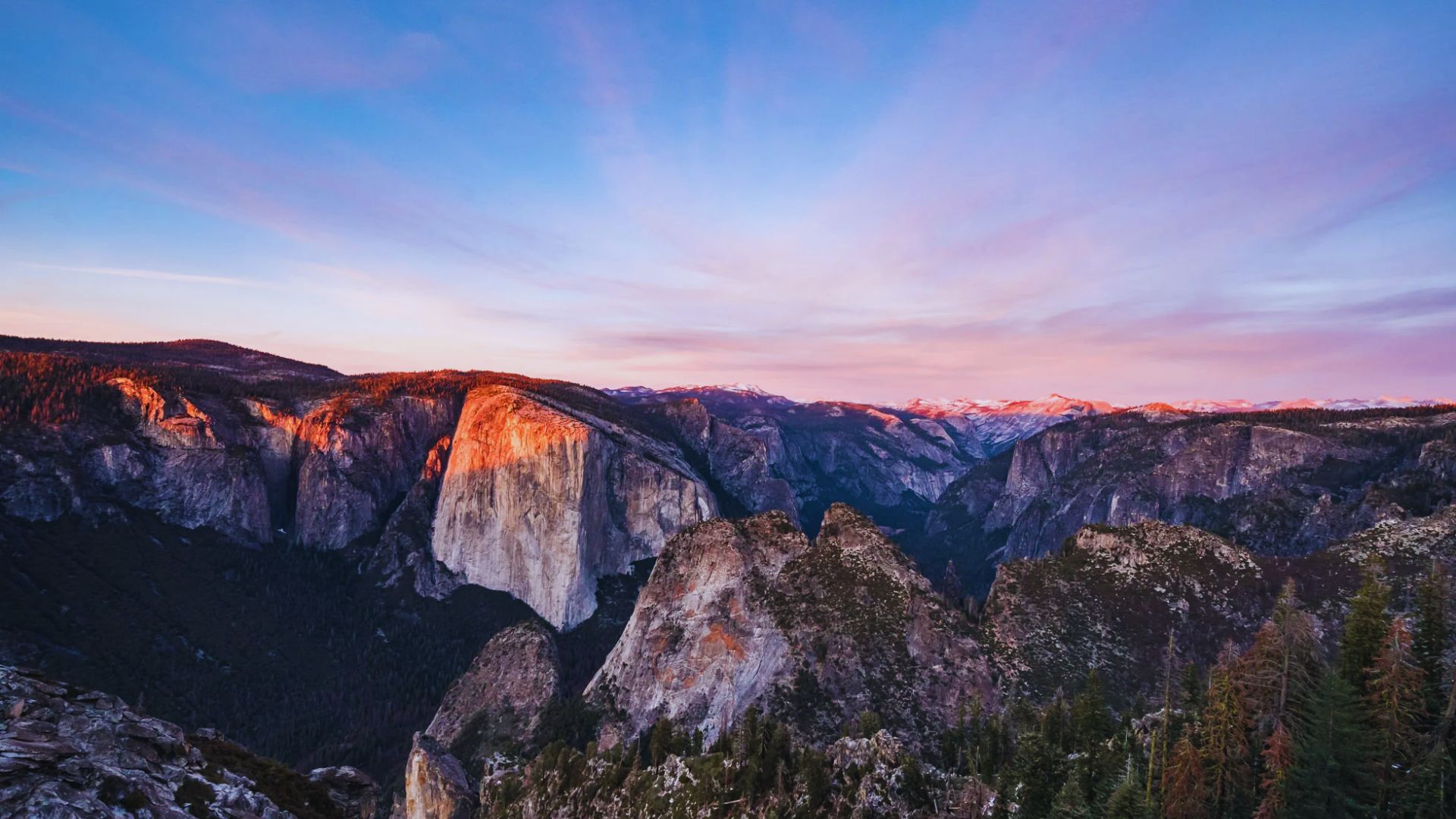
Dewey Point sits on the south rim of Yosemite Valley at 7,385 feet elevation. It’s 7.5 miles from McGurk Meadow Trailhead off Glacier Point Road. You’ll stand directly across from El Capitan with Half Dome rising to the east.
You get Glacier Point views without the crowds. The trail takes you through meadows and forests before opening to that massive overlook. No tour buses or paved paths here.
The round trip covers 15 miles with 2,300 feet of elevation gain. It’s a solid workout but doable for most fit hikers. Spring brings wildflowers, summer offers great weather, and fall shows off golden aspens.
How to Get to the Dewey Point Yosemite Trailhead
From Yosemite Valley, take Wawona Road south. Turn left on Glacier Point Road and drive 7.5 miles. The McGurk Meadow Trailhead parking area appears on your left.
The small lot fits about 15 cars and fills by mid-morning in summer. Arrive before 8 AM. If full, park at Bridalveil Creek Campground a mile down the road.
You need a Yosemite National Park entrance pass ($35 per vehicle for seven days). No wilderness permit needed for day hikes. Overnight trips require permits.
Note: Glacier Point Road closes in winter from November through May.
Dewey Point Yosemite Trail Map
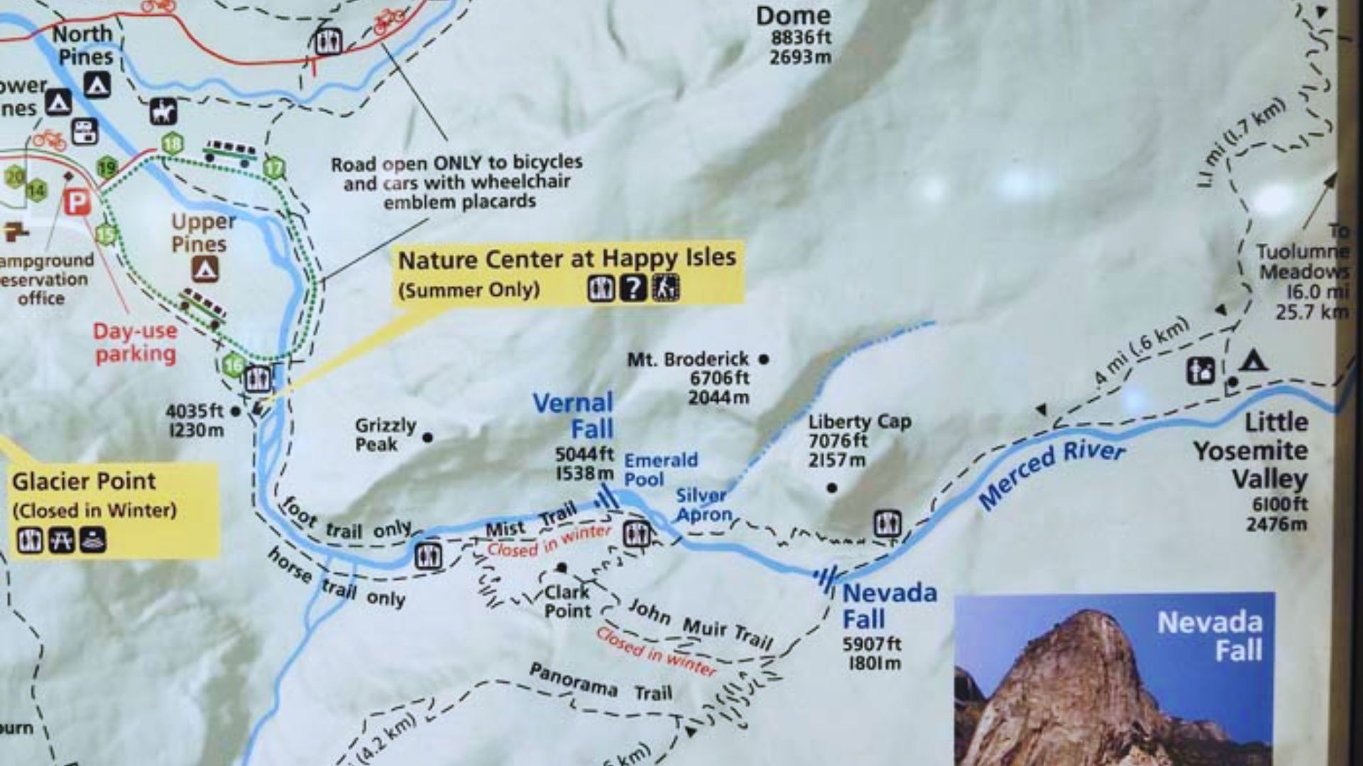
Save these GPS coordinates to your phone or GPS device for easier wayfinding along the route.
The trail follows a simple out-and-back route from McGurk Meadow Trailhead to Dewey Point overlook.
McGurk Meadow Trailhead: 37.670627, -119.628271
Pohono Trail Junction: Turn right toward Dewey Point about two miles from the trailhead
Dewey Point Overlook: 37.670230, -119.627040
Download offline maps before you leave since cell service disappears at the trailhead. Winter snowshoers should bring a GPS device since snow covers all trail markers.
Dewey Point Yosemite Trail Description
The trail starts easy through meadows, then climbs steadily through forest to reach the dramatic rim overlook.
McGurk Meadow and Historic Cabin
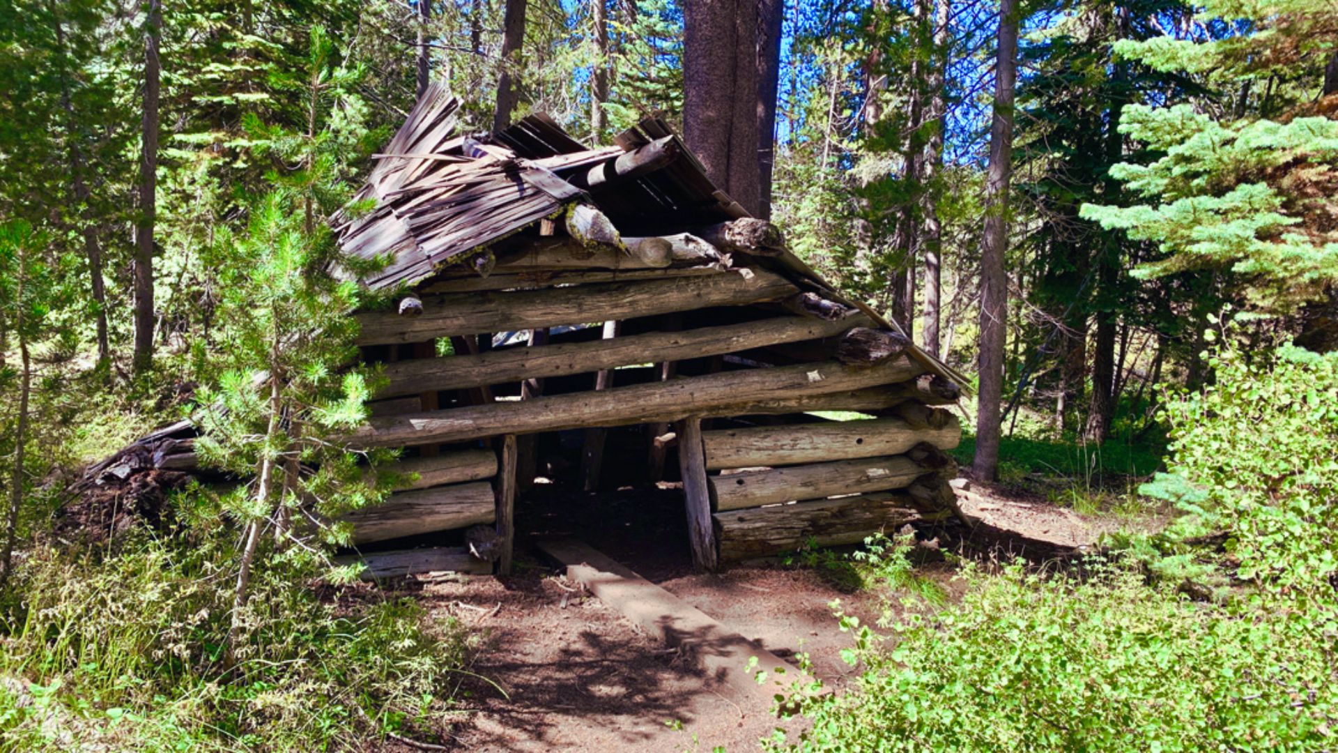
The first 1.5 miles cross flat terrain through McGurk Meadow. Wildflowers bloom here in June and July. You’ll spot a small log cabin on the meadow’s edge dating back to the early 1900s.
Take a quick look but don’t enter since it’s fragile. Watch for deer grazing during early morning hours.
Pohono Trail Junction

After McGurk Meadow, you reach the Pohono Trail junction. Turn right toward Dewey Point. The trail climbs gradually through red fir and lodgepole pine forest, gaining about 800 feet over two miles.
Switchbacks make the climb manageable. Bring a jacket since it stays cool under the trees even in summer.
Final Climb to Dewey Point Overlook
The last half mile opens up as you approach the rim. A final short climb brings you to the granite overlook where the forest suddenly ends. The view hits you all at once.
Yosemite Valley spreads out 3,000 feet below. Some granite slabs near the edge make perfect lunch spots, but be careful since there are no railings.
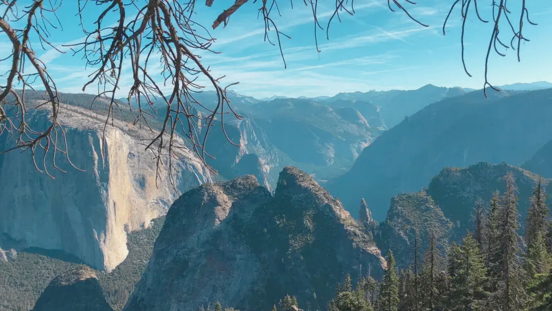
Views From Dewey Point Yosemite
One of the best panoramic overlooks in the park with views stretching from El Capitan to Half Dome.
El Capitan and Yosemite Valley Views
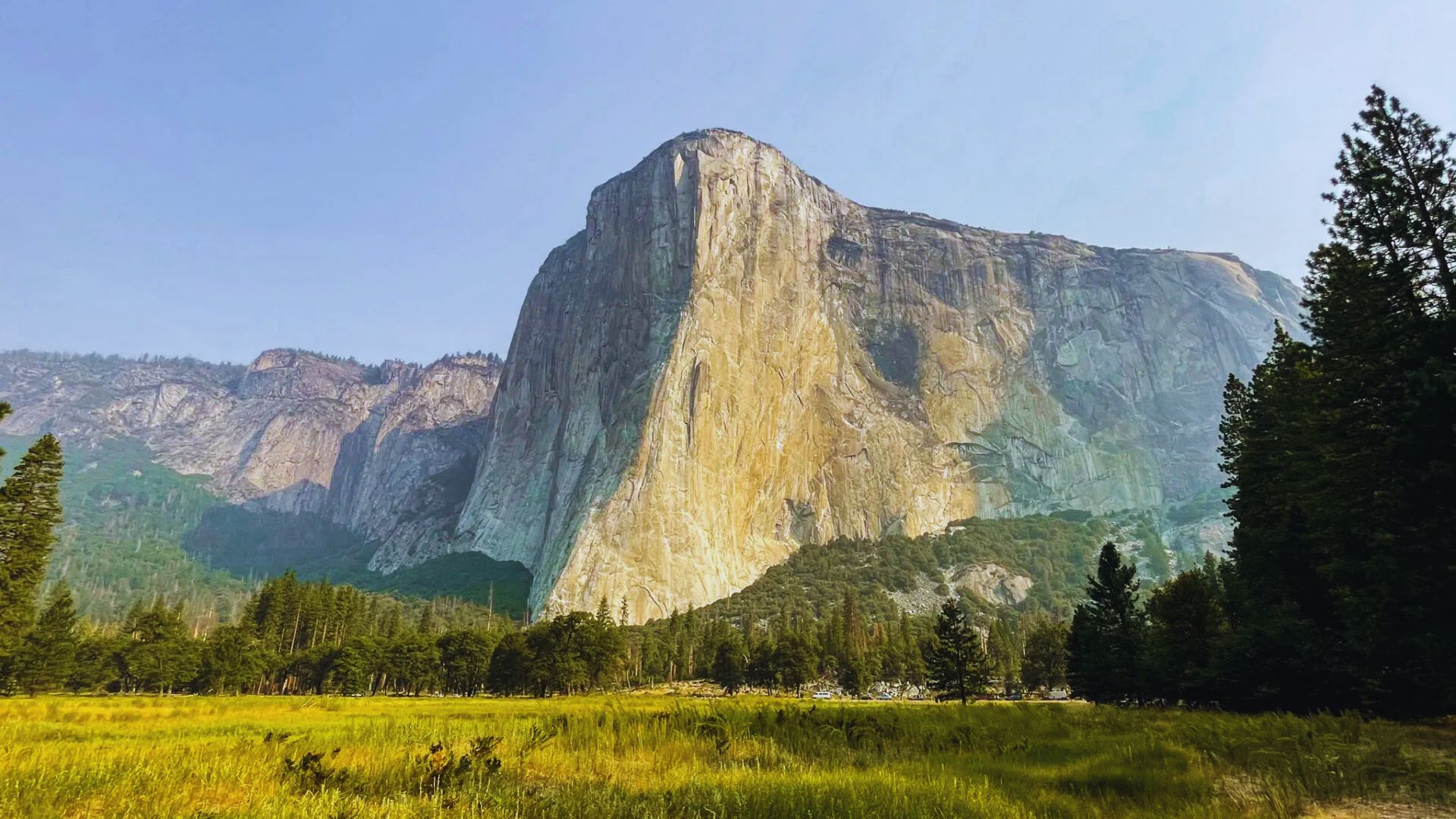
El Capitan dominates the view directly across the valley, rising 3,000 feet from the valley floor. You can see climbers on El Cap with binoculars.
Cathedral Rocks and Cathedral Spires frame the western end. Bridalveil Fall appears as a white ribbon below. The Merced River winds through the valley bottom, flowing full in spring.
Half Dome and Sierra Nevada Views
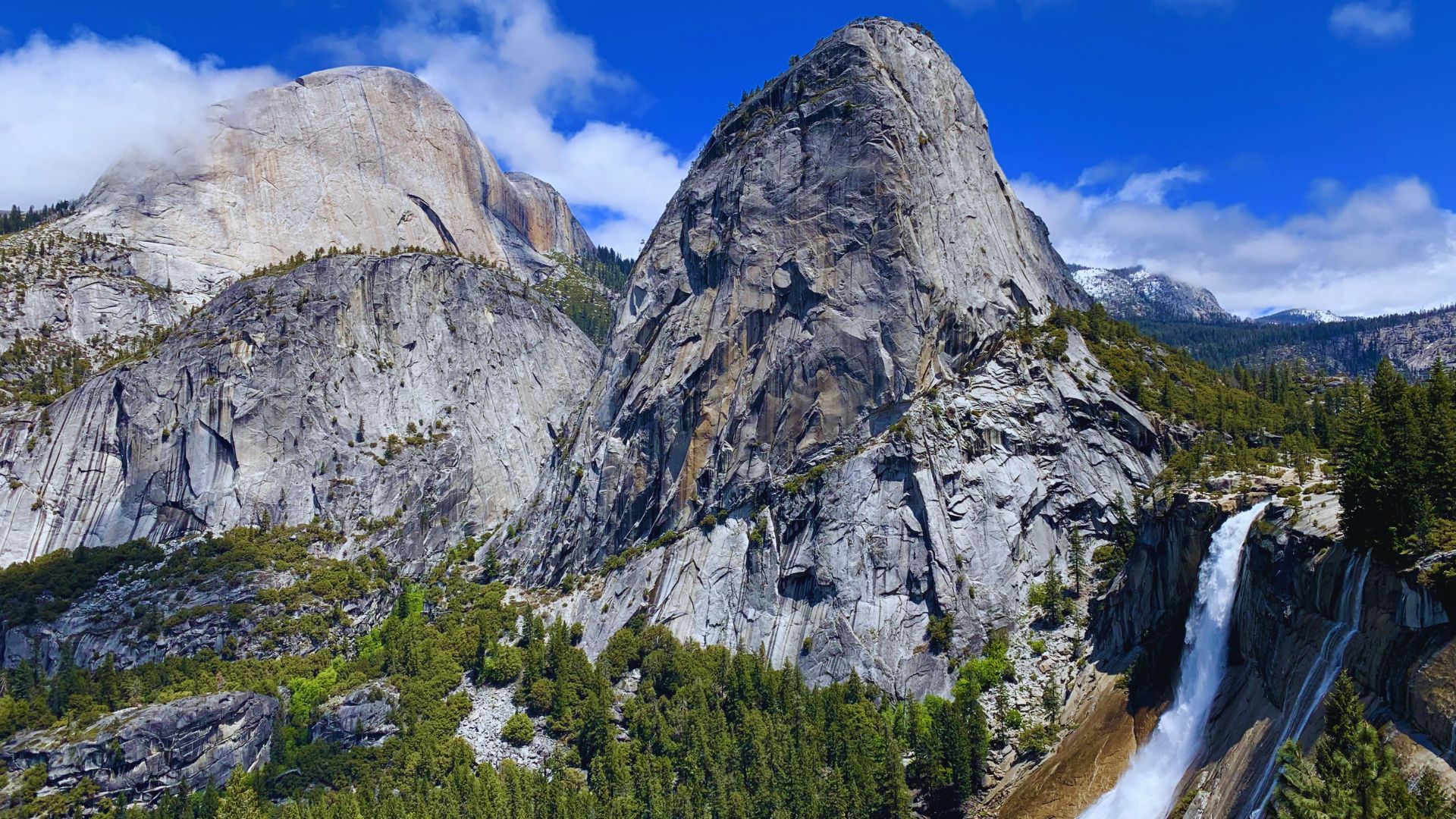
Half Dome rises to the east with its distinctive shape. Cloud’s Rest sits behind Half Dome in the distance.
On clear days, you can see peaks deep into the High Sierra. North Dome appears across the valley to the northeast. Sunrise and sunset both look incredible from this spot.
Dewey Point Yosemite Camping and Backpacking
Spend the night near the rim for sunset and sunrise views without the day hiking crowds.
Where to Camp Near Dewey Point
No designated campsites exist at Dewey Point itself. Camp at least 100 feet from the rim and water sources. Most backpackers set up camp about a quarter mile before the overlook in flat forest spots.
Bridalveil Creek flows near the Pohono Trail junction in spring and early summer. By late summer, it runs dry, so carry all your water if hiking after July.
Wilderness Permit Requirements
All overnight trips require a wilderness permit. Apply online at recreation.gov starting 24 weeks in advance. Request McGurk Meadow Trailhead as your starting point. Permits cost $5 plus $5 per person.
The quota is 10 people per day. Walk-up permits are available at the wilderness center on a first-come, first-served basis. Bear canisters are required for overnight food storage.
Best Time to Hike Dewey Point Yosemite
Late spring through fall offers the best conditions when Glacier Point Road is open and weather is mild.
Spring, Summer, and Fall Conditions
May and June bring wildflowers to McGurk Meadow. Snow usually clears by late May. Glacier Point Road typically opens in May depending on the snowpack.
July through September offers the most reliable weather with warm days and cool nights. Start early to avoid afternoon thunderstorms. October shows off fall colors as aspens turn gold.
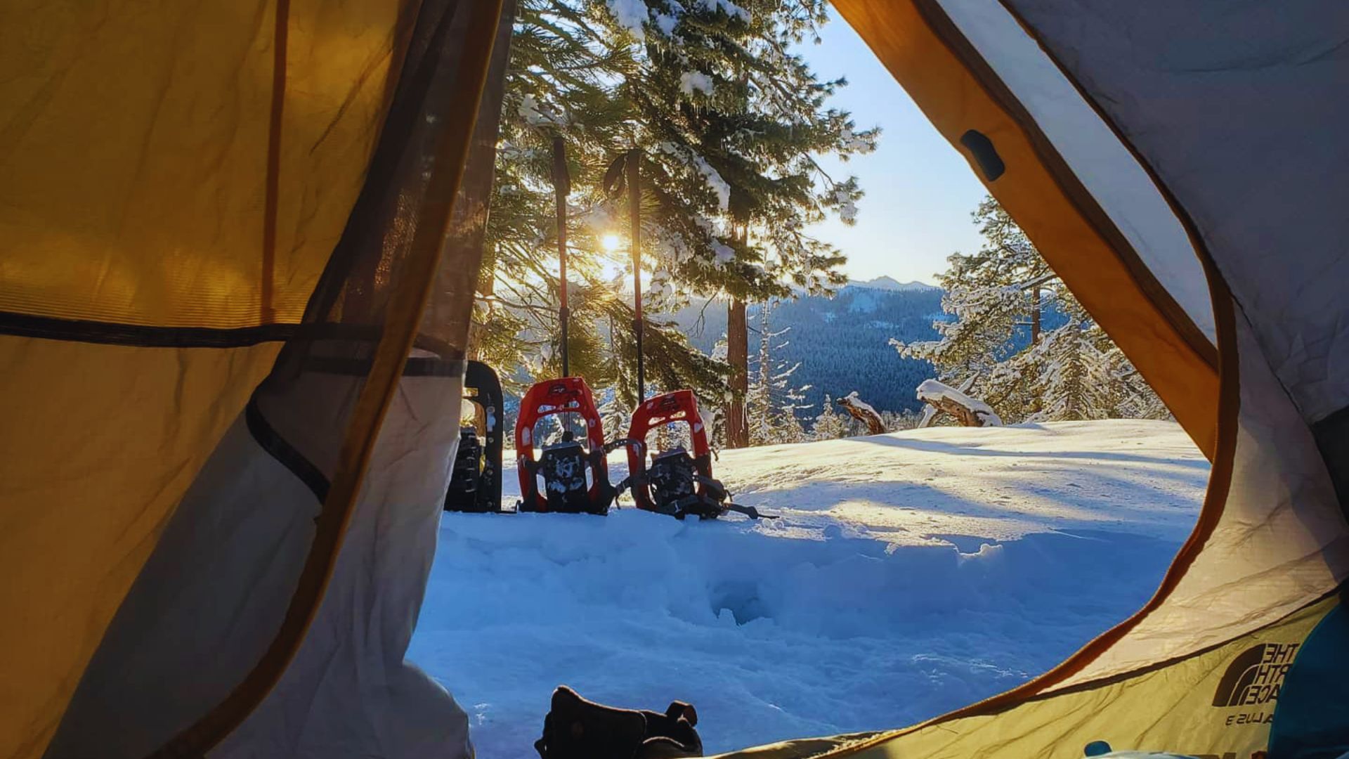
Dewey Point Yosemite Winter and Snowshoeing
Winter access requires snowshoes or cross-country skis. Most winter visitors approach from Badger Pass Ski Area following Glacier Point Road under snow.
Expect full winter conditions from December through April. The winter route covers about 16 miles round trip and requires serious backcountry winter skills.
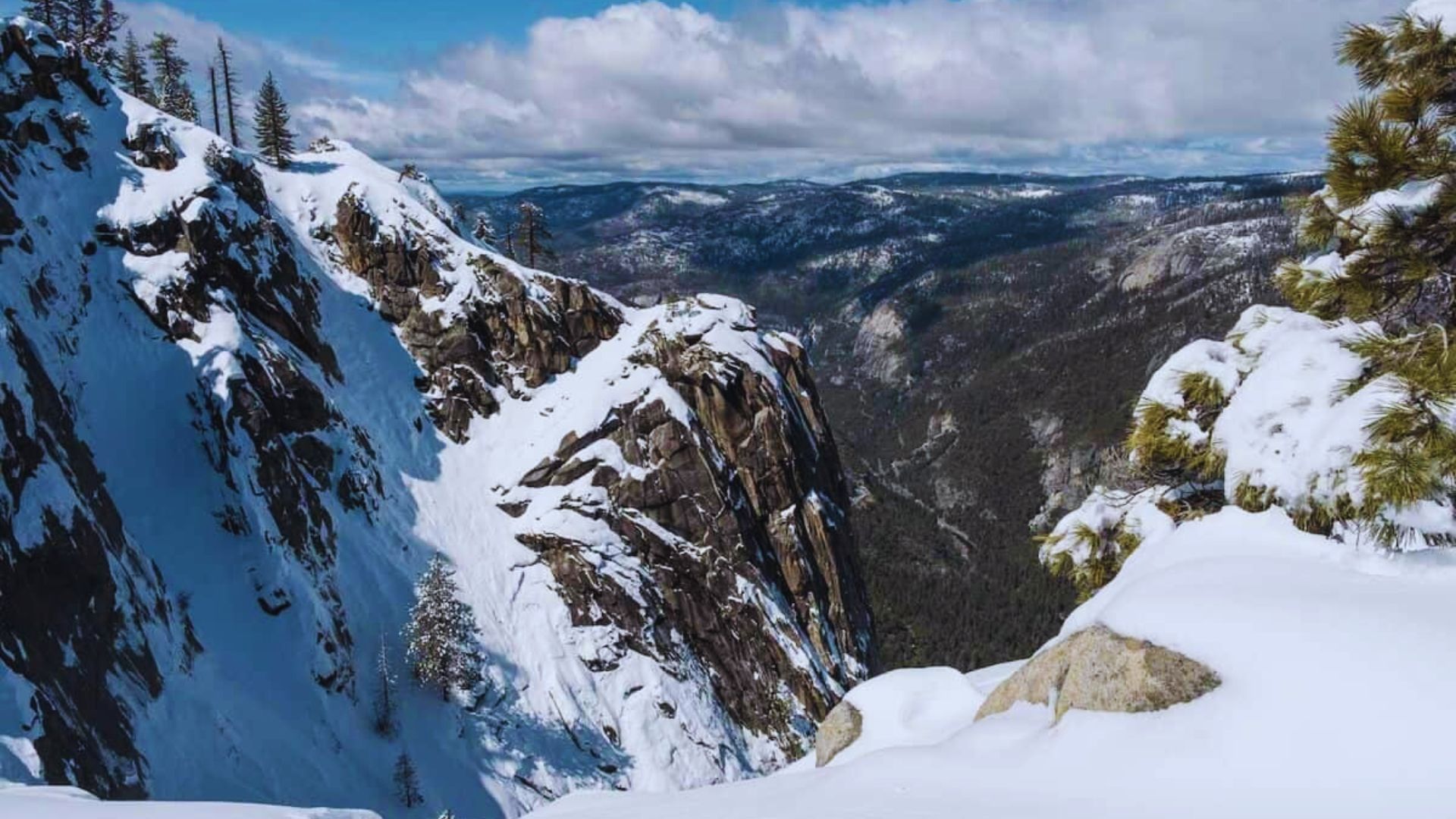
Dewey Point Yosemite Winter Hiking & Snowshoe Guide
Start at Badger Pass Ski Area when Glacier Point Road closes. The parking lot stays plowed all winter. Follow snow-covered Glacier Point Road toward Glacier Point for about 3.5 miles to the McGurk Meadow area. From there, follow the summer trail route to Dewey Point. The round trip covers roughly 16 miles.
Bring a GPS or detailed map since trails disappear under snow. Check avalanche conditions before heading out. Pack the 10 essentials plus extra warm layers since winter storms move in quickly at this elevation.
Tell someone your plans before leaving. Cell service is limited or nonexistent. Start early since winter days are short and you’ll want plenty of daylight for the return trip.
Essential Tips for Hiking Dewey Point Yosemite
Proper planning makes the difference between a great hike and a difficult day on the trail.
- Carry at least 3 liters of water per person since no reliable sources exist in summer. Bridalveil Creek runs near the Pohono Trail junction in spring if you bring a filter.
- Check the weather forecast before starting and download offline maps to your phone. Cell service drops to zero at the trailhead. Afternoon thunderstorms are common in summer.
- Bring a headlamp even for day hikes in case you’re running late. The trail is well-marked in summer, but pay attention at the Pohono Trail junction to turn the right direction.
- Black bears live throughout this area, so store food properly and don’t leave anything scented in your car. Make noise while hiking to avoid surprising mountain lions and other wildlife.
- Stay back from cliff edges at the overlook since granite can be slippery with no barriers. Watch for rattlesnakes on rocks in warm weather and check for ticks after hiking through brush.
Conclusion
The views from Dewey Point Yosemite rival any overlook in the park. You put in the miles and get rewarded with those valley views all to yourself. I love this trail because it feels remote even though you’re not that far from the road.
Bring plenty of water, start early, and take your time at the overlook. The hike back goes faster since it’s mostly downhill.
Have you hiked to Dewey Point before? Drop a comment below and share your experience. Check out my other Yosemite hiking guides for more trail ideas.
Frequently Asked Questions
How Long Does It Take to Hike Dewey Point Yosemite?
Most hikers complete the round trip in six to eight hours including breaks and time at the overlook. Start early to avoid hiking back in the dark.
Is Dewey Point Yosemite Hard?
The trail is moderately difficult with elevation gain over several miles. The grade stays manageable with steady climbing. Any reasonably fit hiker can handle it.
Can You Camp at Dewey Point?
Yes, but you need a wilderness permit for overnight stays. Set up camp in the forest away from the rim and bring all your water since sources dry up by late summer.
When Does Glacier Point Road Open for Dewey Point Access?
Glacier Point Road typically opens in late May and closes in November for winter. Call the park for current road status before planning your trip.
What’s the Difference Between Dewey Point and Glacier Point?
Dewey Point requires a long hike while Glacier Point has road access. The views are similar, but Dewey Point offers solitude without crowds or facilities.