

Have you ever stood on a ridge and felt like you could see forever? That’s exactly what you’ll experience on the Auxier Ridge Trail.
This popular hiking path in Red River Gorge, Kentucky, offers some of the best views in the entire area. You’ll walk along exposed ridgelines, see famous rock formations, and take photos that will make your friends jealous.
The trail works well for most hikers who can handle a moderate walk. You don’t need to be a pro to enjoy these amazing views. This guide will provide you with everything you need to know before hitting the trail.
Trail Overview and Essential Information

Let’s start with the basics so you know what to expect on your hike.
Trail Length and Difficulty Rating
The Auxier Ridge Trail covers 4.2 miles out and back, which means you’ll walk 2.1 miles to the end and 2.1 miles back. The trail number is 204, and it’s rated as moderate difficulty.
You’ll gain about 380 feet in elevation, but it’s spread out in small ups and downs rather than one big climb. Most hikers finish this trail in 2.5 to 3.5 hours, depending on how often they stop for photos and rest breaks.
Main Points of Interest
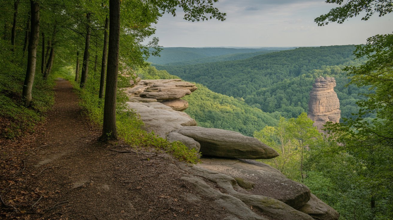
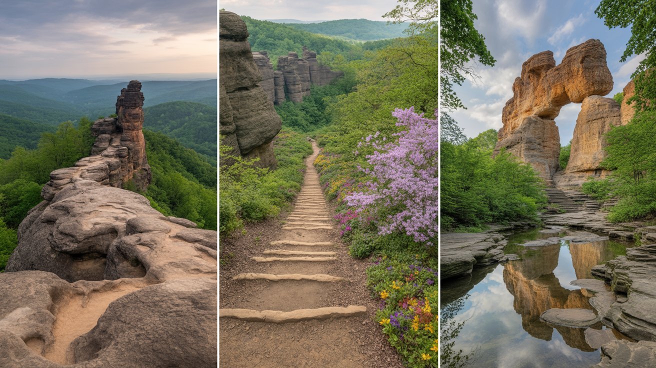
The trail features several famous landmarks you won’t want to miss. Haystack Rock is one of the first major formations you’ll see as you walk along the ridge.
You’ll also get great views of Double Arch to the west and Raven Rock to the east. Courthouse Rock sits at the end of the trail with its own overlook. The entire ridge walk gives you panoramic views in every direction, making this one of the most photographed trails in Kentucky.
When to Plan Your Hike
Fall, winter, and spring are the best times to hike the Auxier Ridge Trail. The temperatures are comfortable, and fall colors make the views even more impressive.
Summer can be tough because the trail is very exposed with little shade. The heat and sun can quickly wear you down. Many hikers choose sunrise or sunset for the best light and cooler temperatures. Just remember that this trail gets crowded on nice weekend days, so early mornings on weekdays are your best bet for a quieter experience.
Following the Auxier Ridge Trail
Here’s what the actual hiking experience looks like from start to finish.
From Trailhead to Ridge
You’ll start at the Tunnel Ridge Road parking lot and begin with a gentle descent into the forest. The trail is well marked with signs and blazes, so you won’t get lost.
The path follows the natural shape of the ridge with small ups and downs. This first section takes you through trees before opening up to the famous ridge views.
The Ridge Experience
Around 1.5 miles into your hike, the trail becomes more exposed and exciting. Some sections are narrow to about 20 feet across, with steep drops on both sides.
You’ll pass Haystack Rock first, then reach the first big overlook with amazing views. Continue to the Courthouse Rock vista at the end. A staircase leads down from this point if you want to extend your hike, but many people turn around here after enjoying the views.
Three Ways to Hike Auxier Ridge
You have options for how far you want to go on this trail.
Simple Out and Back (4.2 miles)
This is the most popular choice and gives you the best views for the least amount of work. You walk to Courthouse Rock, enjoy the vista, and head back the same way.
Most hikers choose this option because it hits all the highlights without adding extra miles or difficulty.
Lollipop Loop via Courthouse Rock (5.2 miles)
Want to see more? Take the stairs down at Courthouse Rock and loop back through the valley below. This adds about 1 mile to your hike and includes more elevation changes.
The valley section features wildflowers in spring and mountain laurel blooms. This loop gives you a different perspective on the rock formations you saw from above.
Extended Loop with Double Arch (8.1 miles)
Experienced hikers can combine the Auxier Ridge Trail with the Double Arch Trail via Auxier Branch. This longer route includes overlooks, the famous arch, and peaceful creekside walking.
Only attempt this loop if you have good fitness and plenty of time. You’ll need 5 to 6 hours to complete the full circuit.
Safety and What to Know Before You Go

This trail is beautiful but requires your full attention for safety.
The ridge has steep drops along both edges, making it a high danger trail if you’re not careful. Narrow sections need extra caution, especially when it’s windy or wet. If you’re bringing children, hold their hands at the narrowest points and keep them in the middle of the trail.
Here are important safety tips:
- Stay on the marked trail at all times
- Don’t get too close to cliff edges for photos
- Watch your footing on rocky surfaces
- Keep dogs on a leash for their safety and others
- Turn back if the weather conditions get bad
- Never hike alone if possible
This trail isn’t a good choice if you’re afraid of heights. The exposed sections and drop-offs are part of what makes the views so good, but they can be scary for some people.
Getting There and Trail Logistics

Getting to the trailhead is straightforward if you follow these directions.
Directions to Trailhead
Take exit 33 off the Mountain Parkway at Slade, Kentucky. Follow the signs toward Red River Gorge and turn onto Tunnel Ridge Road.
The parking area is well-marked and has space for about 30 cars. On busy weekends, you might need to park along the road if the lot is full.
Facilities and Regulations
You’ll find vault toilets at the parking area, which are the only facilities available. There’s no fee to hike this trail, which is a nice bonus.
If you want to camp anywhere in the Red River Gorge between 10 PM and 6 AM, you need a free camping permit. Dogs are allowed but must stay on a leash at all times. Alcohol is not permitted on the trail or in the parking area, and standard forest service rules apply.
Tips for Hiking the Auxier Ridge Trail
Smart planning makes for a better hiking experience.
Start your hike early in the morning or late in the afternoon to avoid the biggest crowds. The exposed ridge means you’ll be in direct sun for much of the hike, so bring more water than you think you need. There are no water sources along the trail.
Additional tips to remember:
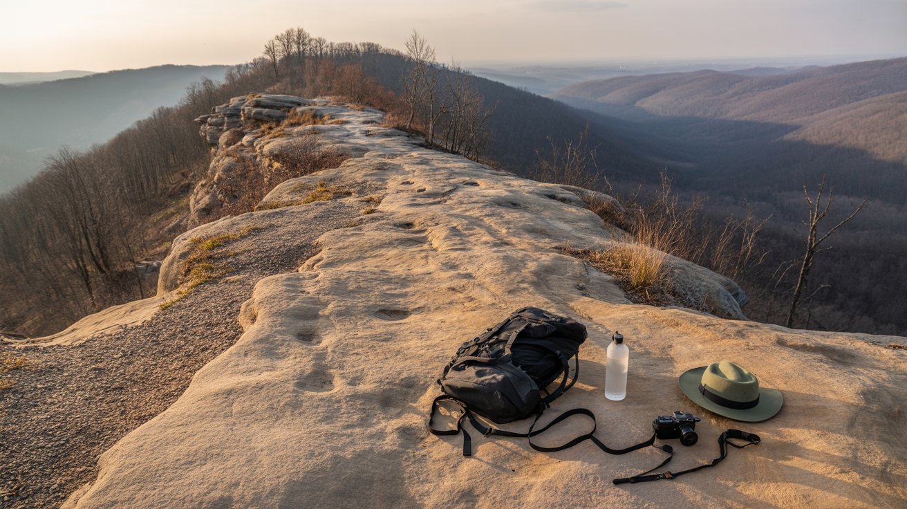
- Wear hiking boots or sturdy shoes with a good grip
- Bring a camera for the amazing photo opportunities
- Check the sunset time if you’re planning an evening hike
- Pack snacks and lunch for the trail
- Wear sunscreen and a hat for sun protection
- Tell someone your hiking plans before you go
Weather can change quickly in the gorge, so check the forecast before you leave home. Wind on the exposed ridge can be strong, and rain makes the rocks slippery.
Conclusion
The Auxier Ridge Trail stands out as one of the most rewarding hikes in Red River Gorge. The combination of accessible distance, moderate difficulty, and incredible views makes it perfect for many skill levels.
You can make this hike as short or long as you want by choosing different turnaround points. The basic out-and-back route works great for families and casual hikers, while stronger hikers can add loops for more miles.
Plan your visit, pack smart, and get ready for views that will take your breath away. This trail delivers an experience you’ll want to repeat again and again.
Frequently Asked Questions
Can You Camp Along the Auxier Ridge Trail?
You cannot camp directly on the trail, but you can camp at least 300 feet away from any trail. You need a free camping permit for overnight stays. Popular camping spots exist in the general Red River Gorge area near the trailhead.
Is There Cell Phone Service on the Trail?
Cell phone service is limited throughout most of Red River Gorge, including on this trail. Some carriers work better than others, but don’t count on having reliable service. Download offline maps before you arrive at the trailhead.
What Should You Bring for a Sunset Hike?
Always bring a headlamp or flashlight with fresh batteries for sunset hikes. Plan to finish before full darkness falls, as hiking this exposed ridge in the dark is dangerous. Include warm layers since temperatures drop quickly after sunset.
Are There Water Sources Along the Route?
No water sources exist on the ridge itself. You must carry all the water you’ll need for the entire hike. Most hikers bring at least 2 liters per person. The exposed trail and sun exposure make proper hydration critical.
How Crowded Does This Trail Get on Weekends?
This trail is very popular on nice weekends, especially during the fall color season. The parking lot fills up by mid-morning. Arrive before 8 AM or after 4 PM for a better parking spot and fewer people on the trail.